تانديل
تانديل
Tandil | |
|---|---|
 | |
| الإحداثيات: 37°19′S 59°08′W / 37.317°S 59.133°W | |
| البلد | |
| المحافظة | |
| القسم | تانديل |
| تأسست | 4 أبريل 1823 |
| المساحة | |
| • الإجمالي | 52٫34 كم² (20٫21 ميل²) |
| المنسوب | 188 m (617 ft) |
| التعداد (2012) | |
| • الإجمالي | 110٬627 |
| • الكثافة | 2٬100/km2 (5٬500/sq mi) |
| CPA Base | B 7000 |
| مفتاح الهاتف | +54 249 |
| الموقع الإلكتروني | الموقع الرسمي |
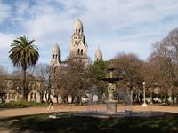
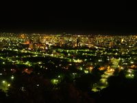
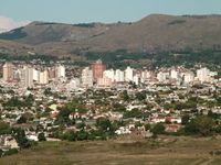
تانديل Tandil هي المدينة الرئيسية في قسم يحمل ذات الاسم في الأرجنتين، في الجنوب الشرقي من ولاية بوينس آيرس، مباشرة شمال بشمال غرب ربى تانديا.
أسماء أماكن
المناخ
| بيانات المناخ لـ تانديل، الأرجنتين (الدرجات القصوى، 1970–الحاضر) | |||||||||||||
|---|---|---|---|---|---|---|---|---|---|---|---|---|---|
| الشهر | ينا | فب | مار | أبر | ماي | يون | يول | أغس | سبت | أكت | نوف | ديس | السنة |
| القصوى القياسية °س (°ف) | 39.3 (102.7) |
37.8 (100.0) |
37.2 (99.0) |
32.5 (90.5) |
28.0 (82.4) |
22.3 (72.1) |
25.4 (77.7) |
31.2 (88.2) |
30.0 (86.0) |
31.3 (88.3) |
34.2 (93.6) |
39.9 (103.8) |
39.9 (103.8) |
| متوسط القصوى اليومية °س (°ف) | 27.9 (82.2) |
26.9 (80.4) |
23.9 (75.0) |
20.2 (68.4) |
16.2 (61.2) |
12.7 (54.9) |
12.3 (54.1) |
14.4 (57.9) |
16.3 (61.3) |
19.7 (67.5) |
23.0 (73.4) |
26.6 (79.9) |
20.0 (68.0) |
| المتوسط اليومي °س (°ف) | 21.1 (70.0) |
20.2 (68.4) |
17.6 (63.7) |
13.8 (56.8) |
10.1 (50.2) |
7.2 (45.0) |
6.7 (44.1) |
8.4 (47.1) |
10.2 (50.4) |
13.7 (56.7) |
16.8 (62.2) |
19.4 (66.9) |
13.8 (56.8) |
| متوسط الدنيا اليومية °س (°ف) | 14.4 (57.9) |
14.1 (57.4) |
11.8 (53.2) |
8.9 (48.0) |
5.4 (41.7) |
2.8 (37.0) |
2.5 (36.5) |
3.3 (37.9) |
4.5 (40.1) |
7.8 (46.0) |
10.5 (50.9) |
12.9 (55.2) |
8.2 (46.8) |
| الصغرى القياسية °س (°ف) | 1.8 (35.2) |
0.8 (33.4) |
0.5 (32.9) |
−4.6 (23.7) |
−5.8 (21.6) |
−9.9 (14.2) |
−11.6 (11.1) |
−8.5 (16.7) |
−7.1 (19.2) |
−3.9 (25.0) |
−2.8 (27.0) |
−0.3 (31.5) |
−11.6 (11.1) |
| متوسط تساقط الأمطار mm (inches) | 124.2 (4.89) |
78.1 (3.07) |
101.7 (4.00) |
54.0 (2.13) |
75.7 (2.98) |
21.5 (0.85) |
33.8 (1.33) |
42.7 (1.68) |
56.7 (2.23) |
108.4 (4.27) |
103.1 (4.06) |
88.7 (3.49) |
888.6 (34.98) |
| Average precipitation days | 10 | 6 | 9 | 7 | 6 | 5 | 6 | 6 | 6 | 10 | 8 | 8 | 87 |
| متوسط الرطوبة النسبية (%) | 56 | 67 | 55 | 56 | 48 | 36 | 41 | 48 | 51 | 57 | 55 | 51 | 52 |
| Mean monthly ساعات سطوع الشمس | 263.5 | 228.8 | 229.4 | 195.0 | 133.3 | 120.0 | 130.2 | 176.7 | 195.0 | 223.2 | 249.0 | 241.8 | 2٬385٫9 |
| نسبة السطوع المحتمل للشمس | 58 | 60 | 60 | 57 | 41 | 40 | 42 | 52 | 52 | 54 | 58 | 53 | 52 |
| Source 1: Servicio Meteorológico Nacional (Argentine Meteorological Service),[1] Oficina de Riesgo Agropecuario (record highs and lows)[2] | |||||||||||||
| Source 2: UNLP (sun and extremes only)[3] | |||||||||||||
الشخصيات
الهامش
- ^ "Guía Climática para el Turismo (Climate Guide for Tourists)" (in Spanish). Servicio Meteorológico Nacional. Retrieved January 21, 2008.
{{cite web}}: CS1 maint: unrecognized language (link) - ^
"Tandil, Buenos Aires". Estadísticas meteorológicas decadiales (in Spanish). Oficina de Riesgo Agropecuario. Retrieved October 26, 2015.
{{cite web}}: CS1 maint: unrecognized language (link) - ^ "Datos bioclimáticos de 173 localidades argentinas". Atlas Bioclimáticos (in Spanish). Universidad Nacional de La Plata. Retrieved April 17, 2014.
{{cite web}}: CS1 maint: unrecognized language (link)
وصلات خارجية
- (بالإسپانية) Official government website
- (بالإسپانية) Tourism, images and information about Tandil Argentina
مشاع المعرفة فيه ميديا متعلقة بموضوع [[commons: Category:تانديل
| تانديل
]].الكلمات الدالة:
This article contains content from Wikimedia licensed under CC BY-SA 4.0. Please comply with the license terms.


