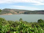
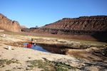
بحيرة بركانية

البحيرة البركانية إنگليزية: Maar هي broad, low-relief volcanic crater caused by a phreatomagmatic eruption (an explosion which occurs when groundwater comes into contact with hot lava or magma). A maar characteristically fills with water to form a relatively shallow crater lake which may also be called a maar.[1] The name comes from a Moselle Franconian dialect word used for the circular lakes of the Daun area of Germany.[2] Maars are shallow, flat-floored craters that scientists interpret as having formed above diatremes as a result of a violent expansion of magmatic gas or steam; deep erosion of a maar presumably would expose a diatreme. Maars range in size from 60 to 8,000 m (200 to 26,250 ft) across and from 10 to 200 m (33 to 656 ft) deep; most maars commonly fill with water to form natural lakes. Most maars have low rims composed of a mixture of loose fragments of volcanic rocks and rocks torn from the walls of the diatreme.
. . . . . . . . . . . . . . . . . . . . . . . . . . . . . . . . . . . . . . . . . . . . . . . . . . . . . . . . . . . . . . . . . . . . . . . . . . . . . . . . . . . . . . . . . . . . . . . . . . . . . . . . . . . . . . . . . . . . . . . . . . . . . . . . . . . . . . . . . . . . . . . . . . . . . . . . . . . . . . . . . . . . . . . .
أمثلة
تم العثور على أكبر الفوهات البركانية المعروفة في شبه جزيرة سيوارد في شمال غرب ألاسكا. ويتراوح حجم هذه الفوهات من 4,000 to 8,000 m (13,123 to 26,247 ft) في القطر وعمق يصل إلى 300 m (984 ft). وحدثت هذه الانفجارات منذ حوالي 100000 سنة في حدث الانفجار الأحدث (فوهة جبل الشيطان) منذ حوالي 17500 سنة. وترجع ضخامة حجم هذه الفوهات إلى رد الفعل الانفجاري الذي يحدث عندما تتلامس الصهارة مع الطبقة الجليدية السميكة. وتكون الانفجارات المائية الصهارية انفجارية على نحو متزايد عندما تكون نسبة الماء إلى الصهارة منخفضة. ونظرًا لأن طبقة الجليد السميكة تذوب ببطء، فإنها توفر مصدرًا ثابتًا من المياه للثوران مع الاحتفاظ بنسبة المياه إلى الصهارة منخفضة. وهذا ينتج ثورانًا بركانيًا انفجاريًا ممتدًا لفترات طويلة يؤدي إلى خلق هذه الفوهات البركانية الضخمة. ومن بين الأمثلة على الفوهات البركانية لشبه جزيرة سيوارد فوهة شمال كليك وفوهة جنوب كليك وفوهة جبل الشيطان وفوهة وايتفيش.[3]
وتحدث الفوهات البركانية الناجمة عن الانفجارات في أمريكا الشمالية وباتاغونيا في أمريكا الجنوبية ومنطقة إيفل في ألمانيا (حيث تم وصفها في الأصل)، وفي مناطق بركانية أخرى من الأرض. وفي أماكن أخرى في أوروبا، تقدم منطقة لا فيستايد دو بال مثالاً مذهلاً للفوهة البركانية، والتي يمكن رؤيتها بسهولة من الأرض أو الجو. وتعد كل من كيلبورن هول وهانت هول، بالقرب من إل باسو، تكساس، فوهاتين بركانيتين. وكان يُعتقد أن بحيرة التمساح في لوس بانوس في الفلبين في الأصل عبارة عن فوهة بركانية عادية، ولكنها فوهة بركانية ناجمة عن انفجار. كما تُعد بحيرة نيوس المشبعة بثاني أكسيد الكربون السيئة السمعة الموجودة في إفريقيا مثالاً آخر. ومن الأمثلة الممتازة على الفوهة البركانية الناجمة عن انفجار هو بحيرة زوني سولت في نيو مكسيكو، وهي بحيرة مالحة ضحلة تشغل فوهة بركان مسطحة بحجم يبلغ حوالي 6,500 ft (2,000 m) عرضيًا و400 ft (120 m) عمقًا. وتتألف حافتها المنخفضة من قطع فضفاضة من الحمم البازلتية والصخور الجدارية (الحجر الرملي والصخر الزيتي والحجر الجيري) من القناة العمودية التحتية، وكذلك قطع عشوائية قديمة من الصخور البلورية القديمة المدفوعة بفعل الانفجار من أعماق كبيرة. وتوجد الفوهات البركانية الناتجة عن الانفجارات في كندا في حقل ويلز غراي-كليروواتر البركاني في شرق ووسط كولومبيا البريطانية وفي حقول الكمبرلايت في جميع أنحاء كندا. ويوجد أحد الحقول البارزة للفوهات البركانية في حقل بالي-أيك البركاني في باتاغونيا، في أمريكا الجنوبية.[4] وتوجد لدى حقل أوكلاند البركاني في المنطقة الحضرية من أوكلاند في نيوزيلندا العديد من الفوهات البركانية، بما في ذلك بحيرة بوبوك التي يمكن الوصول إليها بسهولة في ضاحية نورث شور من تاكابونا.
وإحدى أبرز الفوهات التي حدث خطأ في تعريفها كفوهة بركانية ناتجة عن انفجار في فوهة نيزكية في أريزونا؛ وكان هناك اعتقاد لسنوات عديدة أن هذه الفوهة من أصل بركاني وليس نيزكيًا.[5]
ألمانيا
بحيرات إيفل البركانية
بحيرات إيفل البركانية المملوءة بالمياه
بحيرات إيفل البركانية الجافة
الاستخدام الأوسع لمصطلح بحيرة بركانية
البحيرات البركانية خارج إيفل
بقية أوروپا

الأمريكتان
الشرق الأوسط وأفريقيا
The maar of Birket Ram[6] lies on the Golan Heights; further south maars occur in Africa (Bilate Volcanic Field and Haro Maja in the Butajiri-Silti-Volcanic Field, Ethiopia, the Bayuda Volcanic Field in the Sudan and Lake Nyos in the Oku Volcanic Field in Cameroon).
آسيا وأوقيانوسيا
معرض الصور
Weinfelder Maar, one of the three maars originally described
The maar at Birkat Ram, the Golan Heights
Zengena Lake, a maar in Amhara Region, Ethiopia
El Muweilih Crater in Sudan: Natron-rich clay on the crater floor
Kilbourne Hole maar in the Potrillo volcanic field of New Mexico
Big Soda Lake in Nevada
. . . . . . . . . . . . . . . . . . . . . . . . . . . . . . . . . . . . . . . . . . . . . . . . . . . . . . . . . . . . . . . . . . . . . . . . . . . . . . . . . . . . . . . . . . . . . . . . . . . . . . . . . . . . . . . . . . . . . . . . . . . . . . . . . . . . . . . . . . . . . . . . . . . . . . . . . . . . . . . . . . . . . . . .
انظر أيضاً
المصادر
- ^ David S.G. Thomas and Andrew Goudie (eds.), The Dictionary of Physical Geography (Oxford: Blackwell, 2000), 301. ISBN 0-631-20473-3.
- ^
Notes:
- According to German Wikipedia's "Maar" article, in 1544 in his book Cosmographia, Sebastian Münster (1488–1552) first applied the word "maar" (as Marh) to the Ulmener Maar and the Laacher See. See: Sebastian Münster, Cosmographia (Basel, Switzerland: Heinrich Petri, 1544), p. 341. From p. 341: "Item zwen namhafftiger seen seind in der Eyfel / einer bey de schloß Ulmen / und ein ander bey dem Closter züm Laich / die seind sere tieff / habe kein ynflüß aber vil außflüß / die nennet man Marh unnd seind fischreich." (Also two noteworthy lakes are in the Eifel, one by the Ulmen castle, and another by the monastery at Laich ; they are very deep ; [they] have no streams flowing in but many flowing out ; one calls them "maars" and [they] are rich in fish.)
- In 1819, Johann Steininger (1794–1874), a secondary-school teacher from Trier, coined the term "maar" in its modern sense. See: Steininger, J., Geognostische Studien am Mittelrhein [Geological studies on the middle Rhein] (Mainz, (Germany): Kupferberg, 1819).
- In 1825, George Julius Poulett Scrope (1797–1876) introduced the term "maar" into English. See: Scrope, G.P., Considerations on Volcanoes (London, England: Philipps, 1825), p. 166.
- Prof. Horst Noll, a geologist at the University of Köln (Cologne), Germany, said that the local term maar might even have derived from the Latin word mare (i.e. sea) and been introduced into local language during the Roman occupation of the West Eifel. See: Noll, H. (1967) "Maare und Maar-ähnliche Explosionskrater in Island. Ein Vergleich mit dem Maar-Vulkanismus der Eifel" (Maars and maar-like explosion craters in Iceland. A comparison with the maar-volcanism of the Eifel.), Special publication of the Geological Institute of the University of Köln, p. 1.
- Wilhelm Meyer, Geologie der Eifel [Geology of the Eifel] (Stuttgart, Germany: Schweizerbart'sche Verlagsbuchhandlung, 1986), p. 311.
- Herbert Lutz and Volker Lorenz (2013) "Early volcanological research in the Vulkaneifel, Germany, the classic region of maar–diatreme volcanoes: the years 1774–1865." On-line publication of Springer International Publishing, Berlin, Germany.
- The American Heritage Dictionary states that the word "maar" derives from the Latin mare (sea), as does the German language Universal Lexikon.
- ^ Begét, Steven D.; Hopkins, David M.; Charron (1996). "The Largest Known Maars on Earth, Seward Peninsula, Northwest Alaska" (PDF).
- ^ C. Michael Hogan (2008) Pali Aike, The Megalithic Portal, ed. A. Burnham [1] Archived 2017-06-29 at the Wayback Machine
- ^ The Science: What is the Barringer Meteorite Crater?[[تصنيف:مقالات ذات وصلات خارجية مكسورة from خطأ: زمن غير صحيح.]]<span title=" منذ خطأ: زمن غير صحيح." style="white-space: nowrap;">[وصلة مكسورة] Archived 2017-07-24 at the Wayback Machine
- ^ Neumann, F.; Schölzel, C.; Litt, T.; Hense, A.; Stein, M. (2007). "Holocene vegetation and climate history of the northern Golan heights (Near East)". Vegetation History and Archaeobotany. 16 (4): 329–346. doi:10.1007/s00334-006-0046-x.
خطأ استشهاد: الوسم <ref> ذو الاسم "mWs" المُعرّف في <references> غير مستخدم في النص السابق.
خطأ استشهاد: الوسم <ref> ذو الاسم "WMeyer2" المُعرّف في <references> غير مستخدم في النص السابق.


