بجنورد
بجنورد
Bojnourd | |
|---|---|
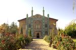
 بيت المرايا المفخم | |
| الإحداثيات: 37°28′30″N 57°20′00″E / 37.47500°N 57.33333°E | |
| البلد | |
| المحافظة | شمال خراسان |
| المقاطعة | بجنورد |
| بخش | المركزي |
| الحكومة | |
| • العمدة | Keyvan Dejhout |
| المساحة | |
| • الإجمالي | 36 كم² (14 ميل²) |
| المنسوب | 1٬070 m (3٬510 ft) |
| التعداد (2011) | |
| • الإجمالي | 199٬791 |
| • الكثافة | 5٬500/km2 (14٬000/sq mi) |
| منطقة التوقيت | UTC+3:30 (IRST) |
| • الصيف (التوقيت الصيفي) | UTC+3:30 (not observed) |
| مفتاح الهاتف | (+98) 584 |
| الموقع الإلكتروني | http://www.bojnordcity.ir/ |
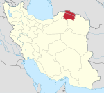
بجنورد هي عاصمة محافظة شمال خراسان، بشمال إيران. وتبعد 701 كم من طهران.
بُجنورد وقع فی شمال شرقی ایران. نفوسها فی 2006 کان 176776 نسمة.[1]
التاريخ
According to local tradition, the whole area was controlled by the Qarai Turks since the Mongol invasion in the 13th century.[2]
Bojnurd is of recent origin and possibly built by the Safavids for the Kurdish Şadiyan tribe who had been settled there to strengthen the Safavid borders against hostile Turkmens. Traditionally, the city was surrounded by a defensive wall and consisted of eleven quarters, bazaars and four mosques.[2]
In 1849, the city saw a revolt which destroyed the city. When traveller G. C. Napier visited the city in 1876, it was noted that the chief of Bojnurd was a Kurd who governed the city without taxation in exchange for military support to the central government in Tehran.[2]
Severe earthquakes in 1896 and 1929 destroyed the city and its surroundings. The city would consequently be rebuilt without historical or recent fortifications in a modern matter.[2] In 1997, a magnitude 6.5 earthquake caused significant damage and many fatalities in the city.[3]
السكان
التعداد
At the time of the 2006 National Census, the city's population was 172,772 in 44,217 households.[4] The following census in 2011 counted 199,791 people in 56,761 households.[5] The 2016 census measured the population of the city as 228,931 people in 67,335 households.[6]
الجغرفيا
Bojnourd city, the capital of North Khorasan province with an area of 36 square kilometers, is located in northeastern Iran at 57 degrees and 20 minutes longitude and 37 degrees and 28 minutes latitude south of Kopedagh mountain range and east of Aladagh mountain range and north of Alborz mountain range. Bojnourd is 1070 meters above sea level and its distance to Tehran is 821 kilometers.[7]
الكليات والجامعات
Universities located in Bojnord include:[8]
- University of Bojnurd
- North Khorasan University of Medical Sciences
- Islamic Azad University of Bojnurd
- Eshragh Institute of Higher Education (Bojnurd, North Khorasan)
- Payam Noor University of Bojnurd
الرجال المشاهیر

- سردار مفخم شادلو
- اسماعیل جرامی مقدم
- یحیی باغصقی
- عبدالحسین تیمورتاش
- ایران تیمورتاش
- دولتمحمد آزادی
- اردوان روزبه
- یحیی علوی فرد
- علی آبجوری
- مهدی شهریاری
- سید محمدکاظم موسوی بجنوردی
- مصطفی دلیریان
- احسان آل بني الحسن
المناخ
| بيانات المناخ لـ بجنورد | |||||||||||||
|---|---|---|---|---|---|---|---|---|---|---|---|---|---|
| الشهر | ينا | فب | مار | أبر | ماي | يون | يول | أغس | سبت | أكت | نوف | ديس | السنة |
| متوسط القصوى اليومية °س (°ف) | 6.3 (43.3) |
7.6 (45.7) |
12.5 (54.5) |
19.9 (67.8) |
24.3 (75.7) |
29.6 (85.3) |
32.4 (90.3) |
31.8 (89.2) |
28.2 (82.8) |
21.2 (70.2) |
14.3 (57.7) |
8.7 (47.7) |
19.7 (67.5) |
| متوسط الدنيا اليومية °س (°ف) | −3.4 (25.9) |
−2.8 (27.0) |
1.1 (34.0) |
6.7 (44.1) |
10.7 (51.3) |
15.1 (59.2) |
17.8 (64.0) |
16.6 (61.9) |
12.5 (54.5) |
6.7 (44.1) |
2.4 (36.3) |
−1.3 (29.7) |
6.8 (44.3) |
| متوسط تساقط الأمطار mm (inches) | 27.6 (1.09) |
30.7 (1.21) |
42.4 (1.67) |
38.5 (1.52) |
34.6 (1.36) |
8.7 (0.34) |
10.1 (0.40) |
6.0 (0.24) |
8.4 (0.33) |
14.1 (0.56) |
26.3 (1.04) |
25.0 (0.98) |
272.4 (10.74) |
| Average precipitation days | 11.1 | 11.5 | 12.8 | 10.6 | 9.6 | 3.6 | 2.6 | 2.0 | 2.4 | 5.6 | 8.3 | 10.1 | 90.2 |
| Source: World Meteorological Organisation | |||||||||||||
المراجع
- ^ قالب:تعدادإيران2006
- ^ أ ب ت ث Ehlers, Eckart; Bosworth, C. E. (1989). "BOJNŪRD". Encyclopedia Iranica. IV.
- ^ "Earthquake Toll Rises in Iran as Aftershocks Hit". Reuters. Tehran, Iran: ReliefWeb. 5 February 1997. Retrieved 10 March 2022.
- ^ "Census of the Islamic Republic of Iran, 1385 (2006)". AMAR (in الفارسية). The Statistical Center of Iran. p. 28. Archived from the original (Excel) on 20 September 2011. Retrieved 25 September 2022.
- ^ "Census of the Islamic Republic of Iran, 1390 (2011)". Syracuse University (in الفارسية). The Statistical Center of Iran. p. 28. Archived from the original (Excel) on 19 January 2023. Retrieved 19 December 2022.
- ^ "Census of the Islamic Republic of Iran, 1395 (2016)". AMAR (in الفارسية). The Statistical Center of Iran. p. 28. Archived from the original (Excel) on 27 October 2020. Retrieved 19 December 2022.
- ^ "Bojnord". www.visitiran.ir (in الإنجليزية). Retrieved 2022-06-05.
- ^ "دانستنیهایی از استان خراسان شمالی".


