المنطقة منزوعة السلاح الكورية
| المنطقة منزوعة السلام الكورية Korean Demilitarized Zone (DMZ) (بالكورية: 한반도 비무장지대 (韓半島非武裝地帶)) Hanbando Bimujangjidae | |
|---|---|
| شبه الجزيرة الكورية | |
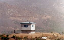
 نقطة تفتيش كورية جنوبية في المنطقة منزوعة السلاح (الصورة من الجانب الكوري الشمالي). | |
 المنطقة منزوعة السلاح الكورية موضحة بالأحمر والخط العسكري منزوع السلاح موضح بالخط الأسود. | |
| النوع | منطقة منزوعة السلاح |
| معلومات الموقع | |
| يتحكم فيه | |
| الحالة | دائمة الحراسة وتعمل. |
| تاريخ الموقع | |
| بناه | |
| قيد الاستخدام | 27 يوليو 1953 وصاعداً |
| الأحداث | تقسيم كوريا |
المنطقة منزوعة السلاح الكورية (الكورية: 한반도 비무장지대; هانجا: 韓半島非武裝地帶)، هي شريط من الأرض يمر عبر شبه الجزيرة الكورية يعمل كمنطقة عازلة بين كوريا الشمالية والجنوبية، ويمتد على طول خط العرض 38 شمالاً. تقطع المنطقة المعزولة السلاح شبه الجزيرة الكورية إلى نصفين، عبر خط التوازي رقم 38 على شكل مثلث، حيث النهاية الغربية للمنطقة المنزوعة السلام جنوب خط التوازي والنهاية الشرقية شماله. تأسست المنطقة كجزء من اتفاقية الهدنة الكورية، بين كوريا الشمالية والصين، وقوات قيادة الأمم المتحدة عام 1953.
يمتد الخط بطول 250 كم،[1] ويبلغ عرضه حوالي 4 كم وبالرغم من اسمه، فيـُعـَد من أكثر المناطق الحدودية توتراً في العالم.[2][3]
التاريخ
خط العرض 38 شمالاً، الذي يقسم شبه الجزيرة الكورية تقريباً إلى نصفين، كان الحد الأصلي بين منطقتي ادارة كل من الولايات المتحدة والاتحاد السوڤيتي لفترة وجيزة بعد الحرب العالمية الثانية. وما أن أنشئت جمهورية كوريا الديمقراطية الشعبية (DPRK، والمسماة بشكل غير رسمي: كوريا الشمالية) و جمهورية كوريا (ROK، والمسماة بشكل غير رسمي: كوريا الجنوبية) في 1948، فقد أصبح حدود "أمر واقع" دولية وأحد أكثر الجبهات توتراً في الحرب الباردة.
وظل كل من الشمال والجنوب معتمداً على الدول الداعمة منذ عام 1948 حتى اندلاع الحرب الكورية. ذلك النزاع الذي أزهق أرواح ثلاثة ملايين نسمة وقسـَّم شبه الجزيرة الكورية حسب الفوارق الأيديولوجية، والذي بدأ في 25 يونيو 1950، بهجوم على طول الجبهة قامت به كوريا الشمالية عبر خط العرض 38 شمالاً، والتي وضعت أوزارها في عام 1953 بعد أن دفع التدخل الغربي الحدود إلى القرب من خط العرض 38.
في معاهدة الهدنة في 27 يوليو 1953، خـُلِقت المنطقة منزوعة السلاح إذ وافق الطرفان على التراجع بقواتهما مسافة 2000 متر من خط الجبهة، خالقين منطقة عازلة عرضها أربعة كيلومترات. خط الفصل العسكري (MDL) يمر في وسط المنطقة منزوعة السلاح ويبين أين كانت الجبهة حين تم توقيع الاتفاقية.
ونظراً لهذا الجمود النظري، والعداوة التي لا تفتر بين الشمال والجنوب، large numbers of troops are still stationed along both sides of the line, each side guarding against potential aggression from the other side. The armistice agreement explains exactly how many military personnel and what kind of weapons are allowed in the DMZ. Soldiers from both sides may patrol inside the DMZ, but they may not cross the MDL; ROK soldiers, however heavily armed, patrol under the aegis of military police, and have memorized each line of the armistice.[4] Sporadic outbreaks of violence have killed over 500 South Korean soldiers, 50 US soldiers and 250 soldiers from DPRK along the DMZ between 1953 and 1999.[5]
Daeseong-dong (وتُكتب أيضاً Tae Sung Dong) و Kijŏng-dong هما المستوطنتين الوحيدتين اللتين تسمح لهما لجنة الهدنة بالبقاء داخل حدود المنطقة منزوعة السلاح.[6] سكان Tae Sung Dong تحكمهم وتحميهم قيادة الأمم المتحدة وعادةً ما يحتاجون لقضاء ما لا يقل عن 240 ليلة كل عام في القرية للحفاظ على إقامتهم.[6] وفي عام 2008، كان عدد سكان القرية 218 نسمة.[6] القرويون في Tae Sung Dong هم من نسل مباشر للأشخاص الذين كانوا يملكون الأرض قبل الحرب الكورية 1950–53.[7]
ولمواصلة ثني كوريا الشمالية من التوغل، ففي عام 2014 أعفت حكومة الولايات المتحدة المنطقة منزوعة السلاح الكورية من تعهدها بالتخلص من الألغام الأرضية المضادة للأفراد.[8]
بناء على اتفاق مشترك بين الولايات المتحدة الأمريكية والاتحاد السوڤييتي السابق تمركزت القوات الأمريكية في الجزء الجنوبي (كوريا الجنوبية). وأُسست جمهورية كوريا الديمقراطية الشعبية عام 1948، نتيجة استفتاء شعبي طالب بتوحيد كوريا وخروج القوات الأجنبية منها. [9]
حوادث واختراقات
منطقة الأمن المشترك
أنفاق التوغل
الأول
الثاني
الثالث
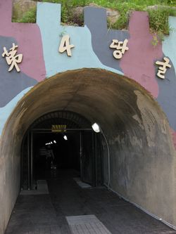
الرابع
الپروپاگندا
المباني
الصواري
الجدار الكوري
النقل
المحمية الطبيعية

انظر أيضاً
- مخيم بونيفاس
- مفوضية الأمم المحايدة للإشراف
- قيادة الأمم المتحدة (كوريا)
- منطقة الأمن المشترك
- اتفاقية الهدنة الكورية
معرض الصور
Looking toward North Korea across the Bridge of No Return. 37°57′21.88″N 126°40′18.86″E / 37.9560778°N 126.6719056°E
ROK MP stands guard on the Bridge of No Return.
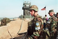
Republic of Korea (ROK) soldiers and a United States (U.S.) officer monitor the Korean Demilitarized Zone from atop OP Ouellette near Panmunjeom.
The Republic of Korea's Freedom Building, JSA, opened in 1998 to host reunification meetings between families separated by the Korean War.
The original Freedom Pagoda was incorporated into the design of the modern Freedom House.
View of the North from the southern side of the Joint Security Area.
Overlooking Conference Row in the Joint Security Area.
A South Korean MP stands guard in the JSA conference center.
Camp Bonifas stands just outside the South Korean Joint Security Area. The road to Panmunjeom is straight ahead. 37°55′56.01″N 126°43′39.67″E / 37.9322250°N 126.7276861°E
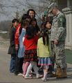
A U.S. Soldier, assigned to the United Nations Command Security Battalion, meets local children while visiting Tae Sung Dong Elementary School, at Daeseong-dong.
Main entrance into the North Korean DMZ, north of Panmunjon. 37°57′54.23″N 126°38′46.59″E / 37.9650639°N 126.6462750°E
A DPRK soldier standing guard on the road to the JSA.
Looking back toward the same entrance. An anti-tank measure carries the slogan: "Reunification without outside interference".
North Korean propaganda that states: "Let us pass on the united country to the next generation!".
The KPA has prepared cement blocks ready to act as emergency roadblocks. 37°57′52.88″N 126°38′53.14″E / 37.9646889°N 126.6480944°E
House where the Armistice Agreement was signed ending the Korean War. 37°57′40″N 126°39′53″E / 37.961092°N 126.6647°E
Crossing into the DPRK's part of Joint Security Area within the DMZ. The fence is electrified and the strip is mined.
North Korea's Hall of Unification in the JSA. 37°57′27.69″N 126°40′37.17″E / 37.9576917°N 126.6769917°E
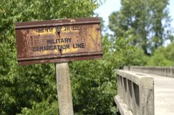
The concrete boundary in Conference Row, JSA, that signifies the Military Demarcation Line (MDL) between the two Koreas.
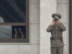
North Korean border troops monitor Conference Row activity from an elevated observation post in the JSA . 37°57′20.14″N 126°40′40.90″E / 37.9555944°N 126.6780278°E
A Korean People's Army Lieutenant Colonel in the JSA. His decorations include a Kim Il Sung lapel badge, Order of the National Flag 2nd class, and two Medals For Military Service.
The Donghae-bukbu line on Korea's east coast. The road and rail link was built for South Koreans visiting the Mount Kumgang Tourist Region in the North.
South Korean soldiers patrolling on the southern side of the JSA and the wall.
A Korean People's Army watchtower in the Joint Security Area in March 1976.
The empty shells of Kijong-dong seen from South Korea.
الهوامش
- ^ "Korean Demilitarized Zone: Image of the Day". NASA Earth Observatory. Retrieved 2010-03-26.
- ^ Bermudez (2001), pg 1.
- ^ " Background Note: North Korea", US Department of State, October, 2006.
- ^ Ahn, JH (2016-03-21). "On patrol in the DMZ: North Korean landmines, biting winds and tin cans: As tensions on the peninsula escalate, a former South Korean guard describes life at one of the world's most fortified borders. NK News reports". The Guardian. Archived from the original on 16 April 2016. Retrieved 2016-04-18.
{{cite web}}: Unknown parameter|deadurl=ignored (|url-status=suggested) (help) - ^ Potts, Rolf (3 February 1999). "Korea's no-man's-land". Salon. Archived from the original on 15 February 2013. Retrieved 31 January 2013.
{{cite web}}: Unknown parameter|deadurl=ignored (|url-status=suggested) (help) - ^ أ ب ت "DMZ sixth-graders become graduates". Stars and Stripes. 2008-02-19. Archived from the original on 11 June 2009.
{{cite news}}: Italic or bold markup not allowed in:|publisher=(help); Unknown parameter|deadurl=ignored (|url-status=suggested) (help) - ^ "Santa mobbed by students during visit to Joint Security Area". army.mil.com -The Official U.S. Army Website. Archived from the original on 24 November 2009. Retrieved 2009-12-11.
{{cite news}}: Unknown parameter|deadurl=ignored (|url-status=suggested) (help) - ^ Kwaak, Jeyup S (24 September 2014). "Why the Korean Peninsula Keeps Land Mines". Wall Street Journal. Archived from the original on 24 September 2014.
{{cite news}}: Unknown parameter|deadurl=ignored (|url-status=suggested) (help) - ^ صفية عيد. "كوريا الشمالية". الموسوعة العربية. Retrieved 2013-04-05.
المصادر
- Bermudez, Joseph S. (2001). Shield of the Great Leader. The Armed Forces of North Korea. The Armed Forces of Asia. Sydney: Allen & Unwin. ISBN 1-86448-582-5.
{{cite book}}: Cite has empty unknown parameter:|coauthors=(help) - Elferink, Alex G. Oude, (1994). The Law of Maritime Boundary Delimitation: a Case Study of the Russian Federation. Dordrecht: Martinus Nijhoff. 10-ISBN 079233082X/13-ISBN 9780792330820; OCLC 123566768
وصلات خارجية
- U.S. Army official Korean Demilitarized Zone image archive
- Washington Post Correspondent Amar Bakshi travels to the Korean Demilitarized Zone... And uncovers the world's most dangerous tourist trap, January 2008.
- Status and ecological resource value of the Republic of Korea's De-militarized Zone
- An English teacher's tour to the DMZ with the USO--pictures and videos
- North Korea Uncovered,(North Korea Google Earth), a comprehensive Google Earth mapping file that maps out the entire Northern half of the DMZ including all of the North Korean buildings, the Axe incident, the location of the signing of the armistice, as well as the two major North Korean military lines
- Tour Of DMZ on YouTube. Dec. 2007
- DMZ Forum: Collaborative international NGO focusing on promoting peace and conservation within the Korean DMZ region
- The DMZ and Tour: Official Seoul City Tourism
- The Road to Freedom Village
- ABCNews/Yahoo! report/blog on the DMZ
- http://news.bbc.co.uk/1/hi/world/asia-pacific/8328488.stm
- Pages using gadget WikiMiniAtlas
- CS1 errors: unsupported parameter
- CS1 errors: markup
- Articles containing كورية-language text
- Pages using infobox military installation with unknown parameters
- Articles containing Korean-language text
- Articles with hatnote templates targeting a nonexistent page
- المنطقة منزوعة السلاح الكورية
- الحدود بين الكوريتين
- جدران عازلة
- مناطق منزوعة السلاح
- تبعات الحرب الكورية

