ألاشانكو
Alashankou
| |
|---|---|
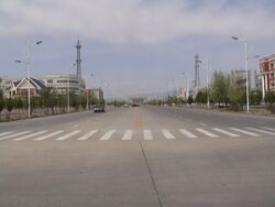
 Tianshan Street, Alashankou | |
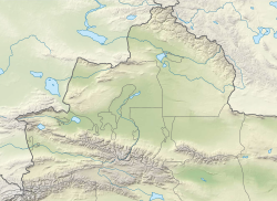
| الإحداثيات: 45°10′24″N 82°33′17″E / 45.1733°N 82.5546°E | |
| Country | China |
| Autonomous region | Xinjiang |
| Autonomous prefecture | Bortala |
| Municipal seat | Alataw Subdistrict |
| المساحة | |
| • الإجمالي | 1٬204 كم² (465 ميل²) |
| التعداد (2020)[1] | |
| • الإجمالي | 11٬097 |
| • الكثافة | 9٫2/km2 (24/sq mi) |
| منطقة التوقيت | UTC+8 (China Standard Time[أ]) |
| الموقع الإلكتروني | www |
| ألاشانكو | |||||||||||
|---|---|---|---|---|---|---|---|---|---|---|---|
| Chinese name | |||||||||||
| الصينية | 阿拉山口市 | ||||||||||
| |||||||||||
| الاسم الصيني البديل | |||||||||||
| الصينية | 阿拉套阿格兹 | ||||||||||
| |||||||||||
| Mongolian name | |||||||||||
| Mongolian Cyrillic | Алаг уул хот | ||||||||||
| Mongolian script | ᠠᠯᠠᠭ ᠠᠭᠤᠯᠠ ᠬᠣᠲᠠ | ||||||||||
| Uyghur name | |||||||||||
| Uyghur | ئالاتاۋ ئېغىزى شەھىرى or ئالاتاۋ ئېغىزى | ||||||||||
| Literal meaning | Alatau Pass | ||||||||||
| |||||||||||
| قزخ name | |||||||||||
| قزخ | الاتاۋ ساعاسى قالاسى or الاتاۋ قالاسى | ||||||||||
Alashankou is a border city in Bortala Mongol Autonomous Prefecture, Xinjiang Uyghur Autonomous Region, China. It is a port of entry by both railroad and highway from Kazakhstan as part of the Eurasian Land Bridge.
استعراض
The city is located at the Dzungarian Gate[2] (Alashankou in Chinese), a pass connecting the two countries through the Dzungarian Alatau mountains. West of the pass, the port of entry on the Kazakhstan side is Dostyk. Alashankou is 73 كيلومتر (45 mi) from Bole, 460 كيلومتر (290 mi) from Ürümqi, and 580 كيلومتر (360 mi) from Almaty.[3] The weather in Alashankou is harsh.[4]
Alashankou is one of China's national first-class ports of entry. The volume of imports and exports passing through Alashankou accounts for 90% of the total for all of Xinjiang.[5] Since 2010, it has surpassed Manzhouli, Inner Mongolia to become the busiest land port-of-entry in China.[6]
Formerly a township-level port commission under the administration of Bole City, Alashankou was upgraded to a county-level city in December 2012. The city governs an area of 1،204 متر كيلومربع (465 sq mi), including 12 متر كيلومربع (4.6 sq mi) of built-up area, which is divided into Alatao and Aibihu subdistricts. It has a permanent population of 10,000 and a floating population of 30,000.[6]
النقل
The agreement between the Soviet Union and the China to connect Kazakhstan with Western China by rail was achieved in 1954. On the Soviet side, the railway reached the border town of Druzhba (Dostyk) in 1959. On the Chinese side, however, the westward construction of the Lanzhou-Xinjiang railway was stopped once it reached Ürümqi in 1962. Due to the Sino-Soviet split, the railway link was not completed until September 12, 1990. The highway port of entry was opened in December 1995.[5]
The railway networks of the two countries use different gauges (China, like most of Europe, uses the standard gauge of 1٬435 mm (4 ft 8 1⁄2 in), but Kazakhstan uses the broader gauge of 1٬520 mm (4 ft 11 27⁄32 in) Russian gauge), so there are breaks of gauge. It is proposed to build a standard gauge transcontinental railway to link Europe and China to bypass these two breaks of gauge. This project was signed in 2004.[7]
On July 10, 2010, Bole Alashankou Airport was opened with scheduled flights to Ürümqi.[8]
Alashankou has again become a major transportation hub due to freight associated with the Belt and Road Initiative's Eurasian Land Bridge Economic Corridor.[2]
التقسيمات الإدارية
Alashankou is made up of 1 subdistrict and 1 town.
| Name | Simplified Chinese | Hanyu Pinyin | Uyghur (UEY) | Uyghur Latin (ULY) | Mongolian (traditional) | Mongolian (Cyrillic) | Administrative division code | |
|---|---|---|---|---|---|---|---|---|
| Subdistrict | ||||||||
| Alataw Subdistrict | 阿拉套街道 | Ālātào Jiēdào | ئالاتاۋ كوچا باشقارمىسى | Alataw kocha bashqarmisi | ᠠᠯᠠᠭ ᠠᠭᠤᠯᠠ ᠵᠡᠭᠡᠯᠢ ᠭᠤᠳᠤᠮᠵᠢ | Алаг уул зээл гудамж | 652702001 | |
| Town | ||||||||
| Ebinur Town | 艾比湖镇 | Àibǐhú Zhèn | ئېبنۇر كۆلى بازىرى | Ëbnur köli baziri | ᠡᠪᠢ ᠨᠠᠭᠤᠷ ᠪᠠᠯᠭᠠᠰᠤ | Эв нуур балгас | 652702100 | |
المناخ
| بيانات المناخ لـ ألاشانكو، elevation 370 m (1،210 ft), (1991–2020 normals, extremes 1981–2010) | |||||||||||||
|---|---|---|---|---|---|---|---|---|---|---|---|---|---|
| الشهر | ينا | فب | مار | أبر | ماي | يون | يول | أغس | سبت | أكت | نوف | ديس | السنة |
| القصوى القياسية °س (°ف) | 8.3 (46.9) |
8.8 (47.8) |
23.5 (74.3) |
36.2 (97.2) |
40.2 (104.4) |
41.8 (107.2) |
44.1 (111.4) |
42.3 (108.1) |
39.1 (102.4) |
30.7 (87.3) |
19.5 (67.1) |
10.9 (51.6) |
44.1 (111.4) |
| متوسط القصوى اليومية °س (°ف) | −12.0 (10.4) |
−6.1 (21.0) |
6.6 (43.9) |
19.8 (67.6) |
26.6 (79.9) |
32.2 (90.0) |
34.2 (93.6) |
32.5 (90.5) |
25.5 (77.9) |
15.5 (59.9) |
3.9 (39.0) |
−7.2 (19.0) |
14.3 (57.7) |
| المتوسط اليومي °س (°ف) | −15.5 (4.1) |
−10.1 (13.8) |
1.9 (35.4) |
13.9 (57.0) |
20.5 (68.9) |
26.1 (79.0) |
27.9 (82.2) |
26.3 (79.3) |
19.8 (67.6) |
10.7 (51.3) |
0.3 (32.5) |
−10.3 (13.5) |
9.3 (48.7) |
| متوسط الدنيا اليومية °س (°ف) | −18.2 (−0.8) |
−13.4 (7.9) |
−2.1 (28.2) |
8.8 (47.8) |
15.0 (59.0) |
20.5 (68.9) |
22.4 (72.3) |
20.8 (69.4) |
14.7 (58.5) |
6.5 (43.7) |
−2.6 (27.3) |
−12.6 (9.3) |
5.0 (41.0) |
| الصغرى القياسية °س (°ف) | −31.4 (−24.5) |
−30.5 (−22.9) |
−25.3 (−13.5) |
−10.6 (12.9) |
1.9 (35.4) |
8.8 (47.8) |
12.7 (54.9) |
9.1 (48.4) |
1.5 (34.7) |
−7.8 (18.0) |
−28.0 (−18.4) |
−31.9 (−25.4) |
−31.9 (−25.4) |
| متوسط تساقط الأمطار mm (inches) | 5.8 (0.23) |
4.2 (0.17) |
4.2 (0.17) |
10.1 (0.40) |
18.8 (0.74) |
15.6 (0.61) |
20.7 (0.81) |
16.5 (0.65) |
11.8 (0.46) |
8.8 (0.35) |
4.9 (0.19) |
8.1 (0.32) |
129.5 (5.1) |
| Average precipitation days (≥ 0.1 mm) | 10.5 | 7.3 | 3.6 | 4.8 | 6.3 | 6.8 | 8.8 | 7.0 | 5.1 | 4.0 | 5.2 | 12.0 | 81.4 |
| متوسط الرطوبة النسبية (%) | 80 | 77 | 63 | 42 | 35 | 34 | 36 | 36 | 39 | 52 | 70 | 81 | 54 |
| Mean monthly ساعات سطوع الشمس | 108.3 | 130.8 | 192.1 | 251.8 | 299.2 | 294.0 | 300.8 | 296.6 | 259.8 | 204.2 | 113.9 | 73.7 | 2٬525٫2 |
| نسبة السطوع المحتمل للشمس | 38 | 44 | 51 | 61 | 65 | 63 | 64 | 70 | 71 | 62 | 41 | 27 | 55 |
| Source: China Meteorological Administration[9][10] | |||||||||||||
انظر أيضاً
Notes
- ^ Locals in Xinjiang frequently observe UTC+6 (Xinjiang Time), 2 hours behind Beijing.
References
- ^ Xinjiang: Prefectures, Cities, Districts and Counties
- ^ أ ب Curtis, Simon; Klaus, Ian (2024). The Belt and Road City: Geopolitics, Urbanization, and China's Search for a New International Order. New Haven and London: Yale University Press. p. 161. doi:10.2307/jj.11589102. ISBN 9780300266900. JSTOR jj.11589102.
- ^ 阿拉山口陸運(鐵路、公路)口岸. 中国网.
- ^ "新疆兵团护路民兵寒冬巡逻阿拉山口铁路线_国内". Archived from the original on 2018-01-22. Retrieved 2018-01-21.
- ^ أ ب 阿拉山口——中国向西开放的前沿. 人民网.
- ^ أ ب 新疆阿拉山口市挂牌成立. Sina (in الصينية). 2012-12-31. Retrieved 2013-02-22.
- ^ "Trans-Kazakhstan link will complete standard-gauge transcontinental artery". Railway Gazette International. Archived from the original on 2011-08-13. Retrieved 2011-10-04.
- ^ 新疆博乐阿拉山口机场正式通航. Xinhua. 2010-07-11. Archived from the original on July 15, 2010.
- ^ 中国气象数据网 – WeatherBk Data (in الصينية المبسطة). China Meteorological Administration. Retrieved 10 October 2023.
- ^ 中国气象数据网 (in الصينية المبسطة). China Meteorological Administration. Retrieved 10 October 2023.
وصلات خارجية
- Pages using gadget WikiMiniAtlas
- CS1 uses الصينية-language script (zh)
- CS1 الصينية-language sources (zh)
- CS1 الصينية المبسطة-language sources (zh-hans)
- Short description is different from Wikidata
- Articles containing صينية-language text
- Articles containing Uyghur-language text
- Articles containing منغولية-language text
- Coordinates on Wikidata
- Articles containing قزخ-language text
- Articles that mention track gauge 1435 mm
- Articles that mention track gauge 1520 mm
- China–Kazakhstan border crossings
- Populated places in Xinjiang
- County-level divisions of Xinjiang


