ملف:Wrightsville PA HD Presby.JPG
حجم هذه المعاينة: 800 × 600 بكسل. البعدان الآخران: 2٬560 × 1٬920 بكسل | 4٬320 × 3٬240 بكسل.
الملف الأصلي (4٬320 × 3٬240 بكسل حجم الملف: 3٫57 ميجابايت، نوع MIME: image/jpeg)
وصف قصير
| ⧼wm-license-information-description⧽ |
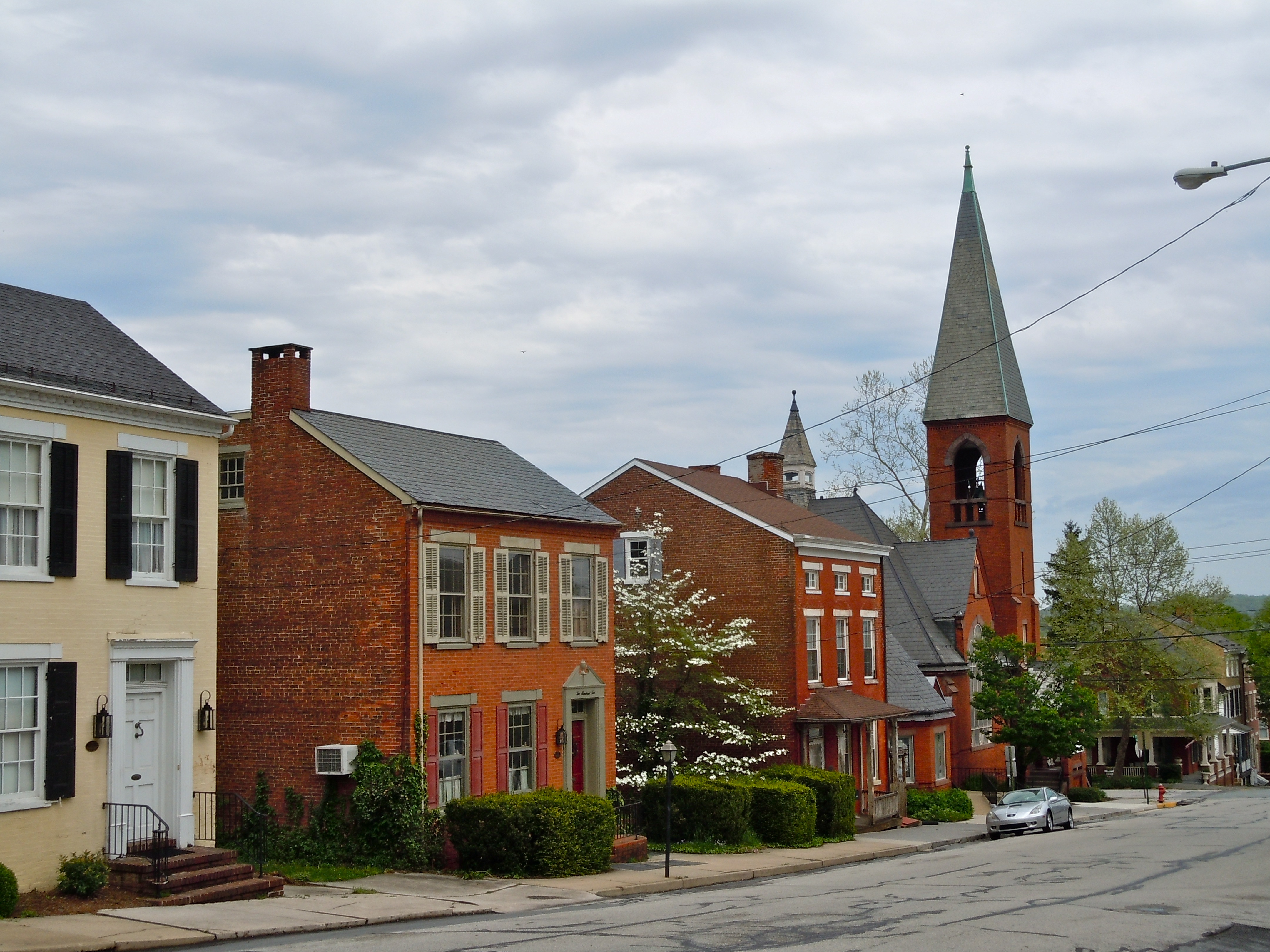
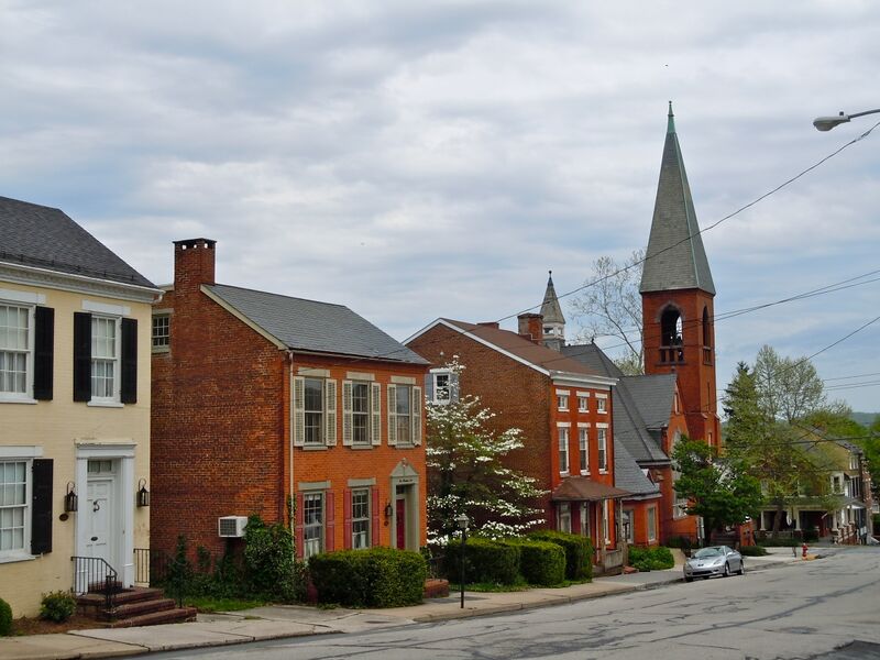
English: Presbyterian Church in Wrightsville Historic District on the NRHP since September 12, 1983. Historic district is roughly bounded by the Susquehanna River and Vine, 4th, and Willow Streets, Wrightsville, York County, Pennsylvania. A block north of US 30.
|
||||||||||||||
| ⧼wm-license-information-date⧽ | 2011 | ||||||||||||||
| ⧼wm-license-information-source⧽ | ⧼Wm-license-own-work⧽ | ||||||||||||||
| ⧼wm-license-information-author⧽ | Smallbones | ||||||||||||||
40°1′26″N 76°31′41″W / 40.02389°N 76.52806°W
ترخيص
تاريخ الملف
اضغط على زمن/تاريخ لرؤية الملف كما بدا في هذا الزمن.
| زمن/تاريخ | صورة مصغرة | الأبعاد | مستخدم | تعليق | |
|---|---|---|---|---|---|
| حالي | ★ مراجعة معتمدة 07:41، 5 ديسمبر 2023 | | 4٬320 × 3٬240 (3٫57 ميجابايت) | Pastakhov (نقاش | مساهمات) | Upload https://upload.wikimedia.org/wikipedia/commons/c/c4/Wrightsville_PA_HD_Presby.JPG |
لا يمكنك استبدال هذا الملف.
وصلات
لا يوجد صفحات تصل لهذه الصورة.