ملف:Storrs at State in Lower Price Hill.jpg
حجم هذه المعاينة: 800 × 450 بكسل. البعد الآخر: 2٬816 × 1٬584 بكسل.
الملف الأصلي (2٬816 × 1٬584 بكسل حجم الملف: 1٫87 ميجابايت، نوع MIME: image/jpeg)
| موضوعات | |
|---|---|
| قوائم حسب الولاية |
|
| قائمة الأراضي | |
| قوائم حسب الولايات المرتبطة | |
| أخرى | |
39°6′12″N 84°33′13″W / 39.10333°N 84.55361°W
| ⧼wm-license-information-description⧽ |
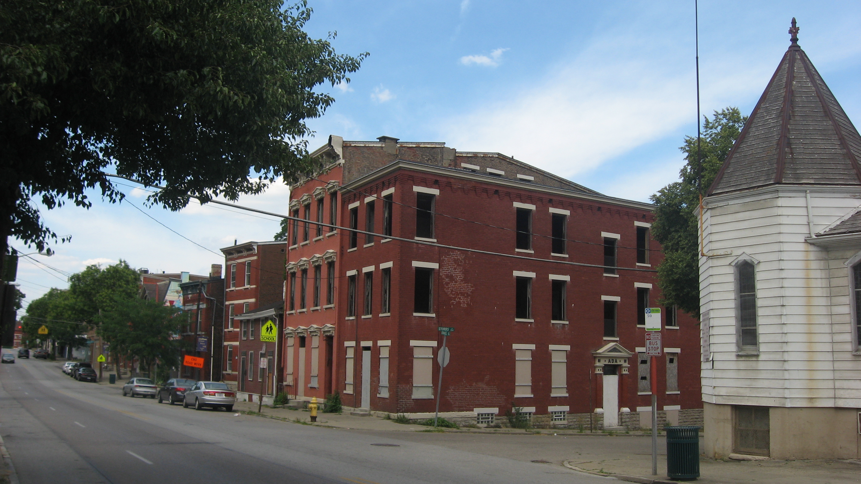
English: Buildings on the eastern side of State Avenue (State Route 264) on the northern side of the Storrs Street intersection (plus the State Avenue Methodist Church on the southern side) in the Lower Price Hill neighborhood of Cincinnati, Ohio, United States. This neighborhood is part of the Lower Price Hill Historic District, a historic district that is listed on the National Register of Historic Places.
|
||
| ⧼wm-license-information-date⧽ | قالب:Taken on | ||
| ⧼wm-license-information-source⧽ | ⧼Wm-license-own-work⧽ | ||
| ⧼wm-license-information-author⧽ | Nyttend | ||
| ⧼wm-license-information-permission⧽ (⧼wm-license-information-permission-reusing-text⧽) |
|
تاريخ الملف
اضغط على زمن/تاريخ لرؤية الملف كما بدا في هذا الزمن.
| زمن/تاريخ | صورة مصغرة | الأبعاد | مستخدم | تعليق | |
|---|---|---|---|---|---|
| حالي | ★ مراجعة معتمدة 04:59، 26 ديسمبر 2023 | | 2٬816 × 1٬584 (1٫87 ميجابايت) | Pastakhov (نقاش | مساهمات) | Upload https://upload.wikimedia.org/wikipedia/commons/4/41/Storrs_at_State_in_Lower_Price_Hill.jpg |
لا يمكنك استبدال هذا الملف.
وصلات
لا يوجد صفحات تصل لهذه الصورة.
معلومات الصورة (ميتا)
تصنيفات:
- Brick houses in Cincinnati, Ohio
- Churches in Cincinnati, Ohio
- Historic districts in Cincinnati, Ohio
- Italianate architecture in Ohio
- United Methodist churches in Ohio
- National Register of Historic Places in Cincinnati, Ohio
- Ohio State Route 264
- Wooden churches in Hamilton County, Ohio
- Community pictures by User:Nyttend