ملف:Somerset north of Orange in Scalp Level.jpg
حجم هذه المعاينة: 800 × 532 بكسل. البعدان الآخران: 2٬560 × 1٬702 بكسل | 6٬016 × 4٬000 بكسل.
الملف الأصلي (6٬016 × 4٬000 بكسل حجم الملف: 6٫37 ميجابايت، نوع MIME: image/jpeg)
| موضوعات | |
|---|---|
| قوائم حسب الولاية |
|
| قائمة الأراضي | |
| قوائم حسب الولايات المرتبطة | |
| أخرى | |
40°14′42″N 78°50′29″W / 40.24500°N 78.84139°W
| ⧼wm-license-information-description⧽ |
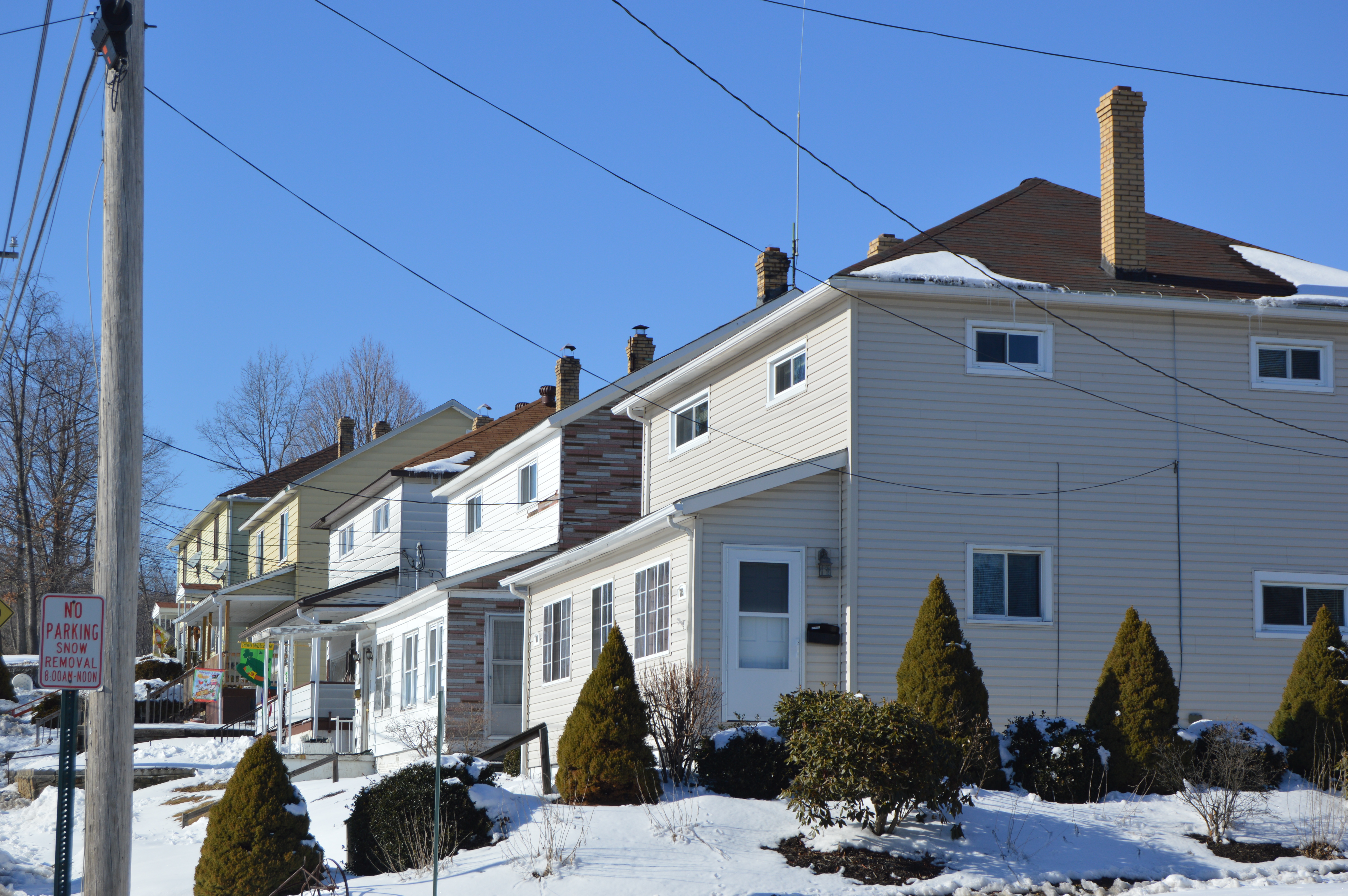
English: Houses on the northeastern side of Somerset Street at the Orange Street intersection in Scalp Level, Pennsylvania, United States. This section of Somerset is part of the Windber Historic District, a historic district that is listed on the National Register of Historic Places.
|
||
| ⧼wm-license-information-date⧽ | قالب:Taken on | ||
| ⧼wm-license-information-source⧽ | ⧼Wm-license-own-work⧽ | ||
| ⧼wm-license-information-author⧽ | Nyttend | ||
| ⧼wm-license-information-permission⧽ (⧼wm-license-information-permission-reusing-text⧽) |
|
تاريخ الملف
اضغط على زمن/تاريخ لرؤية الملف كما بدا في هذا الزمن.
| زمن/تاريخ | صورة مصغرة | الأبعاد | مستخدم | تعليق | |
|---|---|---|---|---|---|
| حالي | ★ مراجعة معتمدة 06:37، 11 أكتوبر 2023 | | 6٬016 × 4٬000 (6٫37 ميجابايت) | Pastakhov (نقاش | مساهمات) | Upload https://upload.wikimedia.org/wikipedia/commons/2/25/Somerset_north_of_Orange_in_Scalp_Level.jpg |
لا يمكنك استبدال هذا الملف.
وصلات
لا يوجد صفحات تصل لهذه الصورة.