ملف:Milestone, Betws-y-Coed (Holyhead 45 miles).JPG
حجم هذه المعاينة: 400 × 600 بكسل. البعد الآخر: 1٬365 × 2٬048 بكسل.
الملف الأصلي (3٬456 × 5٬184 بكسل حجم الملف: 8٫46 ميجابايت، نوع MIME: image/jpeg)
وصف قصير
| ⧼wm-license-information-description⧽ |
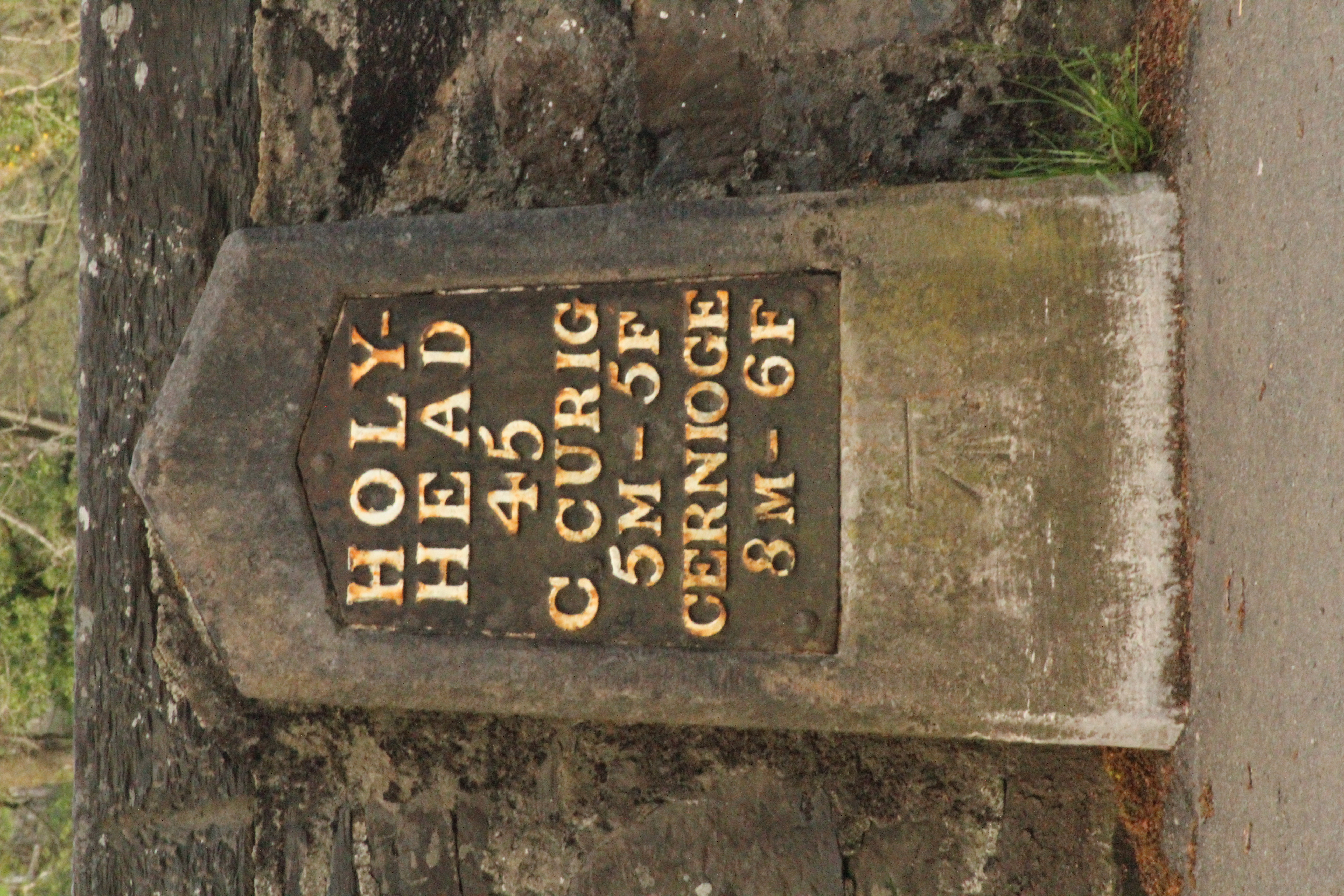
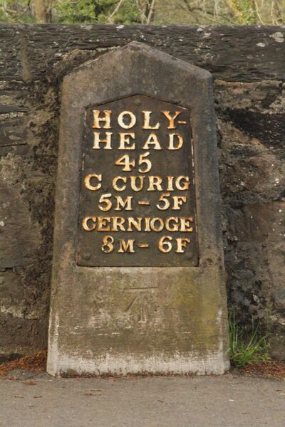
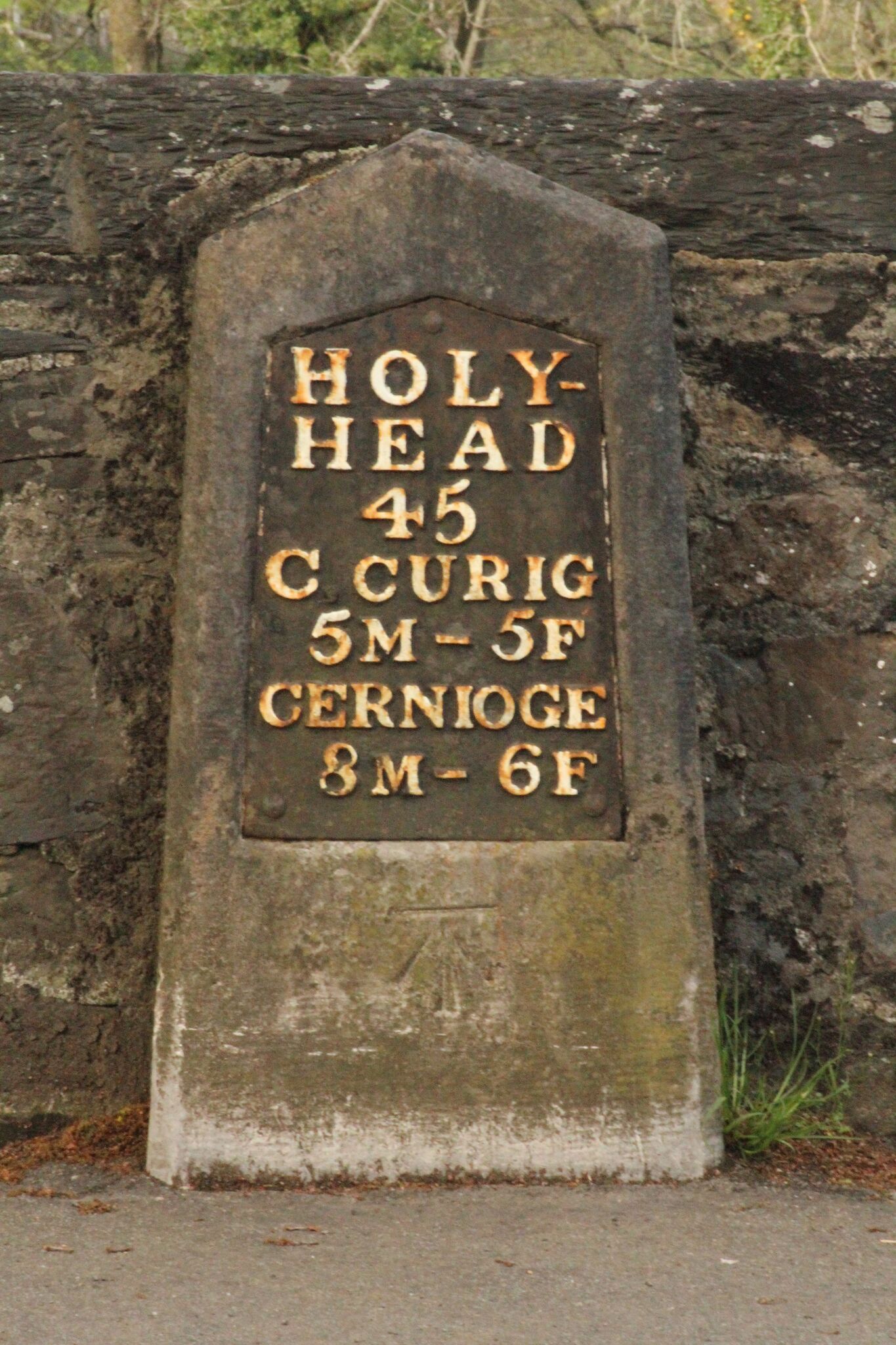
English: Milestone on Telford's road through North Wales (now part of the A5), built in about 1815. The milestone is located between the River Conwy and the main shopping centre of Betws-y-Coed. It shows the distance to Holyhead as 45 miles; the distance to Capel Curig as 5 miles and 5 furlongs and the distance to Cernioge [Inn] (now a farm near Rhydlydan)[1] as 8 miles and 6 furlongs.
|
| ⧼wm-license-information-date⧽ | 2015 |
| ⧼wm-license-information-source⧽ | ⧼Wm-license-own-work⧽ |
| ⧼wm-license-information-author⧽ | Martinvl |
References
- ^ "Cernioge through time". Portsmouth University and others. Retrieved 81 August 2015.
{{cite web}}: Check date values in:|accessdate=(help)
ترخيص
|
تاريخ الملف
اضغط على زمن/تاريخ لرؤية الملف كما بدا في هذا الزمن.
| زمن/تاريخ | صورة مصغرة | الأبعاد | مستخدم | تعليق | |
|---|---|---|---|---|---|
| حالي | ★ مراجعة معتمدة 10:20، 16 يناير 2024 | | 3٬456 × 5٬184 (8٫46 ميجابايت) | Pastakhov (نقاش | مساهمات) | Upload https://upload.wikimedia.org/wikipedia/commons/c/cd/Milestone%2C_Betws-y-Coed_%28Holyhead_45_miles%29.JPG |
لا يمكنك استبدال هذا الملف.
وصلات
لا يوجد صفحات تصل لهذه الصورة.
.JPG&oldid=3895388)