ملف:Market and Main in Rushville.jpg

حجم هذه المعاينة: 800 × 450 بكسل. البعد الآخر: 2٬816 × 1٬584 بكسل.
الملف الأصلي (2٬816 × 1٬584 بكسل حجم الملف: 1٫15 ميجابايت، نوع MIME: image/jpeg)
| موضوعات | |
|---|---|
| قوائم حسب الولاية |
|
| قائمة الأراضي | |
| قوائم حسب الولايات المرتبطة | |
| أخرى | |
39°45′53″N 82°18′53″W / 39.76472°N 82.31472°W
| ⧼wm-license-information-description⧽ |
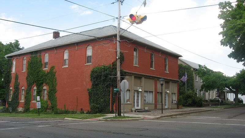
English: Buildings on the northern side of W. Main Street east of the Market Street (State Route 664) intersection in Rushville, Ohio, United States. This block is part of the Rushville Historic District, a historic district that is listed on the National Register of Historic Places.
|
||
| ⧼wm-license-information-date⧽ | قالب:Taken on | ||
| ⧼wm-license-information-source⧽ | ⧼Wm-license-own-work⧽ | ||
| ⧼wm-license-information-author⧽ | Nyttend | ||
| ⧼wm-license-information-permission⧽ (⧼wm-license-information-permission-reusing-text⧽) |
|
تاريخ الملف
اضغط على زمن/تاريخ لرؤية الملف كما بدا في هذا الزمن.
| زمن/تاريخ | صورة مصغرة | الأبعاد | مستخدم | تعليق | |
|---|---|---|---|---|---|
| حالي | ★ مراجعة معتمدة 21:47، 24 ديسمبر 2023 | | 2٬816 × 1٬584 (1٫15 ميجابايت) | Pastakhov (نقاش | مساهمات) | Upload https://upload.wikimedia.org/wikipedia/commons/7/73/Market_and_Main_in_Rushville.jpg |
لا يمكنك استبدال هذا الملف.
وصلات
لا يوجد صفحات تصل لهذه الصورة.