ملف:Kennedy Bridge Chesco.JPG

حجم هذه المعاينة: 800 × 533 بكسل. البعدان الآخران: 2٬560 × 1٬707 بكسل | 4٬056 × 2٬704 بكسل.
الملف الأصلي (4٬056 × 2٬704 بكسل حجم الملف: 3٫95 ميجابايت، نوع MIME: image/jpeg)
| موضوعات | |
|---|---|
| قوائم حسب الولاية |
|
| قائمة الأراضي | |
| قوائم حسب الولايات المرتبطة | |
| أخرى | |
وصف قصير
| ⧼wm-license-information-description⧽ |
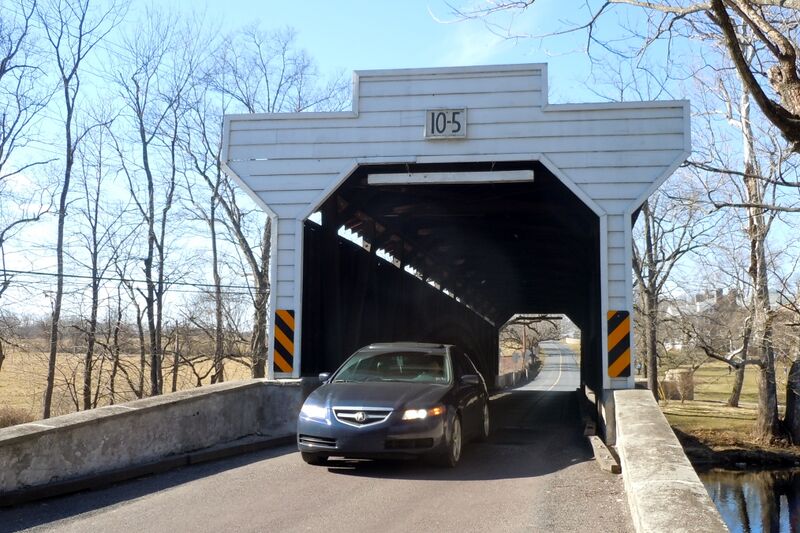
English: Kennedy Bridge (covered bridge) on the NRHP since January 21, 1974. Located north of Kimberton off Pennsylvania Route 23 on Seven Stars Road over French Creek in East Vincent Township, Chester County, Pennsylvania. Near Hare's Hill Road Bridge.
|
| ⧼wm-license-information-date⧽ | 2011 |
| ⧼wm-license-information-source⧽ | ⧼Wm-license-own-work⧽ |
| ⧼wm-license-information-author⧽ | Smallbones |
40°8′25″N 75°34′36″W / 40.14028°N 75.57667°W
ترخيص
تاريخ الملف
اضغط على زمن/تاريخ لرؤية الملف كما بدا في هذا الزمن.
| زمن/تاريخ | صورة مصغرة | الأبعاد | مستخدم | تعليق | |
|---|---|---|---|---|---|
| حالي | ★ مراجعة معتمدة 15:41، 4 ديسمبر 2023 | | 4٬056 × 2٬704 (3٫95 ميجابايت) | Pastakhov (نقاش | مساهمات) | Upload https://upload.wikimedia.org/wikipedia/commons/5/54/Kennedy_Bridge_Chesco.JPG |
لا يمكنك استبدال هذا الملف.
وصلات
لا يوجد صفحات تصل لهذه الصورة.