ملف:Chagrin Falls Triangle Park.jpg

حجم هذه المعاينة: 800 × 532 بكسل. البعدان الآخران: 2٬560 × 1٬702 بكسل | 6٬016 × 4٬000 بكسل.
الملف الأصلي (6٬016 × 4٬000 بكسل حجم الملف: 6٫41 ميجابايت، نوع MIME: image/jpeg)
| موضوعات | |
|---|---|
| قوائم حسب الولاية |
|
| قائمة الأراضي | |
| قوائم حسب الولايات المرتبطة | |
| أخرى | |
41°25′49″N 81°23′30″W / 41.43028°N 81.39167°W
| ⧼wm-license-information-description⧽ |
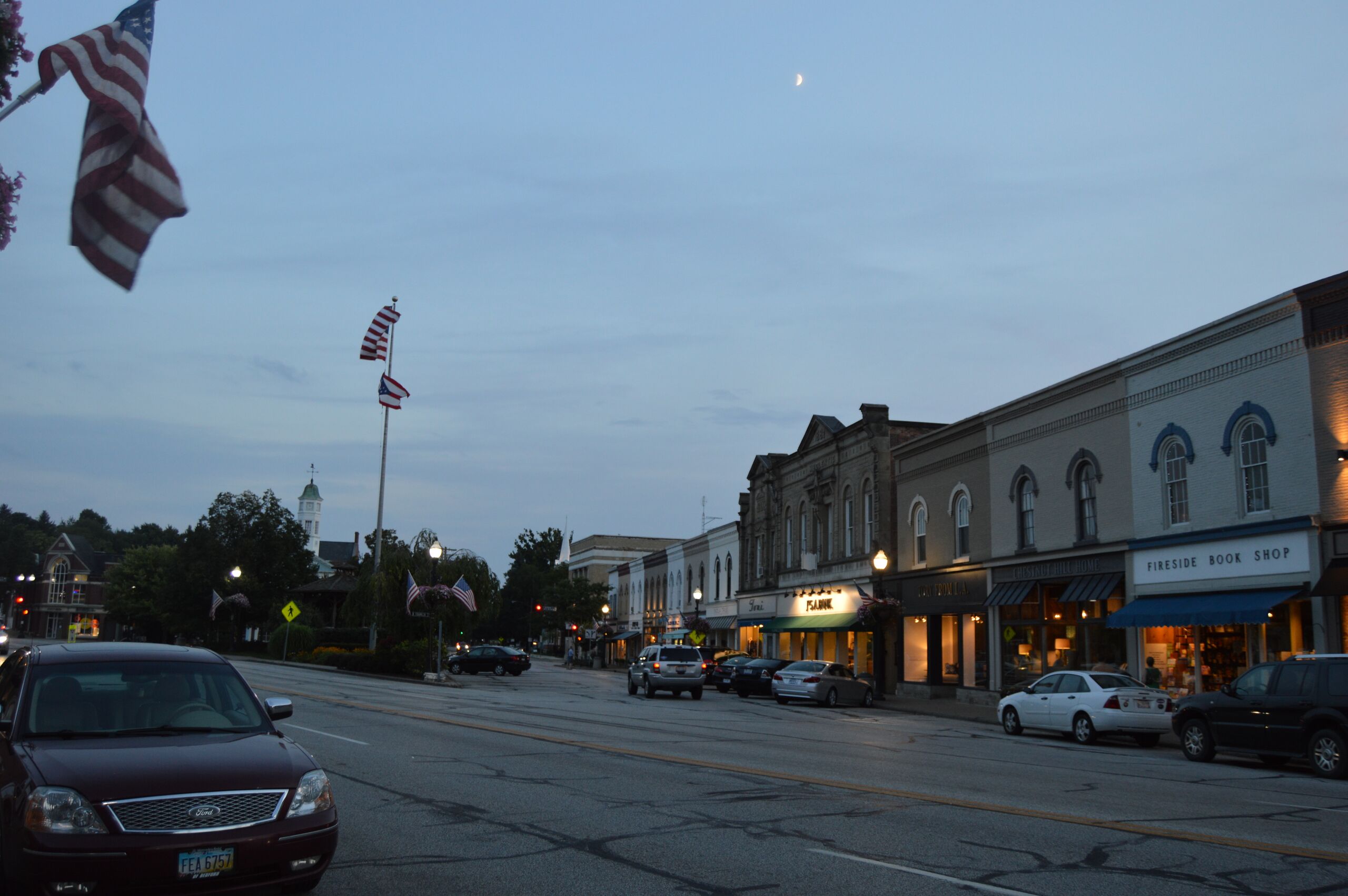
English: Looking south along Franklin Street from the Main Street intersection in Chagrin Falls, Ohio, United States. This section of downtown Chagrin Falls is part of the Chagrin Falls Triangle Park Commercial District, a historic district that is listed on the National Register of Historic Places.
|
||
| ⧼wm-license-information-date⧽ | قالب:Taken on | ||
| ⧼wm-license-information-source⧽ | ⧼Wm-license-own-work⧽ | ||
| ⧼wm-license-information-author⧽ | Nyttend | ||
| ⧼wm-license-information-permission⧽ (⧼wm-license-information-permission-reusing-text⧽) |
|
تاريخ الملف
اضغط على زمن/تاريخ لرؤية الملف كما بدا في هذا الزمن.
| زمن/تاريخ | صورة مصغرة | الأبعاد | مستخدم | تعليق | |
|---|---|---|---|---|---|
| حالي | ★ مراجعة معتمدة 17:48، 13 نوفمبر 2023 | | 6٬016 × 4٬000 (6٫41 ميجابايت) | Pastakhov (نقاش | مساهمات) | Upload https://upload.wikimedia.org/wikipedia/commons/1/13/Chagrin_Falls_Triangle_Park.jpg |
لا يمكنك استبدال هذا الملف.
وصلات
لا يوجد صفحات تصل لهذه الصورة.