طريق تجاري
| لوجستيات الأعمال |
|---|
| طرق التوزيع |
| نظم الإدارة |
| تصنيف الصناعة |
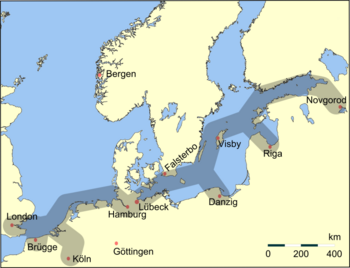
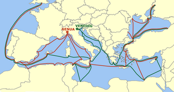
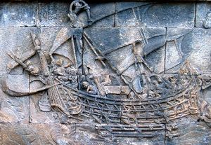
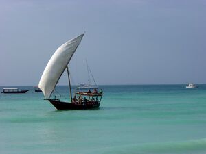
A trade route is a logistical network identified as a series of pathways and stoppages used for the commercial transport of cargo. The term can also be used to refer to trade over bodies of water. Allowing goods to reach distant markets, a single trade route contains long-distance arteries, which may further be connected to smaller networks of commercial and noncommercial transportation routes. Among notable trade routes was the Amber Road, which served as a dependable network for long-distance trade.[1] Maritime trade along the Spice Route became prominent during the Middle Ages, when nations resorted to military means for control of this influential route.[2] During the Middle Ages, organizations such as the Hanseatic League, aimed at protecting interests of the merchants and trade became increasingly prominent.[3]
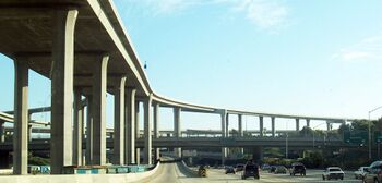
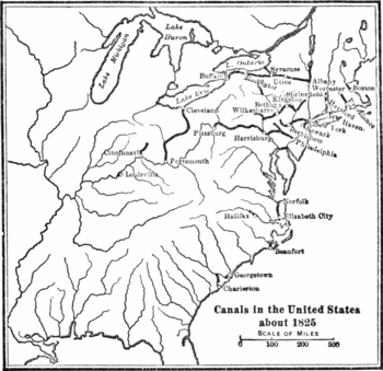
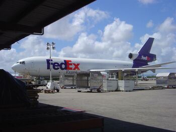
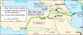
In modern times, commercial activity shifted from the major trade routes of the Old World to newer routes between modern nation-states. This activity was sometimes carried out without traditional protection of trade and under international free-trade agreements, which allowed commercial goods to cross borders with relaxed restrictions.[4] Innovative transportation of modern times includes pipeline transport and the relatively well-known trade involving rail routes, automobiles, and cargo airlines.
التاريخ
تطور الطرق المبكرة
التطور المبكر
التجارة البحرية
الطرق التجارية المرئية
الطرق التجارية التاريخية
الطرق البرية والبحرية المجمعة
طريق البخور
التجارة قبل الكولمبية
الطرق البرية الرئيسية
طريق الحرير

طريق الجذع الكبير
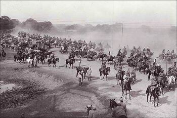
طريق العنبر
طريق البحر
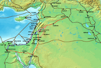
التجارة العابرة للصحراء الكبرى

الطرق البحرية الرئيسية
شبكة التجارة البحرية الأسترونيزية
الطرق الرومانية-الهندية
التجارة الهانزية
من الفارانجيين إلى اليونانيين
تجارة البحر المتوسط للجمهوريات البحرية
طريق التوابل

طريق اليشم البحري

طريق الحرير البحري

الطرق الحديثة

طرق العربات
طرق السكك الحديدية
شبكات الطرق الحديثة
الطرق البحرية الحديثة
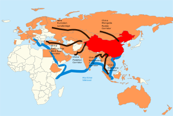
مناطق التجارة الحرة
الطرق الجوية
شبكات خطوط الأنابيب
الهوامش
- ^ خطأ استشهاد: وسم
<ref>غير صحيح؛ لا نص تم توفيره للمراجع المسماةBurns1 - ^ Donkin 2003: 169.
- ^ خطأ استشهاد: وسم
<ref>غير صحيح؛ لا نص تم توفيره للمراجع المسماةDollinger2 - ^ خطأ استشهاد: وسم
<ref>غير صحيح؛ لا نص تم توفيره للمراجع المسماةColumbia2 - ^ "Art of Being Tuareg: Sahara Nomads in a modern world". Smithsonian National Museum of African art.
- ^ Manguin, Pierre-Yves (2016). "Austronesian Shipping in the Indian Ocean: From Outrigger Boats to Trading Ships". In Campbell, Gwyn (ed.). Early Exchange between Africa and the Wider Indian Ocean World. Palgrave Macmillan. pp. 51–76. ISBN 9783319338224.
المصادر
- Stearns, Peter N.; William L. Langer (2001). The Encyclopedia of World History: Ancient, Medieval, and Modern, Chronologically Arranged. Houghton Mifflin Company. ISBN 0-395-65237-5.
- Rawlinson, Hugh George (1916). Intercourse Between India and the Western World: From the Earliest Times to the Fall of Rome. Cambridge University Press.
- Denemark, Robert Allen; el al. (2000). World System History: The Social Science of Long-Term Change. Routledge. ISBN 0-415-23276-7.
- Forbes, Andrew; Henley, David (2011). China's Ancient Tea Horse Road. Chiang Mai: Cognoscenti Books. قالب:ASIN
- Glasse, Cyril (2001). The New Encyclopedia of Islam. Rowman Altamira. ISBN 0-7591-0190-6.
- Kitchen, Kenneth Anderson (1994). Documentation for Ancient Arabia. Liverpool University Press. ISBN 0-85323-359-4.
- Edwards, I. E. S.; Boardman, John; Bury, John B.; Cook, S.A. (1969). The Cambridge Ancient History. Cambridge University Press. ISBN 0-521-22717-8.
- Larsen, Curtis E. (1983). Life and Land Use on the Bahrain Islands: The Geoarcheology of an Ancient Society. University of Chicago Press. ISBN 0-226-46906-9.
- Eckenstein, Lina (2005). A History of Sinai. Adamant Media Corporation. ISBN 0-543-95215-0.
- Lach, Donald Frederick (1994). Asia in the Making of Europe: The Century of Discovery. Book 1. University of Chicago Press. ISBN 0-226-46731-7.
- Shaw, Ian (2003). The Oxford History of Ancient Egypt. Oxford University Press. ISBN 0-19-280458-8.
- Elisseeff, Vadime (2000). The Silk Roads: Highways of Culture and Commerce. Berghahn Books. ISBN 1-57181-221-0.
- Orlinsky, Harry Meyer (1981). Israel Exploration Journal Reader. KTAV Publishing House Inc. ISBN 0-87068-267-9.
- Silver, Morris (1983). Prophets and Markets: The Political Economy of Ancient Israel. Springer. ISBN 0-89838-112-6.
- Ball, Warwick (2000). Rome in the East: The Transformation of an Empire. Routledge. ISBN 0-415-11376-8.
- Donkin, Robin A. (2003). Between East and West: The Moluccas and the Traffic in Spices Up to the Arrival of Europeans. Diane Publishing Company. ISBN 0-87169-248-1.
- Burns, Thomas Samuel (2003). Rome and the Barbarians, 100 B.C.–A.D. 400. Johns Hopkins University Press. ISBN 0-8018-7306-1.
- Seaman, Lewis Charles Bernard (1973). Victorian England: Aspects of English and Imperial History 1837-1901. Routledge. ISBN 0-415-04576-2.
- Hindley, Brian (2004). Trade Liberalization in Aviation Services: Can the Doha Round Free Flight?. American Enterprise Institute. ISBN 0-8447-7171-6.
- Dollinger, Philippe (1999). The German Hansa. Routledge. ISBN 0-415-19072-X.
- "western Africa, history of". Encyclopædia Britannica. Encyclopædia Britannica. 2002.
- Freeman, Donald B. (2003). The Straits of Malacca: Gateway Or Gauntlet?. McGill-Queen's Press. ISBN 0-7735-2515-7.
- Lindsay, W S (2006). History of Merchant Shipping and Ancient Commerce. Adamant Media Corporation. ISBN 0-543-94253-8.
- Holl, Augustin F. C. (2003). Ethnoarchaeology of Shuwa-Arab Settlements. Lexington Books. ISBN 0-7391-0407-1.
- Curtin, Philip DeArmond; el al. (1984). Cross-Cultural Trade in World History. Cambridge University Press. ISBN 0-521-26931-8.
- Young, Gary Keith (2001). Rome's Eastern Trade: International Commerce and Imperial Policy, 31 BC–AD 305. Routledge. ISBN 0-415-24219-3.
- Scarre, Chris (1995). The Penguin Historical Atlas of Ancient Rome. Penguin Books. ISBN 0-14-051329-9.
- Toutain, Jules (1979). The Economic Life of the Ancient World. Ayer Publishing. ISBN 0-405-11578-4.
- Carter, Mia; Harlow, Barbara (2004). Archives of Empire: From the East India Company to the Suez Canal. Duke University Press. ISBN 0-8223-3189-6.
- Major, John (1993). Prize Possession: The United States and the Panama Canal, 1903–1979. Cambridge University Press. ISBN 0-521-52126-2.
- "Roman road system". Encyclopædia Britannica. 2002.
- "wagon train". Encyclopædia Britannica. 2002.
- "canal". Encyclopædia Britannica. 2002.
- "roads and highways". Encyclopædia Britannica. 2002.
- "automotive industry". Encyclopædia Britannica. 2002.
- "truck". Encyclopædia Britannica. 2002.
- "canals and inland waterways". Encyclopædia Britannica. 2002.
- "pipeline". Encyclopædia Britannica. 2002.
- Button, Kenneth John (2004). Wings Across Europe: Towards An Efficient European Air Transport System. Ashgate Publishing. ISBN 0-7546-4321-2.
- G. Schulze, Gunther; Ursprung, Heinrich W., eds. (2003). International Environmental Economics: A Survey of the Issues. US: Oxford University Press. ISBN 0-19-926111-3.
- Krech III, Shepard; Merchant, Carolyn; McNeill, John Robert, eds. (2003). Encyclopedia of World Environmental History. US: Routledge. ISBN 978-0-415-93735-1.
- Schwela, Dietrich; Zali, Olivier (1998). Urban Traffic Pollution. Taylor & Francis, Inc. ISBN 978-0-419-23720-4.
- Kearney, Milo (2003). The Indian Ocean in World History. Routledge. ISBN 0-415-31277-9.
وصلات خارجية
- Trade Routes: The Growth of Global Trade. ArchAtlas, Institute of Archaeology, University of Oxford. Archived 22 أبريل 2008 at the Wayback Machine
- Ancient Trade Routes between Europe and Asia. Department of Ancient Near Eastern Art, The Metropolitan Museum of Art


