كورنيش شانغهاي
| كورنيش شانغهاي | |||||||||||||
|---|---|---|---|---|---|---|---|---|---|---|---|---|---|
 "The Bund" in Simplified (top) and Traditional (bottom) Chinese characters | |||||||||||||
| الصينية المبسطة | 外滩 | ||||||||||||
| الصينية التقليدية | 外灘 | ||||||||||||
| المعنى الحرفي | "Outer Beach" | ||||||||||||
| |||||||||||||
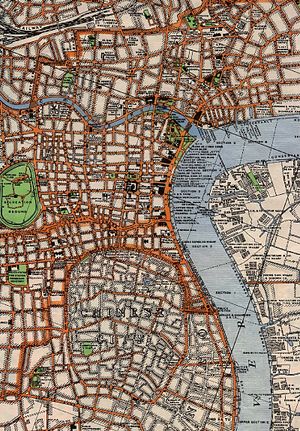
The Bund or Waitan (Chinese: 外滩; pinyin: Wàitān, Shanghainese: nga3thae1, lit. 'Outer Beach') is a waterfront area in central Shanghai. The area centers on a section of Zhongshan Road (East-1 Zhongshan Road) within the former Shanghai International Settlement, which runs along the western bank of the Huangpu River in the eastern part of Huangpu District. The area along the river faces the modern skyscrapers of Pudong District. The Bund usually refers to the buildings and wharves on this section of the road, as well as some adjacent areas. It is one of the most famous tourist destinations in Shanghai. Building heights are restricted in the area.
الاسم
The word bund means an embankment or an embanked quay. The word comes from the Persian word band, through Hindustani, meaning an embankment, levee or dam (a cognate of English terms "bind", "bond" and "band", and the German word "Bund"). Mumbai's Apollo Bunder and city names like Bandar Abbas and Banda Aceh share the same etymology. The various "bunds" in east Asia, may therefore be named after the bunds/levees in Baghdad along the Tigris, given by the immigrating Baghdadi Jews, like the prominent Baghdadi Sassoon family who settled their businesses in Shanghai, and other port cities in east Asia in the 19th century, and heavily built up their harbors. In these Chinese port cities, the English term came to mean, especially, the embanked quay along the shore. In English, "Bund" is pronounced to rhyme with "fund".[1]
There are numerous sites in India, China, and Japan that are called "bunds" (e.g., the Yokohama Bund). However, "The Bund", without qualification to location, usually refers to this stretch of embanked riverfront in Shanghai.
The Chinese name for the Bund is unrelated in meaning: it means literally the "outer bank," referring to the Huangpu River, because this part of the riverfront was located farther downstream than the "inner bank" area adjacent to the old walled city of Shanghai.
التاريخ

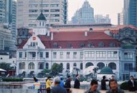
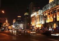
The Shanghai Bund has dozens of historical buildings, lining the Huangpu River, that once housed numerous banks and trading houses from the United Kingdom, France, the الولايات المتحدة, Italy, Russia, Germany, Japan, the Netherlands, and Belgium, as well as the consulates of Russia and Britain, a newspaper, the Shanghai Club and the Masonic Club. The Bund lies north of the old, walled city of Shanghai. It was initially a British settlement; later the British and American settlements were combined in the International Settlement. Magnificent commercial buildings in the Beaux Arts style sprung up in the years around the turn of the 20th century as the Bund developed into a major financial center of east Asia. Directly to the south, and just northeast of the old walled city, the former French Bund (the quai de France, part of the Shanghai French Concession) was of comparable size to the Bund but functioned more as a working harbourside.
By the 1940s, the Bund housed the headquarters of many, if not most, of the major financial institutions operating in China, including the "big four" national banks in the Republic of China era. However, with the Communist victory in the Chinese civil war, many of the financial institutions were moved out gradually in the 1950s, and the hotels and clubs closed or converted to other uses. The statues of colonial figures and foreign worthies which had dotted the riverside were also removed.
العمارة والمباني
الهامش
- ^ "Bund" Oxford English Dictionary, Second edition, 1989; online version November 2010. <http://www.oed.com:80/Entry/24741>; accessed 10 February 2011.
وصلات خارجية
31°14′16.9″N 121°29′10.1″E / 31.238028°N 121.486139°E
- Detailed list of buildings along the Bund
- Key to Buildings with history
- 360 Photosynth of The Bund and Pu Dong
- What year the buildings were built on the Bund
- Historic film footage of buildings along The Bund in year 1928 (begins at 0:40 in linked video clip).
خطأ لوا في وحدة:Authority_control على السطر 278: attempt to call field '_showMessage' (a nil value).
- Pages using gadget WikiMiniAtlas
- Articles containing صينية-language text
- Articles containing simplified Chinese-language text
- Articles with hatnote templates targeting a nonexistent page
- Coordinates on Wikidata
- Art Deco
- الثقافة في شانغهاي
- معالم شانغهاي
- شوارع شانغهاي
- Visitor attractions in Shanghai
- Waterfronts
- المستوطنة الدولية في شانغهاي


