إقليم الأمم الجنوبية
الأمم الجنوبية
ደቡብ ብሔሮች ብሔረሰቦችና ሕዝቦች ክልል | |
|---|---|
 خريطة إثيوپيا موضح عليها موقع منطقة الأمم الجنوبية. | |
| الإحداثيات: 6°03′31″N 36°43′38″E / 6.05862°N 36.7273°E | |
| البلد | إثيوپيا |
| العاصمة | هواسا |
| المساحة | |
| • الإجمالي | 93٬800 كم² (36٬200 ميل²) |
| [2] | |
| التعداد (2017) | |
| • الإجمالي | 11٬426٬000[1] |
| [3] | |
| ISO 3166 code | ET-SN |
| HDI (2017) | 0.464[4] low · 6th |
منطقة الأمم والقوميات والشعوب الجنوبية (أمهرية: የደቡብ ብሔር ብሔረሰቦችና ሕዝቦች ክልል, romanized: Yädäbub Bḥer Bḥeräsäbočna Hzboč Kllə؛ إنگليزية: Southern Nations, Nationalities, and Peoples' Region ويشيع الإشارة إليها بالاختصار الإنگليزي SNNPR) هو اقليم في إثيوپيا. وقد تشكل من اندماج خمس "كيليلوتش"، كانت تسمى المناطق 7 إلى 11، وذلك بعد انتخابات المجالس المحلي في 21 يونيو 1992.[5] وحكومتها توجد في أواسا.
إقليم الأمم الجنوبية تحده كينيا من الجنوب (بما في ذلك جزء من بحيرة توركانا)، ومثلث إيلمي (منطقة نزاع بين كينيا وجنوب السودان) من الجنوب الغربي، وجنوب السودان من الغرب، والإقليم الإثيوپي گامبلا من الشمال الغربي، وإقليم أوروميا من الشمال والشرق، وإقليم سيداما من الشرق. المدن والبلدات الرئيسية في الإقليم تضم: Sodo, Arba Minch, Bonga, Jinka, Dila, Areka, Mizan Teferi, Butajira, Welkite, Durame, Hosaena and Worabe.
The regional government of the Southern Nations, Nationalities, and Peoples' Region is based in the city of Awasa. Following the formation of the Sidama Region in June 2020, Awasa is located outside of the boundaries of the region. The regional government is planning to move to a city within the region's boundaries after two consecutive national electoral cycles.[6]
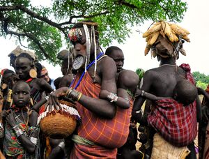
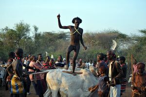
الإقليم يسكنه عشرات القبائل الإثيوبية، منها سيداما وهي قبيله حامية وگوراجية وهي من أصول عربية وكان جميع أفرادها من المسلمين ولكن أصبح نصفها تقريبا مسلمون وولايتا وهي من أصول افريقية وقبائل أخرى صغيره مثل گامو وگوفا وهديه والابا ويم وباسكيتو وبنش وتسامى وزاى وديزو وسورما. ويشتهر الاقليم بأنه مصدر البن وفيه تم اكتشاف أول حبة بن ويبلغ عدد سكانه حوالي 13 مليون نسمه وتشكل سيداما 13.4 وگوراجي 12.9 وولايتا 10.5 ويشكل المسلمون حوالي14%، والپروتستانت 55% ، الأرثوذكس 16% من السكان.
ومن أشهر شخصيات التي ولدت بالاقليم منگستو هايلى مريم من ولايتا والشيخ الكبير حسن انجامو من الابا والقائد العسكري الدموي يتروس أولنگا من گامو وكثير من شيوخ المسلمين الذين ساهمو بنشر الإسلام بالمنطقة.
الديمغرافيا
Based on the 2007 Census conducted by the Central Statistical Agency of Ethiopia (CSA), the SNNPR has an estimated total population of 14,929,548, of whom 7,425,918 were men and 7,503,630 women. 13,433,991 or 89.98% of the population are estimated to be rural inhabitants, while 1,495,557 or 10.02% are urban; this makes the SNNPR Ethiopia's most rural region. With an estimated area of 105,887.18 square kilometers, this region has an estimated density of 141 people per square kilometer. For the entire region 3,110,995 households were counted, which results in an average for the region of 4.8 persons to a household, with urban households having on average 3.9 and rural households 4.9 people.[3] The projected population for 2017 was 19,170,007.[1]
| السنة | تعداد | ±% |
|---|---|---|
| 1994 | 10٬377٬028 | — |
| 2007 | 14٬929٬548 | +43.9% |
| 2017 | 19٬170٬007 | +28.4% |
| source:[7] | ||
الأديان
| الدين | تعداد 1994 | تعداد 2007[3] |
|---|---|---|
| پروتستانت | 34.8% | 55.5% |
| مسيحيون أرثوذكس | 55.6% | 52.86% |
| مسلمون | 16.7% | 14.12% |
| ديانات تقليدية | 15.4% | 6.6% |
| Roman Catholics | 3% | 2.4% |
| انتماءات دينية أخرى | — | 1.5% |
الأعراق
The SNNPR, being an amalgam of the main homelands of numerous ethnicities, contains over 45 indigenous ethnic groups.
| الشعب | تعداد 1994 | 2007 Census[3] |
|---|---|---|
| سيداما | 18% | 19.38% |
| ولايتا | 12% | 10.59% |
| Hadiya | - | 7.98% |
| Gurage | 15% | 19.54% |
| گامو | - | 7% |
| Kafficho | - | 5.44% |
| Silt'e | - | 5.37% |
| أمهرة | - | 4.10% |
- كل الأعراق
The ethnicities native to the SNNPR, with percentages of the population as reported in the 2007 national census and organized by linguistic grouping, include:[3]
- Cushitic:
- Alaba – 1.35%, mostly in Alaba special woreda
- Tembaro People- 1.32%,Mostly in Tembaro Woreda.
- Arbore – 0.04%
- Daasanach – 0.32%, mostly in Dasenech (woreda)
- Dirashe – 0.2%, mostly in Dirashe special woreda
- Gawwada – 0.43%, mostly in Dirashe special woreda
- Gedeo – 4.9%, mostly in Gedeo Zone
- Hadiya – 7.98%, mostly in Hadiya Zone
- Kambaata – 3.82%, mostly in Kembata Tembaro Zone
- Burji – 0.38%, mostly in Burji special woreda
- Konso – 1.47%, mostly in Konso special woreda
- Libido (or Mareqo) – 0.38%, mostly in Mareko (woreda)
- Sidama – 19.38%, mostly in the former Sidama Zone
- Kebena – 1.21% mostly in Kebena (Woreda)
- Tsamai – 0.13%, mostly in Bena Tsemay (woreda)
- Nilo-Saharan:
- Bodi – 0.04%
- Kichepo
- Kwegu – 0.01%
- Me'en – 1%
- Mursi – 0.05%, mostly in South Omo Zone
- Nyangatom – 0.12%, mostly in Nyangatom (woreda)
- Shabo, mostly in Keficho Shekicho Zone
- Shita people
- Suri/Surma – 0.17%, mostly in Surma (woreda)
- Omotic:
- Aari – 1.9%, mostly in Bako Gazer (woreda)
- Basketo – 0.52%, mostly in Basketo special woreda
- Bench – 2.34%, mostly in Bench Maji Zone
- Chara – 0.08%, mostly in South Omo Zone
- Dawro – 3.28%, mostly in Dawro Zone
- Dime – < 0.01%
- Dizi – 0.23%, mostly in Maji (woreda)
- Dorze, mostly in Chencha (woreda)
- Gamo – 7%, mostly in Gamo Gofa Zone
- Goffa – 2.41%, mostly in Gamo Gofa Zone
- Hamar – 0.31%, mostly in Hamer (woreda)
- Kachama, mostly in Arba Minch (woreda)
- Karo – 0.01%
- Kafficho – 5.44%, mostly in Keffa Zone
- Konta – 0.54%, mostly in Konta special woreda
- Koorete – 1.02%, mostly in Amaro special woreda
- Male – 0.59%, mostly in Male (woreda)
- Mello, mostly in Melokoza (woreda)
- Oyda – 0.25%, mostly in Oyda (woreda)
- Shakacho – 0.44%, mostly in Sheka Zone
- Sheko – 0.24%, mostly in Sheko (woreda)
- Welayta – 10.59%, mostly in Wolayita Zone
- Yem (Yemse) – 0.5%, mostly in Yem special woreda
- Semitic:
- Amhara – 4.10%, widespread
- Gurage – 17.57, mostly in Gurage Zone
- Silte – 5.37%, mostly in Silt'e Zone
- Zayse – 0.1%, mostly in the Lake Zway area
- Zergula
اللغات
The 2007 census reported that the predominantly spoken mother tongue languages include Sidama (19.59%), Welayta (10.48%), Hadiya (8%), Gurage languages (7.13%), Gamo (6.9%), Kafa (5.36%) and Amharic (4.10%). Other languages spoken in the State include Kambaata, Mello, Goffa, Gedeo and Dima; because of the relatively few number of speakers of most of the languages in the region, the working language of the state is Amharic (the most widely spoken language in Ethiopia and formerly the only official language).[3]
The 1994 census reported that the predominantly spoken languages include Sidamigna (18%), Guragigna (14.72%), Welayta (11.53%), Hadiyigna (8.53%), Keffigna (5.22%), and Kembatigna (4.35%). Other languages spoken in the State include Gamoigna, Mello, Goffa, and Gedeo.[8]
Amharic is still the working language although most pupils get eight years of primary education in their home language and all secondary and further education is in English.[9]
الزراعة
The CSA reported that for 2004–2005 100,338 tons of coffee were produced in the SNNPR, based on inspection records from the Ethiopian Coffee and Tea authority. This represents 44.2% of the total production in Ethiopia.
رؤساء اللجان التنفيذية
- Abate Kisho (SEPDM) 1992–2001[10]
- Hailemariam Desalegn 12 November 2001 – March 2006[10]
- Shiferaw Shigute (SEPDM) March 2006 – July 2013[10][11]
- Dessie Dalke July 2013 – 2018[11]
- Million Mathiwos 2018 – 2019
- Erstu Yirdaw August 31, 2019 – present
التقسيمات الادارية
The following list of administrative zones and special woredas (an administrative subdivision which is similar to an autonomous area and is not part of a zone) is based on information from the 2007 census; the list of second administrative level bodies maintained by the United Nations Geographic Information Working Group dates from 2002, and shows a previous subdivision.[12]
- Bench Maji
- Dawro (formerly part of North Omo Zone)
- Gamo Zone (formerly known as Gamo Gofa Zone/North Omo Zone)
- Gofa Zone (Formerly part of Gamo Gofa zone)
- Gedeo
- Gurage
- Hadiya
- Keffa (formerly part of Keficho Shekicho Zone)
- Keficho Shekicho
- Kembata Tembaro
- North Omo[أ]
- Sheka (formerly part of Keficho Shekicho Zone)
- Silti
- South Omo
- Wolayita (formerly part of North Omo Zone)
- Alaba Zone (formerly halaba special woreda)
- Amaro (special woreda)
- Alle Special Woreda
- Basketo (special woreda, formerly part of North Omo Zone)
- Burji (special woreda)
- Dirashe (special woreda)
- Konso Zone (formerly special wereda)
- Konta (special woreda, formerly part of North Omo Zone)
- Yem (special woreda)
انظر أيضاً
المصادر
- ^ أ ب Population Projection of Ethiopia for All Regions At Wereda Level from 2014 – 2017. Federal Democratic Republic of Ethiopia Central Statistical Agency. Retrieved 4 June 2018.
- ^ "2011 National Statistics" (PDF). Central Statistics Agency. Archived from the original (PDF) on 23 September 2015. Retrieved 29 June 2014.
- ^ أ ب ت ث ج ح Central Statistical Agency: The 2007 Population and Housing Census of Ethiopia: Statistical Report for Southern Nations, Nationalities and Peoples’ Region; Part I: Population Size and Characteristics. July 2010.
- ^ "Sub-national HDI - Area Database - Global Data Lab". hdi.globaldatalab.org (in الإنجليزية). Retrieved 2018-09-13.
- ^ Lyons, Terrence (1996). "Closing the Transition: The May 1995 Elections in Ethiopia". Journal of Modern African Studies. 34 (1): 135. doi:10.1017/S0022278X00055233. JSTOR 161741.
- ^ http://addisstandard.com/news-snnprs-council-approves-legal-framework-which-makes-hawassa-city-accountable-to-future-sidama-regional-state/
- ^ Southern Nations, Nationalities, and Peoples' Region population statistics
- ^ "FDRE States-Basic Information, Southern nations and Nationalities". Archived from the original on 18 June 2008. Retrieved 10 May 2006.
- ^ Kathleen Heugh: Margins, Diversity and Achievement: System-Wide Data and Implementation of Multilingual Education in Ethiopia, p. 48, في كتب گوگل. In: Durk Gorter, Victoria Zenotz, Jasone Cenoz (eds.): Minority Languages and Multilingual Education: Bridging the Local and the Global. Springer 2013, ISBN 978-94-007-7317-2.
- ^ أ ب ت "Ethiopia Regions". Worldstatesmen.org. Retrieved October 1, 2013.
- ^ أ ب "Ethiopia: Dessie Dalke Appointed As Chief of South Ethiopia State". AllAfrica.com. Ethiopian Radio and Television Agency. July 13, 2013. Retrieved October 1, 2013.
- ^ "Names and codes for January 2000, Ethiopia". World Health Organization. The information in the WHO spreadsheet is built on information received 18 September 2002 from the Ethiopian Ministry of Federal Affairs.
وصلات خارجية
- Map of Southern Nations, Nationalities, and Peoples' Region at UN-OCHA (PDF file)
- Map of Southern Nations, Nationalities and Peoples' Region at DPPA of Ethiopia (PDF file)
- Ethiopia's Vanishing Tribes slideshow by Life magazine
قالب:Zones of the Southern Nations, Nationalities, and Peoples' Region
قالب:Woredas of the Southern Nations, Nationalities, and Peoples' Region
خطأ استشهاد: وسوم <ref> موجودة لمجموعة اسمها "lower-alpha"، ولكن لم يتم العثور على وسم <references group="lower-alpha"/>
- Pages using gadget WikiMiniAtlas
- Short description is different from Wikidata
- Coordinates on Wikidata
- Articles containing أمهرية-language text
- Pages using Lang-xx templates
- Instances of Lang-am using second unnamed parameter
- Articles containing إنگليزية-language text
- أقاليم إثيوپيا
- الأمم الجنوبية
- تأسيسات 1994 في إثيوپيا
- المرتفعات الإثيوپية


