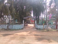
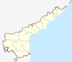
پولاڤارام، ضلع إلورو
پولاڤارام
Polavaram, Prolavaram | |
|---|---|
 سكرتارية قرية پولاڤارام | |
| الإحداثيات: 17°14′52″N 81°38′36″E / 17.2479°N 81.6432°E | |
| البلد | |
| الولاية | أندرا پرادش |
| الضلع | إلورو |
| المساحة | |
| • الإجمالي | 28٫36 كم² (10٫95 ميل²) |
| المنسوب | 16 m (52 ft) |
| التعداد (2011)[2] | |
| • الإجمالي | 13٬861 |
| • الكثافة | 490/km2 (1٬300/sq mi) |
| اللغات | |
| • الرسمية | تلوگو |
| منطقة التوقيت | UTC+5:30 (IST) |
| PIN | 534315 |
| لوحة السيارة | AP37 |
| Lok Sabha constituency | Eluru |
| Vidhan Sabha constituency | Polavaram |
| Climate | hot (Köppen) |
پولاڤارام Polavaram أو پرولاڤارام Prolavaram هي قرية في ضلع إلورو في ولاية أندرا پرادش. وتقع في مندل پولاڤارام في قسم خَراج Jangareddygudem على بعد 35 كم من ضفاف نهر گوداڤاري.[1] كلٌ من تلال پاپي و مشروع پولاڤارام هما معالم رئيسية بالقرب من القرية.
. . . . . . . . . . . . . . . . . . . . . . . . . . . . . . . . . . . . . . . . . . . . . . . . . . . . . . . . . . . . . . . . . . . . . . . . . . . . . . . . . . . . . . . . . . . . . . . . . . . . . . . . . . . . . . . . . . . . . . . . . . . . . . . . . . . . . . . . . . . . . . . . . . . . . . . . . . . . . . . . . . . . . . . .
التاريخ
Historically the area is previously known as Vilasa. According to Vilasa Copper Plate grant (AD 1325) found at Kandarada village, near Pitapuram in East Godavari, Musunuri Prolaya Nayaka donated the village Vilasa in Kona Mandala (present day Konaseema) on banks of river Godavari as an agrahara to a brahmin named Vennaya. Having divided it into 108 shares- Vennaya changed its name to Prolavaram after the king Prola (Varam= gift/boon in Telugu) and gave it further to several brahmins. This is mentioned in Epigraphica Telanganica Volume 3- Decline of Kakatiyas, edited by Dr Gautam Pingle published in 2023 by Dr MCR Human Resource Institute, Govt of Telangana.
الجغرافيا
Polavaram is located at 17°15′00″N 81°38′00″E / 17.2500°N 81.6333°E.[3] It has an average elevation of 16 metres (55 ft).
السكان
اعتبارا من 2011[تحديث] Census of India, Polavaram had a population of 13861. The total population constitute, 6830 males and 7031 females with a sex ratio of 1029 females per 1000 males. 1431 children are in the age group of 0–6 years, with sex ratio of 890 The average literacy rate stands at 76.40%.[4]
انظر أيضاً
المراجع
- ^ أ ب "District Census Handbook - West Godavari" (PDF). Census of India. pp. 22, 176. Retrieved 20 February 2016.
- ^ "Census 2011". The Registrar General & Census Commissioner, India. Retrieved 26 July 2014.
- ^ Fallingrain genomics.Polavaram
- ^ "Polavaram Census 2011". Retrieved 23 May 2017.
وصلات خارجية
- Pages using gadget WikiMiniAtlas
- Articles with hatnote templates targeting a nonexistent page
- Short description with empty Wikidata description
- Coordinates not on Wikidata
- مقالات فيها عبارات متقادمة منذ 2011
- جميع المقالات التي فيها عبارات متقادمة
- Villages in Eluru district
- Places situated on the banks of the Godavari river
