محافظة جيفو
Gifu Prefecture
岐阜県 | |||||||||||||||
|---|---|---|---|---|---|---|---|---|---|---|---|---|---|---|---|
| الترجمة اللفظية بالـ Japanese | |||||||||||||||
| • Japanese | 岐阜県 | ||||||||||||||
| • Rōmaji | Gifu-ken | ||||||||||||||
 | |||||||||||||||
| Country | Japan | ||||||||||||||
| Region | Chūbu (Tōkai) | ||||||||||||||
| Island | Honshu | ||||||||||||||
| Capital | Gifu | ||||||||||||||
| Subdivisions | Districts: 9، Municipalities: 42 | ||||||||||||||
| الحكومة | |||||||||||||||
| • Governor | Hajime Furuta | ||||||||||||||
| المساحة | |||||||||||||||
| • الإجمالي | 10٬621٫29 كم² (4٬100٫90 ميل²) | ||||||||||||||
| ترتيب المساحة | 7th | ||||||||||||||
| التعداد (June 1, 2019) | |||||||||||||||
| • الإجمالي | 1٬991٬390 | ||||||||||||||
| • الترتيب | 17th | ||||||||||||||
| • الكثافة | 190/km2 (490/sq mi) | ||||||||||||||
| ISO 3166 code | JP-21 | ||||||||||||||
| الموقع الإلكتروني | www | ||||||||||||||
| |||||||||||||||
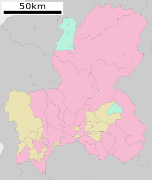
Gifu Prefecture (岐阜県, Gifu-ken) is a prefecture of Japan located in the Chūbu region of Honshu.[1] Gifu Prefecture has a population of 1,991,390 (1 June 2019) and has a geographic area of 10,621 km² (4,100 sq mi). Gifu Prefecture borders Toyama Prefecture to the north; Ishikawa Prefecture to the northwest; Fukui Prefecture to the west; Shiga Prefecture to the southwest; Mie Prefecture and Aichi Prefecture to the south; and Nagano Prefecture to the east.
Gifu is the capital and largest city of Gifu Prefecture, with other major cities including Ōgaki, Kakamigahara, and Tajimi.[2]
Gifu Prefecture is located in the center of Japan, one of only eight landlocked prefectures, and features the country's center of population. Gifu Prefecture has served as the historic crossroads of Japan with routes connecting the east to the west, including the Nakasendō, one of the Five Routes of the Edo Period. Gifu Prefecture was a long-term residence of Oda Nobunaga and Saitō Dōsan, two influential figures of Japanese history in the Sengoku period, spawning the popular phrase of "control Gifu and you control Japan" in the late Medieval era.[3] Gifu Prefecture is known for its traditional Washi paper industry, including Gifu Lanterns and Gifu Umbrellas, and as a center for the Japanese swordsmithing and cutlery industries. Gifu Prefecture is home to Gifu Castle, the 1,300-year-old tradition of Cormorant fishing on the Nagara River, and the site of the Battle of Sekigahara.
جغرافيا
المناخ
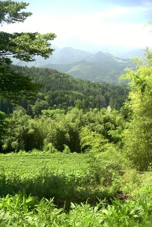
Gifu's climate varies from humid subtropical climate in the south, eventually making the transition to humid continental climate in the north.
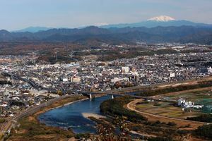
Gifu City (Mino Region)
| ||||||||||||||||||||||||||||||||||||||||||||||||||||||||||||||||||||||||||||||||||||||||||||||||||||||||||||||||||||||||||||||||||||||||||||||||||||||||||||||||||||||||||||||||||||||||||||||||||||
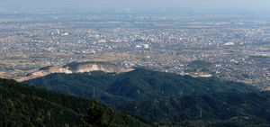
Hida Takayama (Hida Region)
| ||||||||||||||||||||||||||||||||||||||||||||||||||||||||||||||||||||||||||||||||||||||||||||||||||||||||||||||||||||||||||||||||||||||||||||||||||||||||||||||||||||||||||||||||||||||||||||||||||||
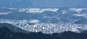
Shōkawa, Takayama (Hida Region)
| ||||||||||||||||||||||||||||||||||||||||||||||||||||||||||||||||||||||||||||||||||||||||||||||||||||||||||||||||||||||||||||||||||||||||||||||||||||||||||||||||||||||||||||||||||||||||||||||||||||
Municipalities
All of the cities, towns, villages and districts of Gifu Prefecture are listed below.
Cities
Twenty-one cities are located in Gifu Prefecture:
- Gifu – (the capital city of the prefecture)
Towns and villages
These are the towns and villages in each district:
See also
- Solar Ark, a solar energy project located in Gifu Prefecture
Notes
- ^ Nussbaum, Louis-Frédéric. (2005). "Gifu-ken" in Japan Encyclopedia, p. 246, p. 246, في كتب گوگل; "Chūbu" in p. 126, p. 126, في كتب گوگل
- ^ Nussbaum, "Gifu" in p. 246, p. 246, في كتب گوگل
- ^ Instant Gifu. Gifu International Center, 1995.
- ^ "平年値(年・月ごとの値)". Japan Meteorological Agency. Retrieved 2011-11-18.
- ^ "観測史上1~10位の値(年間を通じての値)". Japan Meteorological Agency. Retrieved 2010-03-06.
- ^ "平年値(年・月ごとの値)". Japan Meteorological Agency. Retrieved 2010-03-06.
- ^ "観測史上1~10位の値(年間を通じての値)". Japan Meteorological Agency. Retrieved 2010-03-06.
- ^ "AllMetSat Takayama". All Met Sat. Retrieved 2012-02-11.
- ^ "平年値(年・月ごとの値)". Japan Meteorological Agency. Retrieved 2012-05-06.
References
- Nussbaum, Louis-Frédéric and Käthe Roth (2005). Japan Encyclopedia. Cambridge, Massachusetts: Harvard University Press. ISBN 0-674-01753-6; ISBN 978-0-674-01753-5. OCLC 58053128.
External links
 Gifu (prefecture) travel guide from Wikivoyage
- Official website
- Gifu travel guide
- Go Gifu (blog about tourism in Gifu)
- Map of Gifu Prefecture in 1891. National Archives of Japan.
- Pages using gadget WikiMiniAtlas
- Short description matches Wikidata
- Short description is different from Wikidata
- Pages using infobox settlement with no coordinates
- Articles with hatnote templates targeting a nonexistent page
- Official website different in Wikidata and Wikipedia
- Coordinates on Wikidata
- Gifu Prefecture
- Chūbu region
- Prefectures of Japan
- محافظات اليابان


