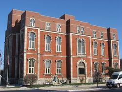
دفاينس، أوهايو
Defiance, Ohio | |
|---|---|
 | |
| الشعار: "A Great Place To Live" | |
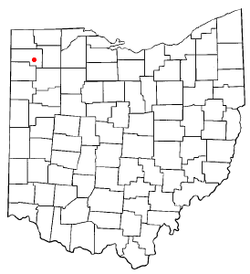
 Location of Defiance, Ohio | |
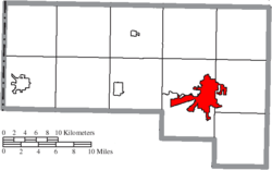
 موقع دفاينس في مقاطعة دفاينس | |
| الإحداثيات: 41°16′55″N 84°21′46″W / 41.28194°N 84.36278°W | |
| البلد | الولايات المتحدة |
| الولاية | أوهايو |
| المقاطعة | دفاينس |
| الحكومة | |
| • العمدة | Michael McCann |
| المساحة | |
| • الإجمالي | 12٫13 ميل² (31٫42 كم²) |
| • البر | 11٫62 ميل² (30٫10 كم²) |
| • الماء | 0٫51 ميل² (1٫32 كم²) |
| المنسوب | 676 ft (206 m) |
| التعداد | |
| • الإجمالي | 16٬494 |
| • Estimate (2018[4]) | 16٬663 |
| • الكثافة | 1٬419٫4/sq mi (548٫0/km2) |
| منطقة التوقيت | UTC-5 (Eastern (EST)) |
| • الصيف (التوقيت الصيفي) | UTC-4 (EDT) |
| ZIP code | 43512 |
| مفتاح الهاتف | 419 |
| FIPS code | 39-21308[5] |
| GNIS feature ID | 1064519[2] |
| الموقع الإلكتروني | City of Defiance Ohio |
دفايـَنس Defiance هي مدينة ومقر مقاطعة مقاطعة دفاينس، أوهايو، الولايات المتحدة، على بعد نحو 89 كم جنوب غرب توليدو و 76 كم شمال شرق فورت وين، إنديانا، في الركن الشمالي الغربي لولاية أوهايو.[6] وبلغ تعداد 16,494 نسمة في تعداد 2010.
. . . . . . . . . . . . . . . . . . . . . . . . . . . . . . . . . . . . . . . . . . . . . . . . . . . . . . . . . . . . . . . . . . . . . . . . . . . . . . . . . . . . . . . . . . . . . . . . . . . . . . . . . . . . . . . . . . . . . . . . . . . . . . . . . . . . . . . . . . . . . . . . . . . . . . . . . . . . . . . . . . . . . . . .
التاريخ
The city contains the site of Fort Defiance, built by General "Mad" Anthony Wayne in August 1794, during the Northwest Indian War, at the confluence of the Auglaize and Maumee rivers. General Wayne surveyed the land and declared to General Scott, "I defy the English, Indians, and all the devils of hell to take it."[7] This area became Fort Defiance. Today a pair of cannons outside the city library on the Maumee River overlook the confluence and mark the location of Fort Defiance, along with a mounded outline of the fort walls. The city was named after Fort Defiance.[8]
From Fort Defiance, the U.S. forces moved northeast along the Maumee River to fight the decisive Battle of Fallen Timbers near the current town of Maumee, Ohio. This victory secured for the United States the Northwest Territory, now the states of Ohio, Michigan, Indiana, Illinois, and Wisconsin.
Fort Winchester was built on the same spot during the War of 1812, but it was a larger fort that extended southward somewhat along the Auglaize River. Historical plaques in the sidewalks mark the full extent of Fort Winchester.
In 1822 Defiance was laid out as a town. In 1845 it was made the county seat of the newly created county, and in 1881 it became a city.[9]
الجغرافيا
إحداثيات دفاينس هي 41°16′55″N 84°21′46″W / 41.28194°N 84.36278°W (41.281891, -84.362856).[10]
الديمغرافيا
| التعداد التاريخي | |||
|---|---|---|---|
| التعداد | Pop. | %± | |
| 1850 | 800 | — | |
| 1860 | 1٬399 | 74٫9% | |
| 1870 | 2٬750 | 96٫6% | |
| 1880 | 5٬907 | 114٫8% | |
| 1890 | 7٬694 | 30٫3% | |
| 1900 | 7٬579 | −1٫5% | |
| 1910 | 7٬327 | −3٫3% | |
| 1920 | 8٬876 | 21٫1% | |
| 1930 | 8٬818 | −0٫7% | |
| 1940 | 9٬744 | 10٫5% | |
| 1950 | 11٬265 | 15٫6% | |
| 1960 | 14٬553 | 29٫2% | |
| 1970 | 16٬281 | 11٫9% | |
| 1980 | 16٬783 | 3٫1% | |
| 1990 | 16٬768 | −0٫1% | |
| 2000 | 16٬465 | −1٫8% | |
| 2010 | 16٬494 | 0٫2% | |
| 2018 (تق.) | 16٬663 | [4] | 1�0% |
| U.S. Decennial Census[11] | |||
انظر أيضاً
المراجع
- ^ خطأ استشهاد: وسم
<ref>غير صحيح؛ لا نص تم توفيره للمراجع المسماةGazetteer files - ^ أ ب "US Board on Geographic Names". United States Geological Survey. 2007-10-25. Retrieved 2008-01-31.
- ^ خطأ استشهاد: وسم
<ref>غير صحيح؛ لا نص تم توفيره للمراجع المسماةFactFinder - ^ أ ب "Population and Housing Unit Estimates". Retrieved June 9, 2019.
- ^ "American FactFinder". United States Census Bureau. Archived from the original on 2013-09-11. Retrieved 2008-01-31.
- ^ "Find a County". National Association of Counties. Archived from the original on 2011-05-31. Retrieved 2011-06-07.
- ^ "Defiance Ohio". Defiance Tourism. Archived from the original on 2017-08-02. Retrieved 2012-07-15.
- ^ "Profile for Defiance, Ohio, OH". ePodunk. Retrieved 2012-07-15.
- ^ One or more of the preceding sentences incorporates text from a publication now in the public domain: Chisholm, Hugh, ed. (1911). . دائرة المعارف البريطانية. Vol. 7 (eleventh ed.). Cambridge University Press. p. 926.
{{cite encyclopedia}}: Cite has empty unknown parameter:|coauthors=(help) - ^ "US Gazetteer files: 2010, 2000, and 1990". United States Census Bureau. 2011-02-12. Retrieved 2011-04-23.
- ^ "Census of Population and Housing". Census.gov. Archived from the original on April 26, 2015. Retrieved June 4, 2015.
وصلات خارجية
- Pages using gadget WikiMiniAtlas
- مقالات المعرفة المحتوية على معلومات من دائرة المعارف البريطانية طبعة 1911
- Wikipedia articles incorporating text from the 1911 Encyclopædia Britannica
- Short description is different from Wikidata
- Coordinates on Wikidata
- Pages using US Census population needing update
- مقار مقاطعات في أوهايو
- مدن مقاطعة دفاينس، أوهايو
- مدن أوهايو
