بريتون هيل
(تم التحويل من Britton Hill)
| Britton Hill | |
|---|---|
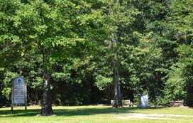
 The summit of Britton Hill, the state of Florida's highest point at 345 feet (105 m). | |
| أعلى نقطة | |
| الارتفاع | 345 ft (105 m) [1] |
| البروز | 65 ft (20 m) [1] |
| الإدراج | U.S. state high point 50th |
| الإحداثيات | 30°59′19″N 86°16′55″W / 30.9885139°N 86.2818893°W [2] |
| الجغرافيا | |
| السلسلة الأم | Florida Ridge Hills |
| الخريطة الطبوغرافية | USGS Paxton |
| الجيولوجيا | |
| عمر الصخر | Tertiary |
| نوع الجبل | رسوبية |
| التسلق | |
| أسهل السبل | paved road |
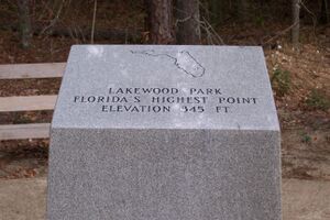
Britton Hill is the highest natural point in the state of Florida, United States, with a summit elevation of 345 feet (105 meters) above mean sea level. Britton Hill is the lowest state highpoint in the United States,[3] 103 feet (31 m) lower than the next lowest highpoint, Ebright Azimuth in Delaware, and far lower than many skyscrapers in Miami and other urban areas of Florida.
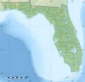
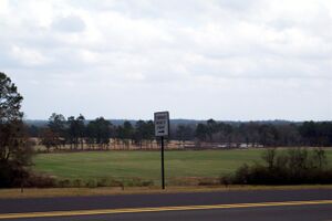
The hill is located in northern Walton County near the town of Lakewood, Florida, just off County Road 285 about two miles (three kilometers) southeast of Florala, Alabama. It is inside Lakewood Park, which marks the high point and features a monument, trails, and an information board.
انظر أيضاً
المراجع
- ^ أ ب "Britton Hill". Peakbagger.com.
- ^ "Britton Hill". نظام معلومات الأسماء الجغرافية، المسح الجيولوجي الأمريكي.
- ^ Florida's Highest Point, WTVY, updated April 09, 2007
وصلات خارجية
 Media related to Britton Hill at Wikimedia Commons
- قالب:Cite summitpost


