ڤالخنزي
| ڤالخنزي | |
|---|---|
| Walchensee | |
| Walchensee Error {{native name checker}}: parameter value is malformed (help) | |
 | |
| الموقع | كوشل، باڤاريا |
| الاحداثيات | 47°35′38″N 11°20′46″E / 47.59389°N 11.34611°E |
| الموارد الرئيسية | أوبرناخ |
| التصريفات الرئيسية | Jachen محطة بحيرة ڤالخن للطاقة |
| منطقة المستجمعات | 779.3 كم² |
| بلدان الحوض | ألمانيا |
| أقصى طول | 6.7 كم |
| أقصى عرض | 5 كم |
| مساحة السطح | 16.4 كم² |
| متوسط العمق | 81.4 متر |
| أقصى عمق | 192.3 متر |
| حجم المياه | 1,324×106 m3 (46.8×10⁹ cu ft) |
| ارتفاع السطح | 800.8 متر |
| الجزر | زاساو |
| التجمعات السكنية | كوشل |
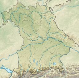
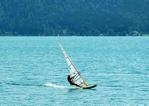
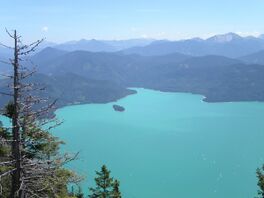
ڤالخنزي Walchensee أو بحيرة ڤالخن هي واحدة من أعمق وأكبر البحيرات الجبلية في ألمانيا، بعمق أقصى 192.3 متر ومساحة 16.4 كم². تبعد البحيرة 75 كم جنوب ميونخ في وسط الألپ الباڤارية. البحيرة بأكملها، بما في ذلك جزيرة زاساو، تقع ضمن بلدية كوشل. مالك البحيرة والجزيرة هي ولاية باڤاريا. إلى الشرق والجنوب، فإن البحيرة تحد بلدية ياخناو.
البيئة
النبيت والوحيش
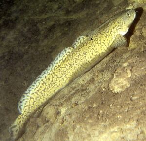
The first fish were introduced into the lake more than 500 years ago: whitefish Coregonus sp. were introduced from Kochelsee in 1480, followed by char from Tegernsee. The lake environment can be divided into three zones: shore, bottom, and open water. The following table lists the fish that can be found in these zones.
More than 50% of the fish species that live here are threatened or at least endangered in Bavaria, including the wels catfish and Rutilus meidingerii. The swan mussel is also on the IUCN Red List of endangered plant and animals.
السياحة
معالم
محطة ڤالخنزي للطاقة
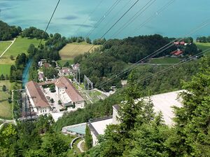
In 1924, Bayernwerk AG put the Lake Walchen Power Plant into operation on the south shore of Kochelsee. Six pipes carry water from Walchensee 200 m down the mountain to the hydroelectric plant. In order to increase the amount of water available for the plant, a 7-km long tunnel was driven in the Karwendel to tap the Rißbach and Isar rivers, feeding Walchensee. Overall, Walchensee has an average volume of 1.3 billion cubic meters. Two smaller hydroelectric plants were built directly on Walchensee: one at the mouth of the Niedernach in the southeast and one on the Obernach in the southwest.
Large amounts of water are only taken from lake during winter months so as not to disturb the tourist industry during the peak season. Because of the large fluctuations in water level during the winter, the lake no longer freezes.
- Maximum water level 802 m above sea level
- Nominal water level 801.5 m above sea level
- Minimum water level 795 m above sea level
The ice that does form in the individual bays is very thin and is off limits.
حطام
رسم الطبيعة
في 1934، خلّد الرسام لورنزو كواليو الأصغر ڤالخنزي في لوحة زيتية بالعنوان البسيط Der Walchensee. اللوحة معروضة اليوم في متحف مدينة ميونخ.

بعد الحرب العالمية الأولى، اشترى الفنان لوڤس كورنث بيتاً في أورفلد. ومن 1919 حتى آخر عمره في 1925، أمضى الانطباعي أشهر الصيف مع زوجته بجانب البحيرة. نجاحه كرسام مناظر طبيعية اعتمد على العمل الذي قام به عن ڤالخنزي. وقد رسم أكثر من 60 من تلك اللوحات.
