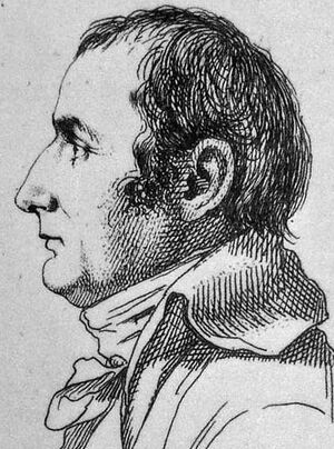
پيير جاكوتان
پيير جاكوتان (Pierre Jacotin ؛ 1765 – 1827) كان مدير survey for the Carte de l'Égypte (Description de l'Égypte), the first triangulation-based map of Egypt, Syria and Palestine.
The maps were surveyed in 1799–1800 during the campaign in Egypt and Palestine of Napoleon.
After his return from Egypt, Jacotin worked on preparing the plates for publication, but in 1808 Napoleon formally made them state secrets and forbade publication. This was apparently connected with Napoleon's efforts at the time to establish an alliance with the Ottomans. It was not until 1828–30 that the engraved plates could be published, as found in "Palestine and Egypt under the Ottomans" By Hisham Khatib.[1]
المراجع
ببليوجرافيا
- Khatib, Hisham (2003). Palestine and Egypt Under the Ottomans: Paintings, Books, Photographs, Maps and Manuscripts. I. B. Tauris. ISBN 1-860-64888-6.
للاستزادة
- Kallner, D. H. (1944). "Jacotin's Map of Palestine". Quarterly Statement - Palestine Exploration Fund. 76: 157–163. doi:10.1179/peq.1944.76.1.157.
- Karmon, Y. (1960). "An Analysis of Jacotin's Map of Palestine" (PDF). Israel Exploration Journal. 10 (3, 4): 155–173, 244–253.
- Panckoucke, Charles Louis Fleury (1824). Description de l'Égypte: ou, Recueil des observations et des recherches qui ont été faites en ... Vol. 17. Paris: Imprimerie de C.L.F . Panckoucke. (Pierre Jacotin: pp. 437-652, “Syria”: pp. 594-609 )
وصلات خارجية
- Jacotin maps at the David Rumsey Historical Map Collection [1].
This article contains content from Wikimedia licensed under CC BY-SA 4.0. Please comply with the license terms.


