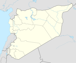
ناحية تسيل
تسيل | |
|---|---|
Town | |
| الإحداثيات: 32°50′7″N 35°58′17″E / 32.83528°N 35.97139°E | |
| موقع الجريدة | 241/249 PAL |
| البلد | |
| المحافظة | درعا |
| المنطقة | إزرع |
| الناحية | تسيل |
| المنسوب | 525 m (1٬722 ft) |
| التعداد (2004)[1] | |
| • الإجمالي | 15٫985 |
| منطقة التوقيت | UTC+2 (EET) |
| • الصيف (التوقيت الصيفي) | UTC+3 (EEST) |
ناحية تسيل إحدى نواحي سوريا تتبع إداريّاً لمحافظة درعا منطقة إزرع ومركزها بلدة تسيل، بلغ تعداد سكان الناحية 17,778 نسمة حسب التعداد السكاني لعام 2004.[2]
. . . . . . . . . . . . . . . . . . . . . . . . . . . . . . . . . . . . . . . . . . . . . . . . . . . . . . . . . . . . . . . . . . . . . . . . . . . . . . . . . . . . . . . . . . . . . . . . . . . . . . . . . . . . . . . . . . . . . . . . . . . . . . . . . . . . . . . . . . . . . . . . . . . . . . . . . . . . . . . . . . . . . . . .
التقسيمات الادارية
تنقسم تسيل إلى البلدات والقرى التالية:
المصادر
- ^ خطأ استشهاد: وسم
<ref>غير صحيح؛ لا نص تم توفيره للمراجع المسماةCBS - ^ المكتب المركزي للإحصاء: نشرة السكان - ناحية تسيل. تاريخ الولوج 7 نيسان/أبريل 2013
المراجع
- Hütteroth, Wolf-Dieter; Abdulfattah, Kamal (1977). Historical Geography of Palestine, Transjordan and Southern Syria in the Late 16th Century. Erlanger Geographische Arbeiten, Sonderband 5. Erlangen, Germany: Vorstand der Fränkischen Geographischen Gesellschaft. ISBN 3-920405-41-2.
- Moralee, Jason (2004). "For Salvation's Sake": Provincial Loyalty, Personal Religion, and Epigraphic Production in the Roman and Late Antique Near East. Psychology Press. ISBN 0415967783.
- O'Shea, Stephen (2007). Sea of Faith: Islam and Christianity in the Medieval Mediterranean World. Bloomsbury Publishing USA. ISBN 0802715176.
- Schumacher, Gottlieb; Oliphant, Laurence; le Strange, Guy (1889). Across the Jordan: being an exploration and survey of part of Hauran and Jaulan. Bentley.
وصلات خارجية
- Map of the town, Google Maps
- Boutmiye-map, 20K
الكلمات الدالة:


