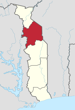
منطقة كارا
كارا
Kara | |
|---|---|
 Kara Region | |
| البلد | |
| Capital | Kara |
| المساحة | |
| • الإجمالي | 11٬738 كم² (4٬532 ميل²) |
| التعداد (2010 census) | |
| • الإجمالي | 769٬940 |
| • الكثافة | 66/km2 (170/sq mi) |
| HDI (2017) | 0.463[1] low · 5th |
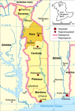
منطقة كارا ( Kara Region ؛ فرنسية: Région de la Kara) هي واحدة من مناطق توگو الخمس. كارا هي العاصمة الإقليمية.
Other major cities in the Kara region include Bafilo, Bassar, Kpagouda and Niamtougou.
Kara is divided into the prefectures of Assoli, Bassar, Bimah, Dankpen, Doufelgou, Kéran, and Kozah.
Kara is located north of Centrale Region and south of Savanes Region. To the west lies the Northern Region of Ghana, and to the east lie the Atakora (further north) and Donga (further south) Departments of Benin.
. . . . . . . . . . . . . . . . . . . . . . . . . . . . . . . . . . . . . . . . . . . . . . . . . . . . . . . . . . . . . . . . . . . . . . . . . . . . . . . . . . . . . . . . . . . . . . . . . . . . . . . . . . . . . . . . . . . . . . . . . . . . . . . . . . . . . . . . . . . . . . . . . . . . . . . . . . . . . . . . . . . . . . . .
انظر أيضاً
المراجع
- ^ "Sub-national HDI - Area Database - Global Data Lab". hdi.globaldatalab.org (in الإنجليزية). Retrieved 2018-09-13.
- تحويل قالب:مناطق توگو

