ملف:Watsontown River Bridge.jpg
حجم هذه المعاينة: 746 × 600 بكسل. البعد الآخر: 806 × 648 بكسل.
الملف الأصلي (806 × 648 بكسل حجم الملف: 64 كيلوبايت، نوع MIME: image/jpeg)
| موضوعات | |
|---|---|
| قوائم حسب الولاية |
|
| قائمة الأراضي | |
| قوائم حسب الولايات المرتبطة | |
| أخرى | |
41°4′51″N 76°51′55″W / 41.08083°N 76.86528°W
| ⧼wm-license-information-description⧽ |
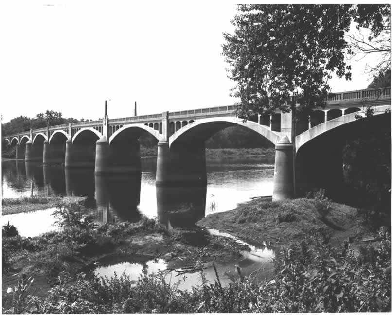
English: Side of the Watsontown River Bridge, which carries a spur of Legislative Route 240 over the West Branch of the Susquehanna River between Watsontown in Northumberland County and White Deer Township in Union County in the U.S. state of Pennsylvania. Built in 1927, this open spandrel concrete deck arch bridge is listed on the National Register of Historic Places.
|
| ⧼wm-license-information-date⧽ | 1982 |
| ⧼wm-license-information-source⧽ | "Watsontown River Bridge" (National Register of Historic Places form). National Park Service (June 22, 1988). Photo from http://www.arch.state.pa.us, searchable database, at http://www.arch.state.pa.us/images/hires/H000239_01B.jpg |
| ⧼wm-license-information-author⧽ | PennDOT |
| ⧼wm-license-information-permission⧽ (⧼wm-license-information-permission-reusing-text⧽) |
قالب:Pennsylvania Department of Transportation permission |
تاريخ الملف
اضغط على زمن/تاريخ لرؤية الملف كما بدا في هذا الزمن.
| زمن/تاريخ | صورة مصغرة | الأبعاد | مستخدم | تعليق | |
|---|---|---|---|---|---|
| حالي | ★ مراجعة معتمدة 22:22، 30 أكتوبر 2023 | | 806 × 648 (64 كيلوبايت) | Pastakhov (نقاش | مساهمات) | Upload https://upload.wikimedia.org/wikipedia/commons/5/5a/Watsontown_River_Bridge.jpg |
لا يمكنك استبدال هذا الملف.
وصلات
لا يوجد صفحات تصل لهذه الصورة.
تصنيفات:
- Built in Pennsylvania in 1927
- Bridges in the United States completed in 1927
- 1920s bridges in Pennsylvania
- Pennsylvania in the 1980s
- Bridges in Union County, Pennsylvania
- Bridges on the National Register of Historic Places in Pennsylvania
- Bridges over the Susquehanna River
- Concrete deck arch bridges in Pennsylvania
- National Register of Historic Places in Northumberland County, Pennsylvania
- Bridges in Northumberland County, Pennsylvania
- National Register of Historic Places in Union County, Pennsylvania
- West Branch Susquehanna River
- Other people's pictures by User:Nyttend