ملف:Norðausturkjördæmi.png

حجم هذه المعاينة: 800 × 586 بكسل. البعد الآخر: 1٬600 × 1٬171 بكسل.
الملف الأصلي (1٬600 × 1٬171 بكسل حجم الملف: 390 كيلوبايت، نوع MIME: image/png)
وصف قصير
| ⧼wm-license-information-description⧽ |
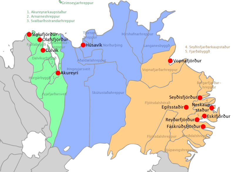
A map of the northeastern electoral district in Iceland with names of municipalities and largest towns. |
| ⧼wm-license-information-date⧽ | 2007 |
| ⧼wm-license-information-source⧽ | ⧼Wm-license-own-work⧽ |
| ⧼wm-license-information-author⧽ | Biekko |
ترخيص
|

تاريخ الملف
اضغط على زمن/تاريخ لرؤية الملف كما بدا في هذا الزمن.
| زمن/تاريخ | صورة مصغرة | الأبعاد | مستخدم | تعليق | |
|---|---|---|---|---|---|
| حالي | ★ مراجعة معتمدة 07:15، 28 نوفمبر 2023 | | 1٬600 × 1٬171 (390 كيلوبايت) | Pastakhov (نقاش | مساهمات) | Upload https://upload.wikimedia.org/wikipedia/commons/3/39/Nor%C3%B0austurkj%C3%B6rd%C3%A6mi.png |
لا يمكنك استبدال هذا الملف.
وصلات
لا يوجد صفحات تصل لهذه الصورة.