ملف:Map of the Scarborough Historic District.tiff

حجم معاينة PNG لذلك الملف ذي الامتداد TIF: 643 × 600 بكسل. البعد الآخر: 2٬195 × 2٬048 بكسل.
الملف الأصلي (5٬099 × 4٬757 بكسل حجم الملف: 92٫53 ميجابايت، نوع MIME: image/tiff)
وصف قصير
| ⧼wm-license-information-description⧽ |
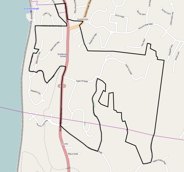
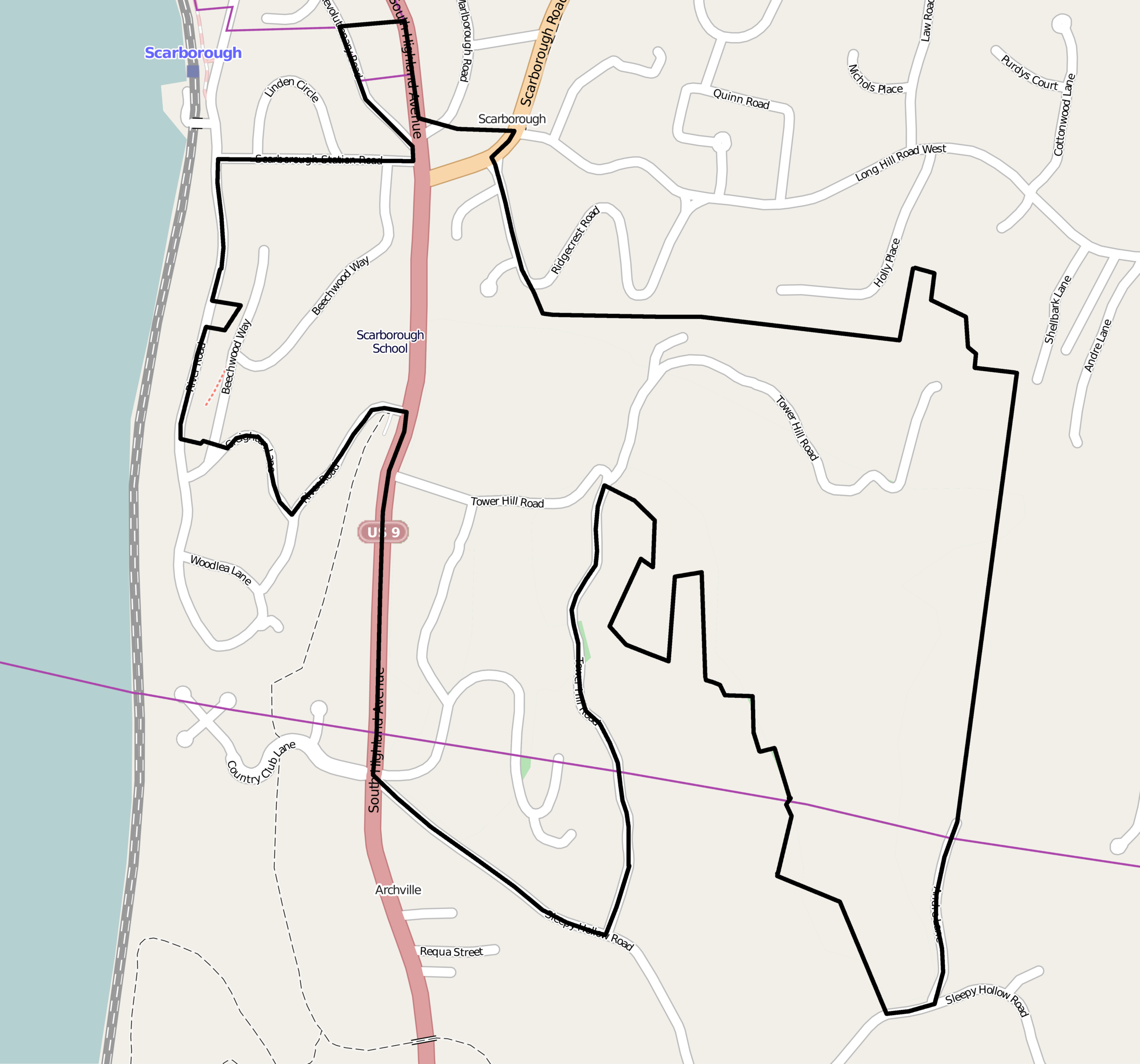
English: Map showing the boundaries of the Scarborough Historic District in Briarcliff Manor, New York, United States. The historic district is listed on the National Register of Historic Places. Boundaries are derived from the map attached to the district's National Register nomination form.
|
||
| ⧼wm-license-information-date⧽ | 2014, {{time}} – invalid date format 30 (help) | ||
| ⧼wm-license-information-source⧽ | Screenshot of OpenStreetMap's map of the Scarborough vicinity, with district boundary lines drawn by uploader | ||
| ⧼wm-license-information-author⧽ | OpenStreetMap editors (map), Ɱ (district boundaries) | ||
| ⧼wm-license-information-permission⧽ (⧼wm-license-information-permission-reusing-text⧽) |
My work is public domain, and the original map is |
تاريخ الملف
اضغط على زمن/تاريخ لرؤية الملف كما بدا في هذا الزمن.
| زمن/تاريخ | صورة مصغرة | الأبعاد | مستخدم | تعليق | |
|---|---|---|---|---|---|
| حالي | ★ مراجعة معتمدة 03:09، 18 نوفمبر 2023 |  | 5٬099 × 4٬757 (92٫53 ميجابايت) | Pastakhov (نقاش | مساهمات) | Upload https://upload.wikimedia.org/wikipedia/commons/e/ee/Map_of_the_Scarborough_Historic_District.tiff |
لا يمكنك استبدال هذا الملف.
وصلات
لا يوجد صفحات تصل لهذه الصورة.