ملف:Downtown West Liberty, Kentucky.jpg
حجم هذه المعاينة: 800 × 600 بكسل. البعد الآخر: 1٬600 × 1٬200 بكسل.
الملف الأصلي (1٬600 × 1٬200 بكسل حجم الملف: 249 كيلوبايت، نوع MIME: image/jpeg)
37°55′15″N 83°15′36.5″W / 37.92083°N 83.260139°W
| ⧼wm-license-information-description⧽ |
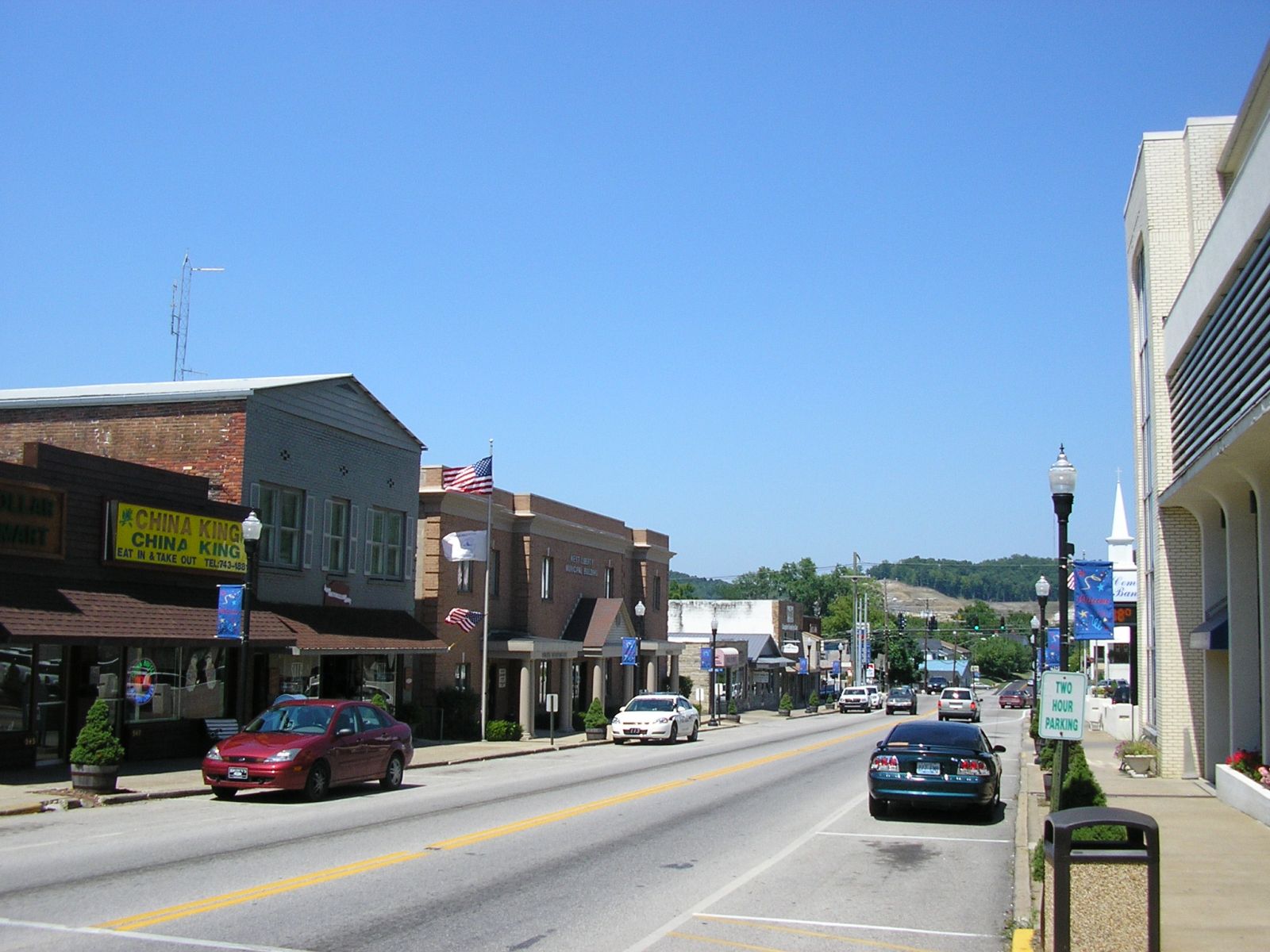
English: Downtown West Liberty, Kentucky, United States, as it appeared circa 2007. Photo looks north on Main Street (U.S. Route 460) north of the courthouse. During the Early March 2012 tornado outbreak, a tornado travelled through the middle of the downtown, destroying virtually everything visible on the right side of the street as well as some buildings on the left side.
|
|||
| ⧼wm-license-information-date⧽ | ||||
| ⧼wm-license-information-source⧽ | ⧼Wm-license-own-work⧽ | |||
| ⧼wm-license-information-author⧽ | W.marsh | |||
| ⧼wm-license-information-permission⧽ (⧼wm-license-information-permission-reusing-text⧽) |
|

تاريخ الملف
اضغط على زمن/تاريخ لرؤية الملف كما بدا في هذا الزمن.
| زمن/تاريخ | صورة مصغرة | الأبعاد | مستخدم | تعليق | |
|---|---|---|---|---|---|
| حالي | ★ مراجعة معتمدة 17:19، 17 أكتوبر 2023 | | 1٬600 × 1٬200 (249 كيلوبايت) | Pastakhov (نقاش | مساهمات) | Upload https://upload.wikimedia.org/wikipedia/commons/8/89/Downtown_West_Liberty%2C_Kentucky.jpg |
لا يمكنك استبدال هذا الملف.
وصلات
لا يوجد صفحات تصل لهذه الصورة.