ملف:Desertification Control Project, Ningxia China - Planet Labs satellite image.jpg

حجم هذه المعاينة: 799 × 599 بكسل. البعدان الآخران: 2٬560 × 1٬920 بكسل | 3٬510 × 2٬633 بكسل.
الملف الأصلي (3٬510 × 2٬633 بكسل حجم الملف: 2٫26 ميجابايت، نوع MIME: image/jpeg)
وصف قصير
| ⧼wm-license-information-description⧽ |
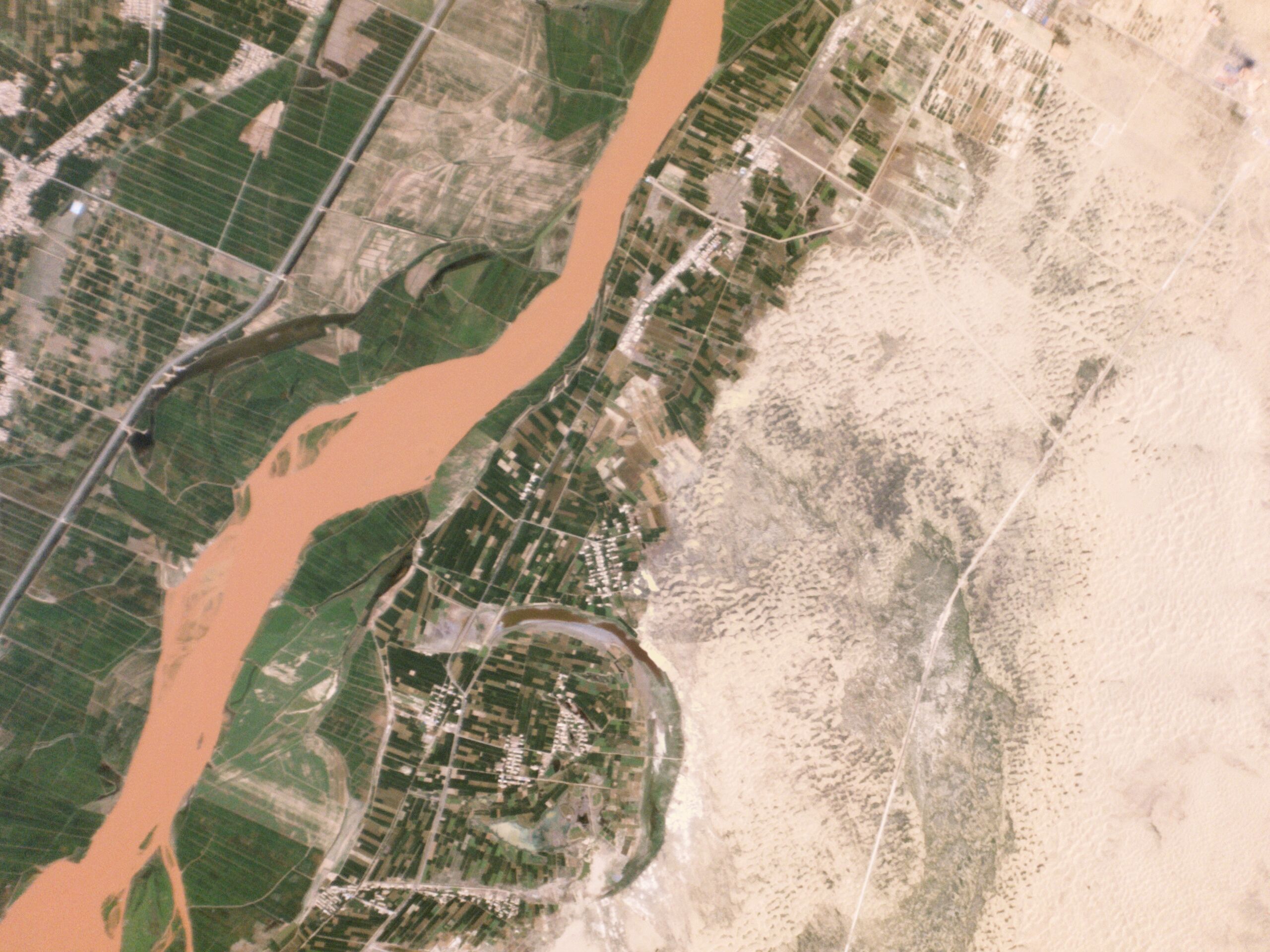
English: Desertification Control Project, Ningxia China - Planet Labs satellite image.
Agricultural lands abut the Yellow River, just outside of Touzha (头闸镇) in Pingluo County, Shizuishan, Ningxia Hui Autonomous Region, China. This area is part of the Ningxia Hui Autonomous Region in Northwestern China, where a desertification control project is under way to preserve agricultural lands. (See also File:Txu-pclmaps-oclc-22834566 g-9a.jpg for a map including this location (north of Wuduizi 五堆子).)
|
| ⧼wm-license-information-date⧽ | 2014 |
| ⧼wm-license-information-source⧽ | https://www.planet.com/gallery/ningxia-hui/ |
| ⧼wm-license-information-author⧽ | Planet Labs inc. |
ترخيص
|
|
هذا العمل مرخّص تحت رخصة المشاع الإبداعي الملزمة بنسبة العمل لمؤلفه وبترخيص الأعمال المشتقة بالمثل 4.0. |
تاريخ الملف
اضغط على زمن/تاريخ لرؤية الملف كما بدا في هذا الزمن.
| زمن/تاريخ | صورة مصغرة | الأبعاد | مستخدم | تعليق | |
|---|---|---|---|---|---|
| حالي | ★ مراجعة معتمدة 22:06، 20 أكتوبر 2023 | | 3٬510 × 2٬633 (2٫26 ميجابايت) | Pastakhov (نقاش | مساهمات) | Upload https://upload.wikimedia.org/wikipedia/commons/b/bd/Desertification_Control_Project%2C_Ningxia_China_-_Planet_Labs_satellite_image.jpg |
لا يمكنك استبدال هذا الملف.
وصلات
لا يوجد صفحات تصل لهذه الصورة.