مقاطعة ماديسون، إلينوي
مقاطعة ماديسون | |
|---|---|
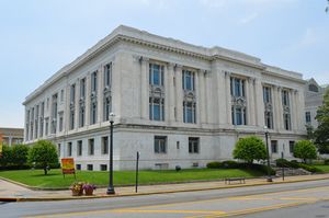
 مبنى محكمة مقاطعة ماديسون، إدواردزڤل | |
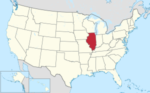
 الموقع ضمن ولاية إلينوي | |
 موقع إلينوي ضمن الولايات المتحدة | |
| الإحداثيات: 38°50′N 89°55′W / 38.83°N 89.91°W | |
| البلد | |
| State | |
| تأسست | 14 سبتمبر, 1812 |
| السمِيْ | جيمس ماديسون |
| Seat | إدواردزڤل |
| Largest city | گرانيت سيتي |
| المساحة | |
| • الإجمالي | 741 ميل² (1٬920 كم²) |
| • البر | 716 ميل² (1٬850 كم²) |
| • الماء | 25 ميل² (60 كم²) 3.4% |
| التعداد (2010) | |
| • الإجمالي | 269٬282 |
| • Estimate (2019) | 262٬966 |
| • الكثافة | 360/sq mi (140/km2) |
| منطقة التوقيت | UTC−6 (Central) |
| • الصيف (التوقيت الصيفي) | UTC−5 (CDT) |
| Congressional districts | 12th، 13th، 15th |
| الموقع الإلكتروني | www |
مقاطعة ماديسون إنگليزية: Madison County هي إحدى المقاطعات في ولاية إلينوي في الولايات المتحدة.
. . . . . . . . . . . . . . . . . . . . . . . . . . . . . . . . . . . . . . . . . . . . . . . . . . . . . . . . . . . . . . . . . . . . . . . . . . . . . . . . . . . . . . . . . . . . . . . . . . . . . . . . . . . . . . . . . . . . . . . . . . . . . . . . . . . . . . . . . . . . . . . . . . . . . . . . . . . . . . . . . . . . . . . .
التاريخ
Madison County was established on September 14, 1812. It was formed from parts of Randolph and St. Clair counties and named for President James Madison.[1] At the time of its formation, Madison County included all of the modern State of Illinois north of St. Louis, as well as all of Wisconsin, part of Minnesota, and Michigan's Upper Peninsula.
Madison County between its creation in 1812 and 1815, extending north to Lake Superior and the border with Rupert's Land
الجغرافيا
According to the U.S. Census Bureau, the county has a total area of 741 square miles (1,920 km2), of which 716 square miles (1,850 km2) is land and 25 square miles (65 km2) (3.4%) is water.[2] Madison County is on the Mississippi River, while the other major body of water is Horseshoe Lake.
المناخ
| إدواردزڤل، إلينوي | ||||||||||||||||||||||||||||||||||||||||||||||||||||||||||||
|---|---|---|---|---|---|---|---|---|---|---|---|---|---|---|---|---|---|---|---|---|---|---|---|---|---|---|---|---|---|---|---|---|---|---|---|---|---|---|---|---|---|---|---|---|---|---|---|---|---|---|---|---|---|---|---|---|---|---|---|---|
| جدول الطقس (التفسير) | ||||||||||||||||||||||||||||||||||||||||||||||||||||||||||||
| ||||||||||||||||||||||||||||||||||||||||||||||||||||||||||||
| ||||||||||||||||||||||||||||||||||||||||||||||||||||||||||||
. . . . . . . . . . . . . . . . . . . . . . . . . . . . . . . . . . . . . . . . . . . . . . . . . . . . . . . . . . . . . . . . . . . . . . . . . . . . . . . . . . . . . . . . . . . . . . . . . . . . . . . . . . . . . . . . . . . . . . . . . . . . . . . . . . . . . . . . . . . . . . . . . . . . . . . . . . . . . . . . . . . . . . . .
المقاطعات والمدن المجاورة
- Bond County - east
- Clinton County - southeast
- Jersey County - northwest
- Macoupin County - north
- Montgomery County - northeast
- St. Charles County, Missouri - northwest
- St. Clair County - south
- St. Louis, Missouri - west
- St. Louis County, Missouri - west
الديمغرافيا
| التعداد التاريخي | |||
|---|---|---|---|
| التعداد | Pop. | %± | |
| 1820 | 13٬550 | — | |
| 1830 | 6٬221 | −54٫1% | |
| 1840 | 14٬433 | 132�0% | |
| 1850 | 20٬441 | 41٫6% | |
| 1860 | 31٬251 | 52٫9% | |
| 1870 | 44٬131 | 41٫2% | |
| 1880 | 50٬126 | 13٫6% | |
| 1890 | 51٬535 | 2٫8% | |
| 1900 | 64٬694 | 25٫5% | |
| 1910 | 89٬847 | 38٫9% | |
| 1920 | 106٬895 | 19�0% | |
| 1930 | 143٬830 | 34٫6% | |
| 1940 | 149٬349 | 3٫8% | |
| 1950 | 182٬307 | 22٫1% | |
| 1960 | 224٬689 | 23٫2% | |
| 1970 | 250٬934 | 11٫7% | |
| 1980 | 247٬691 | −1٫3% | |
| 1990 | 249٬238 | 0٫6% | |
| 2000 | 258٬941 | 3٫9% | |
| 2010 | 269٬282 | 4�0% | |
| 2019 (تق.) | 262٬966 | [4] | −2٫3% |
| U.S. Decennial Census[5] 1790-1960[6] 1900-1990[7] 1990-2000[8] 2010-2019[9] | |||
التجمعات
المدن
القرى
Census-designated places
تجمعات أخرى غير مشهرة
البلديات
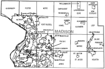
Madison County is divided into twenty-four townships:
السياسة
Like much of southern Illinois, Madison County was a predominantly Democratic area for much of its history, but in recent elections has been moving towards the Republicans. Mitt Romney narrowly carried the county in the 2012 presidential election, becoming the first Republican presidential nominee to do so since 1984. In 2016, Donald Trump carried the largest share of the vote for any Republican presidential candidate since 1972. The county also supported the Republican candidates for governor in 2010 and 2014.
| Year | Republican | Democratic | Third parties |
|---|---|---|---|
| 2016 | 54.2% 70,490 | 38.9% 50,587 | 7.0% 9,102 |
| 2012 | 49.3% 60,608 | 48.0% 58,922 | 2.7% 3,355 |
| 2008 | 44.4% 57,177 | 53.6% 68,979 | 2.0% 2,534 |
| 2004 | 48.0% 59,384 | 51.3% 63,399 | 0.7% 895 |
| 2000 | 43.9% 48,821 | 53.2% 59,077 | 2.9% 3,206 |
| 1996 | 35.6% 35,758 | 53.3% 53,568 | 11.2% 11,247 |
| 1992 | 28.2% 32,167 | 51.3% 58,484 | 20.6% 23,444 |
| 1988 | 45.0% 44,907 | 54.3% 54,175 | 0.6% 613 |
| 1984 | 53.9% 57,021 | 45.7% 48,352 | 0.3% 340 |
| 1980 | 51.1% 51,160 | 43.8% 43,860 | 5.1% 5,104 |
| 1976 | 43.3% 44,183 | 55.4% 56,457 | 1.3% 1,358 |
| 1972 | 55.9% 55,385 | 43.7% 43,289 | 0.5% 442 |
| 1968 | 39.2% 39,622 | 45.9% 46,384 | 15.0% 15,123 |
| 1964 | 31.6% 30,009 | 68.5% 65,115 | |
| 1960 | 43.9% 42,984 | 56.0% 54,787 | 0.1% 133 |
| 1956 | 45.1% 39,413 | 54.8% 47,897 | 0.1% 88 |
| 1952 | 41.6% 36,206 | 58.3% 50,734 | 0.1% 99 |
| 1948 | 37.8% 25,059 | 61.7% 40,897 | 0.5% 350 |
| 1944 | 41.2% 28,399 | 58.2% 40,114 | 0.5% 359 |
| 1940 | 40.1% 30,445 | 59.0% 44,803 | 0.9% 681 |
| 1936 | 33.6% 22,073 | 64.2% 42,172 | 2.2% 1,441 |
| 1932 | 34.6% 19,774 | 61.5% 35,211 | 3.9% 2,253 |
| 1928 | 53.5% 28,028 | 45.1% 23,658 | 1.4% 720 |
| 1924 | 47.6% 19,926 | 30.7% 12,863 | 21.7% 9,062 |
| 1920 | 57.8% 19,249 | 30.5% 10,149 | 11.7% 3,894 |
| 1916 | 49.8% 17,594 | 46.2% 16,302 | 4.0% 1,421 |
| 1912 | 30.6% 5,462 | 40.0% 7,155 | 29.4% 5,251 |
| 1908 | 51.1% 9,463 | 42.2% 7,812 | 6.6% 1,228 |
| 1904 | 57.1% 9,009 | 34.4% 5,429 | 8.5% 1,333 |
| 1900 | 53.4% 8,106 | 44.5% 6,753 | 2.2% 331 |
| 1896 | 53.3% 7,431 | 45.5% 6,344 | 1.3% 177 |
| 1892 | 45.9% 5,355 | 48.7% 5,680 | 5.4% 634 |
. . . . . . . . . . . . . . . . . . . . . . . . . . . . . . . . . . . . . . . . . . . . . . . . . . . . . . . . . . . . . . . . . . . . . . . . . . . . . . . . . . . . . . . . . . . . . . . . . . . . . . . . . . . . . . . . . . . . . . . . . . . . . . . . . . . . . . . . . . . . . . . . . . . . . . . . . . . . . . . . . . . . . . . .
انظر أيضاً
الهامش
- ^ Adams, James N. (compiler) (1989), Keller, William E., ed., Illinois Place Names, Springfield: Illinois State Historical Society, pp. 593, ISBN 0-912226-24-2, https://archive.org/details/illinoisplacenam00adam/page/593
- ^ خطأ استشهاد: وسم
<ref>غير صحيح؛ لا نص تم توفيره للمراجع المسماةcensus-density - ^ "المتوسطات الشهرية في إدواردزڤل، إلينوي". The Weather Channel. Archived from the original on October 23, 2012. Retrieved January 27, 2011.
- ^ "Population and Housing Unit Estimates". Retrieved March 26, 2020.
- ^ "U.S. Decennial Census". United States Census Bureau. Retrieved July 7, 2014.
- ^ "Historical Census Browser". University of Virginia Library. Archived from the original on August 11, 2012. Retrieved July 7, 2014.
- ^ "Population of Counties by Decennial Census: 1900 to 1990". United States Census Bureau. Archived from the original on April 24, 2014. Retrieved July 7, 2014.
- ^ "Census 2000 PHC-T-4. Ranking Tables for Counties: 1990 and 2000" (PDF). United States Census Bureau. Archived (PDF) from the original on December 18, 2014. Retrieved July 7, 2014.
- ^ خطأ استشهاد: وسم
<ref>غير صحيح؛ لا نص تم توفيره للمراجع المسماةQF - ^ Leip, David. "Dave Leip's Atlas of U.S. Presidential Elections". uselectionatlas.org. Archived from the original on March 23, 2018. Retrieved April 30, 2018.
وصلات خارجية
- Pages using gadget WikiMiniAtlas
- Short description is different from Wikidata
- Coordinates on Wikidata
- مقاطعات إلينوي
- Pages using infobox U.S. county with unknown parameters
- Articles containing إنگليزية-language text
- Pages using Lang-xx templates
- Pages using US Census population needing update
- Portal-inline template with redlinked portals
- Pages with empty portal template
- مقاطعة ماديسون، إلينوي
- تأسيسات 1812 في إقليم إلينوي
- Illinois counties on the Mississippi River
- Metro East
- أماكن مأهولة تأسست في 1812
- Pre-statehood history of Illinois
- مقاطعات ولاية إلينوي الأمريكية


