مقاطعة رفسنجان
مقاطعة رفسنجان
فارسية: شهرستان رفسنجان Rafsanjan County | |
|---|---|
مقاطعة | |
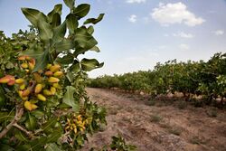
 مزارع الفستق في رفسنجان | |
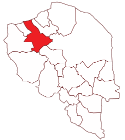
 موقع مقاطعة كرمان في محافظة كرمان | |
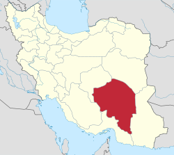
 موقع محافظة كرمان في إيران | |
| الإحداثيات: 30°35′N 55°59′E / 30.583°N 55.983°E[1] | |
| البلد | |
| المحافظة | كرمان |
| العاصمة | رفسنجان |
| البخوش | Central، Ferdows، Koshkuiyeh، Nuq |
| التعداد (2016)[2] | |
| • الإجمالي | 311٬214 |
| منطقة التوقيت | UTC+3:30 (IRST) |
| مقاطعة رفسنجان can be found at GEOnet Names Server, at this link, by opening the Advanced Search box, entering "9206670" in the "Unique Feature Id" form, and clicking on "Search Database". | |
مقاطعة رفسنجان (فارسية: شهرستان رفسنجان) في محافظة كرمان، بوسط إيران. وعاصمتها هي مدينة رفسنجان.[3]
At the 2006 census, the county's population was 291,417, in 71,830 households.[4] The following census in 2011 counted 287,921 people in 76,797 households,[5] by which time Anar District had been separated from the county in the establishment of Anar County.[6] At the 2016 census, the county's population was 311,214 in 91,511 households.[2]
Former Iranian president, Akbar Hashemi Rafsanjani was born in Bahreman, in Rafsanjan County.[7]
. . . . . . . . . . . . . . . . . . . . . . . . . . . . . . . . . . . . . . . . . . . . . . . . . . . . . . . . . . . . . . . . . . . . . . . . . . . . . . . . . . . . . . . . . . . . . . . . . . . . . . . . . . . . . . . . . . . . . . . . . . . . . . . . . . . . . . . . . . . . . . . . . . . . . . . . . . . . . . . . . . . . . . . .
التقسيمات الإدارية
The population history and structural changes of Rafsanjan County's administrative divisions over three consecutive censuses are shown in the following table. The latest census shows four districts, 14 rural districts, and five cities.[2]
After the 2016 census, the village of Javadiyeh ol Hiyeh was elevated to the status of a city.[8]
| Administrative Divisions | 2006[4] | 2011[5] | 2016[2] |
|---|---|---|---|
| Central District | 211,495 | 237,265 | 255,377 |
| Azadegan RD | 11,930 | 13,683 | 14,427 |
| Darreh Doran RD | 2,493 | 3,176 | 4,461 |
| Eslamiyeh RD | 14,919 | 18,350 | 20,182 |
| Kabutar Khan RD | 10,110 | 10,545 | 12,114 |
| Khenaman RD | 1,749 | 2,202 | 1,966 |
| Qasemabad RD | 17,430 | 21,646 | 23,869 |
| Razmavaran RD | 7,512 | 8,552 | 8,766 |
| Sarcheshmeh RD | 513 | 1,285 | 1,716 |
| Mes-e Sarcheshmeh (city) | 8,451 | 6,406 | 5,967 |
| Rafsanjan (city) | 136,388 | 151,420 | 161,909 |
| Anar District1 | 31,554 | ||
| Bayaz RD | 8,325 | ||
| Hoseynabad RD | 6,394 | ||
| Aminshahr (city) | 4,044 | ||
| Anar (city) | 12,791 | ||
| Ferdows District | 14,959 | 15,818 | 19,020 |
| Ferdows RD | 6,889 | 5,517 | 5,874 |
| Rezvan RD | 8,070 | 8,068 | 10,668 |
| Safayyeh (city) | 2,233 | 2,478 | |
| Koshkuiyeh District | 22,048 | 20,587 | 22,133 |
| Koshkuiyeh RD | 5,995 | 5,325 | 5,969 |
| Raviz RD | 1,374 | 1,012 | 1,420 |
| Sharifabad RD | 8,529 | 7,640 | 7,100 |
| Koshkuiyeh (city) | 6,150 | 6,610 | 7,644 |
| Nuq District | 11,361 | 12,641 | 13,955 |
| Bahreman RD | 6,956 | 8,113 | 8,690 |
| Bahreman (city) | 4,405 | 4,528 | 5,265 |
| Javadiyeh ol Hiyeh (city)2 | |||
| Total | 291,417 | 287,921 | 311,214 |
| RD: Rural District 1Became a part of Anar County[6] 2Became a city after the 2016 census[8] | |||
المراجع
- ^ OpenStreetMap contributors (3 July 2023). "Rafsanjan County" (Map). OpenStreetMap. Retrieved 3 July 2023.
- ^ أ ب ت ث "Census of the Islamic Republic of Iran, 1395 (2016)". AMAR (in الفارسية). The Statistical Center of Iran. p. 08. Archived from the original (Excel) on 20 October 2020. Retrieved 19 December 2022.
- ^ Habibi, Hassan (21 June 1369). "Approval of the organization and chain of citizenship of the elements and units of the national divisions of Kerman province, centered in the city of Kerman". Lamtakam (in الفارسية). Ministry of Interior, Defense Political Commission of the Government Council. Archived from the original on 30 January 2024. Retrieved 30 January 2024.
- ^ أ ب "Census of the Islamic Republic of Iran, 1385 (2006)". AMAR (in الفارسية). The Statistical Center of Iran. p. 08. Archived from the original (Excel) on 20 September 2011. Retrieved 25 September 2022.
- ^ أ ب "Census of the Islamic Republic of Iran, 1390 (2011)". Syracuse University (in الفارسية). The Statistical Center of Iran. p. 08. Archived from the original (Excel) on 29 March 2023. Retrieved 19 December 2022.
- ^ أ ب Davoudi, Parviz (17 June 2009). "Anar County was added to the country". Tabnak (in الفارسية). Ministry of Interior, Council of Ministers. Archived from the original on 14 October 2013. Retrieved 5 November 2023.
- ^ "Iran Report: May 9, 2005". Radio Free Europe. 9 May 2005. Retrieved 31 May 2013.
- ^ أ ب Jahangiri, Ishaq (12 December 2017). "Letter of approval regarding the conversion of Javadiyeh ol Hiyeh village, located in Bahreman Rural District, Nuq District, Rafsanjan County, Kerman province, to a city". Qavanin (in الفارسية). Ministry of Interior. Archived from the original on 26 April 2019. Retrieved 3 July 2023.
