مقاطعة أوكلاهوما، أوكلاهوما
Oklahoma County | |
|---|---|
 | |
 الموقع ضمن ولاية Oklahoma | |
 موقع Oklahoma ضمن الولايات المتحدة | |
| الإحداثيات: 35°29′N 97°32′W / 35.48°N 97.53°W | |
| البلد | |
| State | |
| تأسست | 1890 |
| Seat | أوكلاهوما سيتي |
| Largest city | أوكلاهوما سيتي |
| المساحة | |
| • الإجمالي | 718 ميل² (1٬860 كم²) |
| • البر | 708٫82 ميل² (1٬835٫8 كم²) |
| • الماء | 9٫6 ميل² (25 كم²) 1.3%% |
| التعداد | |
| • Estimate (2019) | 797٬434 |
| • الكثافة | 1٬111٫6/sq mi (429٫2/km2) |
| منطقة التوقيت | UTC−6 (Central) |
| • الصيف (التوقيت الصيفي) | UTC−5 (CDT) |
| Congressional districts | 4th، 5th |
| الموقع الإلكتروني | www |
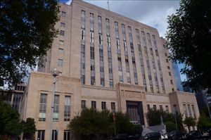
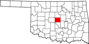
مقاطعة أوكلاهوما (Oklahoma County) هي مقاطعة تقع في وسط ولاية أوكلاهوما الأمريكية. في عام 2003 بلغ عدد سكانها 668000. حاضرتها هي أوكلاهوما سيتي، عاصمة الولاية. تأسست المقاطعة عام 1890. مساحتها 1860 كم²، منها 24 كم² تغطيها المياه.
. . . . . . . . . . . . . . . . . . . . . . . . . . . . . . . . . . . . . . . . . . . . . . . . . . . . . . . . . . . . . . . . . . . . . . . . . . . . . . . . . . . . . . . . . . . . . . . . . . . . . . . . . . . . . . . . . . . . . . . . . . . . . . . . . . . . . . . . . . . . . . . . . . . . . . . . . . . . . . . . . . . . . . . .
الجغرافيا
المقاطعات المجاورة
- Logan County (north)
- Lincoln County (east)
- Pottawatomie County (southeast)
- Cleveland County (south)
- Canadian County (west)
- Kingfisher County (northwest)
National protected area
الديمغرافيا
| التعداد التاريخي | |||
|---|---|---|---|
| التعداد | Pop. | %± | |
| 1890 | 11٬742 | — | |
| 1900 | 25٬915 | 120٫7% | |
| 1910 | 85٬232 | 228٫9% | |
| 1920 | 116٬307 | 36٫5% | |
| 1930 | 221٬738 | 90٫6% | |
| 1940 | 244٬159 | 10٫1% | |
| 1950 | 325٬352 | 33٫3% | |
| 1960 | 439٬506 | 35٫1% | |
| 1970 | 526٬805 | 19٫9% | |
| 1980 | 568٬933 | 8�0% | |
| 1990 | 599٬611 | 5٫4% | |
| 2000 | 660٬448 | 10٫1% | |
| 2010 | 718٬633 | 8٫8% | |
| 2019 (تق.) | 797٬434 | [1] | 11�0% |
| U.S. Decennial Census[2] 1790-1960[3] 1900-1990[4] 1990-2000[5] 2010-2019[6] | |||
مفوضو المقاطعة
| District | الاسم | الحزب | تولى |
|---|---|---|---|
| 1 | Carrie Blumert | Democrat | 2019 |
| 2 | Brian Maughan | Republican | 2009 |
| 3 | Kevin Calvey | Republican | 2019 |
مكاتب المقاطعة
| Office | Name | Party | Took office |
|---|---|---|---|
| Assessor | Larry Stein | Republican | 2019 |
| County Clerk | David B. Hooten | Republican | 2017 |
| Court Clerk | Rick Warren | Republican | 2017 |
| District Attorney | David Prater | Democrat | 2007 |
| Sheriff | P.D. Taylor | Republican | 2017 |
| Treasurer | Forrest Freeman | Republican | 1993 |
Oklahoma House of Representatives
| District | Name | Party | Took office |
|---|---|---|---|
| 31 | Gary Mize | Republican | 2019 |
| 39 | Ryan Martinez | Republican | 2016 |
| 41 | Denise Crosswhite-Hader | Republican | 2019 |
| 54 | Kevin West | Republican | 2016 |
| 82 | Nicole Miller | Republican | 2019 |
| 83 | Chelsey Branham | Democrat | 2019 |
| 84 | Tammy West | Republican | 2016 |
| 85 | Cyndi Muson | Democratic | 2015 |
| 87 | Collin Walke | Democrat | 2016 |
| 88 | Jason Dunnington | Democrat | 2014 |
| 89 | Vacant | - | - |
| 90 | Jon Echols | Republican | 2013 |
| 92 | Forrest Bennett | Democrat | 2016 |
| 93 | Mickey Dollens | Democrat | 2016 |
| 94 | Andy Fugate | Democrat | 2019 |
| 95 | Kelley Albright | Democrat | 2019 |
| 96 | Lewis Moore | Republican | 2009 |
| 97 | Jason Lowe | Democrat | 2016 |
| 99 | Ajay Pittman | Democrat | 2019 |
| 100 | Marilyn Stark | Republican | 2019 |
| 101 | Robert Manger | Republican | 2019 |
Oklahoma Senate
| District | Name | Party | Took office |
|---|---|---|---|
| 15 | Rob Standridge | Republican | 2012 |
| 17 | Ron Sharp | Republican | 2012 |
| 22 | Stephanie Bice | Republican | 2014 |
| 30 | Julia Kirt | Democrat | 2018 |
| 40 | Carrie Hicks | Democrat | 2018 |
| 41 | Adam Pugh | Republican | 2016 |
| 42 | Brenda Stanley | Republican | 2018 |
| 44 | Michael Brooks | Democrat | 2017 |
| 45 | Paul Rosino | Republican | 2017 |
| 46 | Kay Floyd | Democrat | 2014 |
| 47 | Greg Treat | Republican | 2011 |
| 48 | George Young | Democrat | 2018 |
Congressional
| District | Name | Party | Took office |
|---|---|---|---|
| OK-4 | Tom Cole | Republican | 2003 |
| OK-5 | Kendra Horn | Democrat | 2019 |
| Voter Registration and Party Enrollment as of November 1, 2019[7] | |||||
|---|---|---|---|---|---|
| Party | Number of Voters | Percentage | |||
| Democratic | 150,459 | 37.21% | |||
| Republican | 177,392 | 43.87% | |||
| Libertarian | 2,577 | 0.64% | |||
| Unaffiliated | 73,930 | 18.28% | |||
| Total | 404,358 | 100% | |||
| Year | Republican | Democratic | Third parties |
|---|---|---|---|
| 2016 | 51.7% 141,569 | 41.2% 112,813 | 7.1% 19,560 |
| 2012 | 58.3% 149,728 | 41.7% 106,982 | |
| 2008 | 58.4% 163,172 | 41.6% 116,182 | |
| 2004 | 64.2% 174,741 | 35.8% 97,298 | |
| 2000 | 62.3% 139,078 | 36.6% 81,590 | 1.1% 2,443 |
| 1996 | 54.7% 120,429 | 36.5% 80,438 | 8.8% 19,386 |
| 1992 | 48.8% 126,788 | 29.3% 76,271 | 21.9% 56,864 |
| 1988 | 63.6% 135,376 | 35.6% 75,812 | 0.8% 1,703 |
| 1984 | 71.7% 159,974 | 27.0% 60,235 | 1.4% 3,052 |
| 1980 | 66.1% 139,538 | 27.8% 58,765 | 6.1% 12,970 |
| 1976 | 56.7% 119,120 | 41.5% 87,185 | 1.8% 3,808 |
| 1972 | 75.2% 156,437 | 22.6% 46,986 | 2.2% 4,502 |
| 1968 | 49.7% 93,212 | 32.2% 60,395 | 18.1% 33,834 |
| 1964 | 48.0% 83,660 | 52.0% 90,641 | |
| 1960 | 61.4% 102,992 | 38.6% 64,648 | |
| 1956 | 59.8% 85,395 | 40.2% 57,512 | |
| 1952 | 57.6% 95,492 | 42.4% 70,199 | |
| 1948 | 40.1% 40,161 | 59.9% 59,954 | |
| 1944 | 42.3% 42,464 | 57.6% 57,812 | 0.1% 116 |
| 1940 | 39.8% 35,639 | 59.9% 53,649 | 0.4% 329 |
| 1936 | 32.2% 24,312 | 67.4% 50,946 | 0.5% 373 |
| 1932 | 34.1% 21,238 | 66.0% 41,130 | |
| 1928 | 69.1% 36,608 | 30.4% 16,073 | 0.5% 272 |
| 1924 | 40.6% 17,504 | 50.4% 21,708 | 9.0% 3,873 |
| 1920 | 44.7% 15,350 | 51.9% 17,820 | 3.5% 1,189 |
| 1916 | 36.3% 5,291 | 54.7% 7,971 | 8.9% 1,302 |
| 1912 | 42.0% 5,706 | 51.3% 6,963 | 6.7% 910 |
. . . . . . . . . . . . . . . . . . . . . . . . . . . . . . . . . . . . . . . . . . . . . . . . . . . . . . . . . . . . . . . . . . . . . . . . . . . . . . . . . . . . . . . . . . . . . . . . . . . . . . . . . . . . . . . . . . . . . . . . . . . . . . . . . . . . . . . . . . . . . . . . . . . . . . . . . . . . . . . . . . . . . . . .
Communities
Cities
Towns
Unincorporated communities
See also
- List of counties in Oklahoma
- National Register of Historic Places listings in Oklahoma County, Oklahoma
References
- ^ "County Population Totals and Components of Change: 2010-2019". United States Census Bureau. Retrieved March 26, 2020.
- ^ "U.S. Decennial Census". United States Census Bureau. Retrieved February 21, 2015.
- ^ "Historical Census Browser". University of Virginia Library. Retrieved February 21, 2015.
- ^ Forstall, Richard L., ed. (March 27, 1995). "Population of Counties by Decennial Census: 1900 to 1990". United States Census Bureau. Retrieved February 21, 2015.
- ^ "Census 2000 PHC-T-4. Ranking Tables for Counties: 1990 and 2000" (PDF). United States Census Bureau. April 2, 2001. Retrieved February 21, 2016.
- ^ خطأ استشهاد: وسم
<ref>غير صحيح؛ لا نص تم توفيره للمراجع المسماةQF - ^ "Oklahoma Registration Statistics by County" (PDF). OK.gov (PDF). November 1, 2019. Retrieved 2020-06-13.
- ^ Leip, David. "Dave Leip's Atlas of U.S. Presidential Elections". uselectionatlas.org. Retrieved March 29, 2018.
External links
- Oklahoma County Government's website
- Oklahoma Digital Maps: Digital Collections of Oklahoma and Indian Territory

|
Logan County | Kingfisher County | 
| |
| Lincoln County | Canadian County | |||
| Pottawatomie County | Cleveland County |
قالب:Oklahoma County, Oklahoma قالب:Oklahoma City Metropolitan Area
- Pages using gadget WikiMiniAtlas
- Short description is different from Wikidata
- Coordinates on Wikidata
- مقاطعات Oklahoma
- Pages using infobox U.S. county with unknown parameters
- Pages using US Census population needing update
- Oklahoma County, Oklahoma
- Oklahoma City metropolitan area
- 1890 establishments in Oklahoma Territory
- Populated places established in 1890
- مقاطعات ولاية أوكلاهوما الأمريكية


