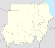
مطار مروي
مطار مروي | |||||||||||
|---|---|---|---|---|---|---|---|---|---|---|---|
| الملخص | |||||||||||
| نوع المطار | Public | ||||||||||
| يخدم | مروي | ||||||||||
| المنسوب AMSL | 899 ft / 274 m | ||||||||||
| الإحداثيات | 18°26′35″N 31°50′35″E / 18.44306°N 31.84306°E | ||||||||||
| Map | |||||||||||
| Runways | |||||||||||
| |||||||||||
Merowe Airport (IATA: MWE, ICAO: HSMN) is an airport serving the town of Merowe in Sudan. After critical facilities were completed in 2006, the current airport replaced the smaller Merowe Town airport 3 kilometres (1.9 mi) to the west.[3] The new Merowe airport has hosted Sudanese Air Force jet fighters, but does not host any full time units stationed.[4]
الخطوط الجوية والوجهات
| شركة الطيران | الوجهات |
|---|---|
| Nova Airways | الخرطوم |
انظر أيضاً
المصادر
- ^ Google Map - Merowe
- ^ Airport information for HSMR at Great Circle Mapper. Data current as of October 2006.
- ^ "Google Maps". Google Maps (in الإنجليزية). Retrieved 2018-08-26.
- ^ "Orbats".
