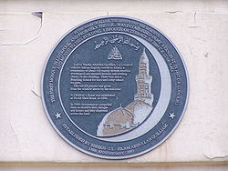
مسجد الرحمة
| مسجد الرحمة | |
|---|---|
 | |
 | |
| معلومات عامة | |
| البلدة أو المدينة | ليفربول |
| البلد | |
مسجد الرحمة إنگليزية: Al-Rahma Mosque يوجد في شارع هاذرلي، ليڤرپول، إنگلترة، يتسع لـ 1,000 مصلي.
ليڤرپول هي المدينة الثالثة في إنجلترا[1]التي يوجد بها مسجد ، الذي افتتح في العنوان التالي 8 شرفة بوروهام من قبل المدعي العام للمدينة الذي اعتنق الإسلام وليام عبد الله كويليام في 25 ديسمبر، 1889
A new and much larger three storey mosque is currently undergoing construction. The new Mosque is much more traditional in appearance with a Golden Dome and Crescent on top. The Mosque is scheduled to open in 2008 during Liverpool's tenure as European Capital of Culture.
The previous Mosque was built in the 1960s having recent extensions to accommodate more worshippers. During Fridays and Muslim festivals the Pakistan Centre opposite and the car park were also used as temporary prayer space.
The “Liverpool Muslim Society”[2] was set up in 1953.
شاهد ايضا
- الدين في المملكة المتحدة
- جدول زمني بأهم الحوادث السياسية في التاريخ الإسلامي
- العمارة الإسلامية
- الفن الاسلامي
- قائمة المساجد
روابط خارجية
This article needs references that appear in reliable third-party publications. Primary sources or sources affiliated with the subject are generally not sufficient for a Wikipedia article. Please add more appropriate citations from reliable sources. (March 2007) |
مراجع
- ^ مسجد شاه جهان تم افتتاحه للمصلين في اكتوبر أو نوفمبر 1889.
- ^ Liverpool Muslim Society
53°23′39″N 2°57′41″W / 53.39417°N 2.96139°W (شارع هافرلي.)
- Pages using gadget WikiMiniAtlas
- Infobox mapframe without OSM relation ID on Wikidata
- Pages using infobox building with unsupported parameters
- Articles containing إنگليزية-language text
- Pages using Lang-xx templates
- Articles lacking reliable references from March 2007
- All articles lacking sources
- Coordinates on Wikidata
- مساجد في إنگلترة
- أبنية و إنشاءات في ليفربول
- صفحات مع الخرائط