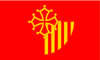
لانگدوك-روسيون
(تم التحويل من لانگدو - روسيو)
Languedoc-Roussillon
Lengadòc-Rosselhon (أوكسيتان) | |
|---|---|
 | |
 | |
| البلد | |
| انحلت | 2016-01-01 |
| Prefecture | مونپلييه |
| Departments | |
| الحكومة | |
| • President | Damien Alary (DVG) |
| المساحة | |
| • الإجمالي | 27٬376 كم² (10٬570 ميل²) |
| التعداد (2012-01-01) | |
| • الإجمالي | 2٬700٬266 |
| • الكثافة | 99/km2 (260/sq mi) |
| منطقة التوقيت | UTC+1 (CET) |
| • الصيف (التوقيت الصيفي) | UTC+2 (CEST) |
| ISO 3166 code | FR-K |
| GDP (2012)[1] | Ranked 10th |
| Total | €63.9 billion (US$82.2 bn) |
| Per capita | €23,566 (US$30,311) |
| NUTS Region | FR8 |
| الموقع الإلكتروني | laregion.fr |
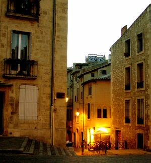
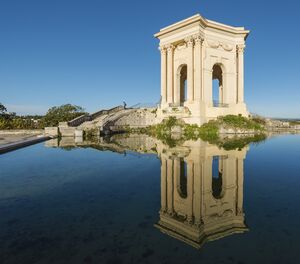
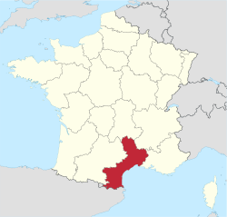
لانگدوك-روسيون (بالفرنسية: Languedoc-Roussillon) (أوكسيتان: Lengadòc-Rosselhon؛ قطلان: Llenguadoc-Rosselló) هي منطقة ادارية سابقة في وسط جنوب فرنسا وعاصمتها هي مونبيلييه. وفي 1 يناير 2016، اندمجت مع منطقة ميدي-پيريني لتصبحا أوكسيتاني.[2] وكانت تتكون من خمس أقسام، ويحدها المناطق الفرنسية پروڤانس-ألپ-كوت دازور، رون-ألپ، أوڤرن، الپيرنيس الوسطى من جهة، واسبانيا، أندورا والبحر المتوسط من الجهة الأخرى.
الجغرافيا
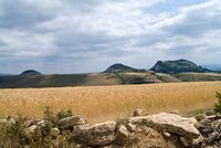
Landscape in Lozère, Languedoc-Roussillon
The region is made up of the following historical provinces:
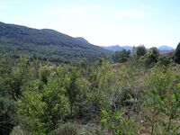
Landscape in Aude, Languedoc-Roussillon
- 68.7% of Languedoc-Roussillon was formerly part the province of Languedoc: the departments of Hérault, Gard, Aude, the extreme south and extreme east of Lozère, and the extreme north of Pyrénées-Orientales. The former province of Languedoc also extends over what is now the Midi-Pyrénées region, including the old capital of Languedoc Toulouse.
- 17.9% of Languedoc-Roussillon was formerly the province of Gévaudan, now the department of Lozère. A small part of the former Gévaudan lies inside the current Auvergne region. Gévaudan is often considered to be a sub-province inside the province of Languedoc, in which case Languedoc would account for 86.6% of Languedoc-Roussillon.
- 13.4% of Languedoc-Roussillon, located in the southernmost part of the region, is a collection of five historical Catalan pays, from east to west: Roussillon, Vallespir, Conflent, Capcir, and Cerdagne, all of which are now part of the department of Pyrénées-Orientales. These pays were part of the Ancien Régime province of Roussillon, owning its name to the largest and most populous of the five pays, Roussillon. "Province of Roussillon and adjacent lands of Cerdagne" was indeed the name that was officially used after the area became French in 1659, based on the historical division of the five pays between the county of Roussillon (Roussillon and Vallespir) and the county of Cerdagne (Cerdagne, Capcir, and Conflent).
Llívia is a town of Cerdanya, province of Girona, Catalonia, Spain, that forms a Spanish exclave surrounded by French territory (department of Pyrénées-Orientales).
أهم المدن الرئيسية
السياسة
الثقافة
اللغة
الأدب
الموسيقى
النبيذ
جنوب فرنسا
انظر أيضا
وصلات خارجية
مشاع المعرفة فيه ميديا متعلقة بموضوع لانگدو - روسيو.
- Languedoc-Rousillon Tourist Board Official Tourism Committee Website for the Region (in English)
- (بالفرنسية) Regional Council of Languedoc-Roussillon
- Regordane Info - The independent portal for The Regordane Way or St Gilles TrailThe Regordane Trail runs north-south through Languedoc-Roussillon. (in English and French)
المصادر
- ^ INSEE. "Produits intérieurs bruts régionaux et valeurs ajoutées régionales de 1990 à 2012". Retrieved 2014-03-04.
- ^ قالب:Cite French law
- Joseph, Robert (2005). French Wine Revised and Updated. Dorling Kindersley. pp. 190–201. ISBN 0-7566-1520-8.
- Official Béziers Tourist Office Website
الكلمات الدالة:
This article may include material from Wikimedia licensed under CC BY-SA 4.0. Please comply with the license terms.
تصنيفات:
- Pages using gadget WikiMiniAtlas
- Short description is different from Wikidata
- Articles containing أوكسيتان (بعد 1500)-language text
- Pages using infobox settlement with no coordinates
- Pages using Lang-xx templates
- Articles containing قطلان-language text
- Coordinates on Wikidata
- لانگدو - روسيو
- أقاليم التصنيف الثاني في الاتحاد الأوروپي
- Languedoc-Roussillon wine AOCs
- مناطق فرنسا


