لاتينا، لاتسيو
Latina | |
|---|---|
| Comune di Latina | |
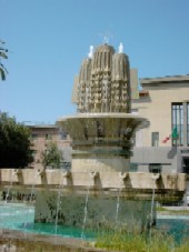
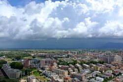 Panorama of Latina | |
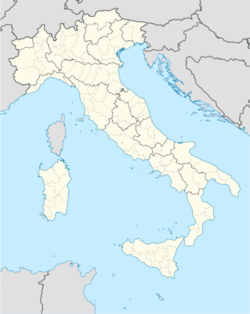
| الإحداثيات: 41°28′N 12°54′E / 41.467°N 12.900°E | |
| البلد | إيطاليا |
| المنطقة | Lazio |
| المقاطعة | لاتينا (LT) |
| Frazioni | See list |
| الحكومة | |
| • العمدة | Giovanni Di Giorgi ([[قائمة الأحزاب السياسية في إيطاليا|PdL]]) |
| المساحة | |
| • الإجمالي | 277 كم² (107 ميل²) |
| المنسوب | 21 m (69 ft) |
| التعداد (30 April 2011) | |
| • الإجمالي | 119٬895 |
| • الكثافة | 430/km2 (1٬100/sq mi) |
| صفة المواطن | Latinensi |
| منطقة التوقيت | UTC+1 (CET) |
| • الصيف (التوقيت الصيفي) | UTC+2 (CEST) |
| الرمز البريدي | 04100, 04010, 04013 |
| مفتاح الهاتف | 0773 |
| Patron saint | Saint Maria Goretti and St. Mark |
| يوم القديس | April 25 |
| الموقع الإلكتروني | Official website |
لاتينا (Latina؛ النطق بالإيطالية: [laˈtiːna]) هي مدينة عاصمة مقاطعة لاتينا في إقليم لاتسيو بالجزء الجنوبي من وسط إيطاليا. سكانها حوالي 112.188 نسمة . أسست في 30 يونيو حزيران سنة 1932 م أيام حكم الفاشية تحت إسم ليتوريا Littoria . بعد هزيمة الفاشية في الحرب العالمية الثانية استبدل اسمها إلى لاتينا . بنيت على سهل بونتينا على بعد 62 كم جنوب العاصمة روما وترتفع 21 متر فوق مستوى سطح البحر .
. . . . . . . . . . . . . . . . . . . . . . . . . . . . . . . . . . . . . . . . . . . . . . . . . . . . . . . . . . . . . . . . . . . . . . . . . . . . . . . . . . . . . . . . . . . . . . . . . . . . . . . . . . . . . . . . . . . . . . . . . . . . . . . . . . . . . . . . . . . . . . . . . . . . . . . . . . . . . . . . . . . . . . . .
Climate
Latina has a Mediterranean climate (Köppen climate classification Csa) like most of southern Italy.
| Climate data for Latina | |||||||||||||
|---|---|---|---|---|---|---|---|---|---|---|---|---|---|
| Month | Jan | Feb | Mar | Apr | May | Jun | Jul | Aug | Sep | Oct | Nov | Dec | Year |
| Mean daily maximum °C (°F) | 11.1 (52.0) |
12.2 (54.0) |
16.1 (61.0) |
19.4 (66.9) |
23.9 (75.0) |
27.8 (82.0) |
31.1 (88.0) |
30.6 (87.1) |
27.8 (82.0) |
22.2 (72.0) |
16.7 (62.1) |
13.3 (55.9) |
21.1 (70.0) |
| Mean daily minimum °C (°F) | 2.8 (37.0) |
3.3 (37.9) |
6.1 (43.0) |
8.9 (48.0) |
12.8 (55.0) |
16.1 (61.0) |
18.3 (64.9) |
18.3 (64.9) |
16.1 (61.0) |
11.7 (53.1) |
7.2 (45.0) |
5.0 (41.0) |
10.6 (51.1) |
| Average precipitation mm (inches) | 81.3 (3.20) |
68.6 (2.70) |
73.7 (2.90) |
66.0 (2.60) |
58.9 (2.32) |
40.7 (1.60) |
17.8 (0.70) |
25.4 (1.00) |
66.0 (2.60) |
127.0 (5.00) |
111.8 (4.40) |
99.1 (3.90) |
830.6 (32.70) |
| Source: Weatherbase[1] | |||||||||||||
العلاقات الدولية
Twin towns / Sister cities
Latina is twinned with:
 Palos de la Frontera, اسبانيا
 Farroupilha, البرازيل
 Birkenhead, إنگلنرة
Gallery
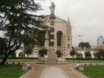
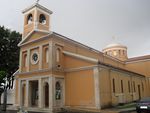
The church of Borgo Sabotino
Torre Pontina, the tallest building in the city and the 6th tallest in Italy
- Stadio francioni.jpg
انظر أيضاً
- Latina railway station
- F.C. Latina, a football club
الهامش
وصلات خارجية
- Official website
- Ofteland, Hanne Storm (2002). "Littoria" (pdf). Institute for Art History, University of Oslo. Retrieved 5 February 2010.
- Articles with hatnote templates targeting a nonexistent page
- Missing redirects
- Short description is different from Wikidata
- Articles containing إيطالية-language text
- Pages using gadget WikiMiniAtlas
- Pages using infobox settlement with image map1 but not image map
- Italian commune articles with missing parameters
- Latina, Lazio
- Cities and towns in Lazio
- مدن مخططة
- Italian fascist architecture
- Populated places established in 1932
- مدن إيطاليا
- صفحات مع الخرائط

