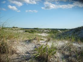
كيپ كد
| كيپ كد Cape Cod | |
|---|---|
 | |
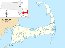 كيپ كد (مقاطعة بارنستيبل)، في مساتشوستس | |
| البلد | الولايات المتحدة |
| المنطقة | نيو إنگلاند |
| المسحات المائية المحيطة | |
| الإحداثيات | 41°41′N 70°12′W / 41.68°N 70.2°W |
| المساحة | 339 sq mi (880 km2)[1] |
| الارتفاع | 306 ft (93 m) |
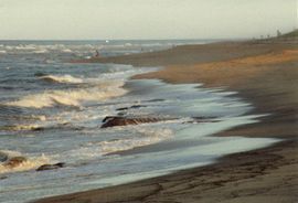
كيپ كد Cape Cod هو رأس بحري يمتد في المحيط الأطلسي في أقصى الأجزاء شرقاً في ولاية مساتشوستس، في شمال شرق الولايات المتحدة. Its historic, maritime character and ample beaches attract heavy tourism during the summer months. In 1914, the Cape Cod Canal was cut through the base or isthmus of the peninsula, turning nearly all of Cape Cod into what would technically be described as an island (though this term is not common in everyday speech).
Cape Cod is approximately co-extensive with مقاطعة بارنستيبل، though small portions of the towns of Bourne and Sandwich lie west of the canal. Both road bridges connecting the Cape to the mainland cross the canal: the Sagamore Bridge and the جسر بورن. In addition, the Cape Cod Canal Railroad Bridge carries railway freight and limited passenger services onto the Cape. Cape territory is divided into fifteen towns with many villages; Provincetown lies at the tip of the peninsula.
منطقة كيب كد والجزر
الجغرافيا والتقسيمات السياسية
البلدات والقرى
كيپ كود والجزر
إلى الجنوب من كيب كد، يقع Nantucket Sound؛ نانتكت وMartha's Vineyard, both large islands; and the mostly privately owned Elizabeth Islands.
القطاعات
الجيولوجيا
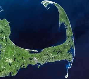
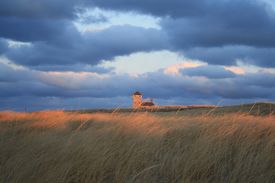
Cape Cod is part of a continuous archipelagic region consisting of a thin line of islands stretching toward New York, historically known by naturalists as the Outer Lands. This continuity is because the islands and Cape are all terminal glacial moraines laid down some 16,000 to 20,000 years ago.
History

Cape Cod was a landmark for early explorers. It may have been the "Promontory of Vinland" mentioned by the Norse voyagers (985–1025). The Manomet River area (taken up by the western end of the Cape Cod Canal in the early 20th century) is claimed by some to have been visited by Leif Eiriksson,[3] and a stone wall[4] discovered in Provincetown in 1805 is also claimed to have been built by his younger brother Thorvald Eiriksson around 1007 AD,[5] when according to Norse sagas, the keel of his ship was repaired in the harbor. He was killed later in the same journey, and is said to have been returned to this spot for burial.[6] However, there is no tangible support of the presence of Norse voyagers in Cape Cod,[7] and the view is not generally accepted by archaeologists or historians.[8][9]
Giovanni da Verrazzano in 1524 approached it from the south. He named Martha's Vineyard Claudia, after Claude of France, the wife of Francis I of France.[10] In 1525, Portuguese explorer Estêvão Gomes, sailing under the Spanish crown, called it Cabo de la Arenas.[11]
انظر أيضاً
الهامش
Notes
- ^ خطأ استشهاد: وسم
<ref>غير صحيح؛ لا نص تم توفيره للمراجع المسماةUSCG - ^ "Provincetown Spit, Cape Cod, Massachusetts". NASA Earth Observatory. Retrieved May 2, 2006.
- ^ "Aptucxet Trading Post, Bourne Historical Society, Bourne, Cape Cod, MA". Bourne Historical Society. Retrieved Feb 27, 2011.
- ^ "The Norse Wall House on Wikimapia". Retrieved February 13, 2007.
- ^ "The Norse Wall". capelinks.com. Retrieved February 13, 2007.
- ^ Jennings, Herman A. (1890). Provincetown, or, odds and ends from the tip end. Yarmouthport, Massachusetts: F. Hallett, Printer. pp. 9–14.
- ^ Tager, Jack and Jennifer L. Herman (2008). Massachusetts Encyclopedia. North American Book Dist LLC. p. 280. ISBN 9781878592651.
- ^ Bailey, Anthony (1999). The Coast of Summer: Sailing New England Waters from Shelter Island to Cape Cod. Sheridan House, Inc. p. 154. ISBN 9781574090741.
- ^ Stockwell, Mary (2006). A Journey Through Maine. Gibbs Smith. p. 48. ISBN 9781423624165.
- ^ Baer, Chris. "HISTORY OF MARTHA'S VINEYARD". Historical Records of Dukes County, Massachusetts. Retrieved June 27, 2009.
- ^ David J. Weber (1992). The Spanish frontier in North America. Yale University Press. p. 36. ISBN 978-0-300-05917-5. Retrieved March 18, 2012.
Sources
Geologic History of Cape Cod, Massachusetts, by the United States Geological Survey (USGS)
وصلات خارجية
- Cape Cod Chamber of Commerce
 Cape Cod travel guide from Wikivoyage
- "Geologic History of Cape Cod, Massachusetts", U.S. Geological Survey
- Ripley, George; Dana, Charles A., eds. (1879). . The American Cyclopædia.
- Vintage Images of Cape Cod, Boston Globe
- Pages using gadget WikiMiniAtlas
- Wikipedia articles incorporating a citation from The American Cyclopaedia
- Wikipedia articles incorporating a citation from The American Cyclopaedia with a Wikisource reference
- Cape Cod and the Islands
- Landforms of Barnstable County, Massachusetts
- Headlands of Massachusetts
- New England
- Peninsulas of Massachusetts
- Regions of Massachusetts
- Geology of Massachusetts
- Barrier islands of Massachusetts

