قالب:مقدونيا التاريخية
| مقدونيا التاريخية | |
| مقدونيا القديمة | الفترة الرومانية |
| [[Image:LocationMacedonia-OTT-2-z.png|center|162px|الفترة العثمانية: لم تكن مقدونيا جزءاً من الدولة العثمانية. | |
| المقاطعة البيزنطية (حدود تقريبية) |
الفترة العثمانية (تقريبية) |
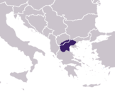
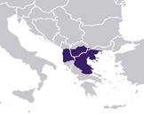
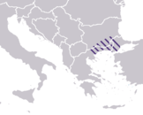
| مقدونيا القديمة: Approximate borders of the kingdom before its major expansion, ح. 350 ق.م المقاطعة الرومانية (approximate borders of maximum extent). There was also a later diocese of Macedonia. مقاطعة بيزنطية: situated much further east than previous and later units (approximate borders). الفترة الدولة العثمانية: During the first four centuries of the Ottoman period, western scholars thought of Macedonia in terms of Greco-Roman geography. The Ottoman Empire did not have an وحدة إدارية by that name. In the early 19th century, the definition of Macedonia by most scholars, approximately matched the contemporary region, with occasional variations.[1] | |
الهوامش
- ^ Wilkinson, H.R. (1951). Maps and Politics; a review of the ethnographic cartography of Macedonia. Liverpool: Liverpool University Press. pp. (a) p. 1, (b) pp. 2–4, 99, 121 ff., (c) p. 120, (d) pp. 4, 99, 137, (e) pp. 2, 4. قالب:LCC.
]


