قالب:جدول كيبوتس
| Uses Lua: |
This template is meant for Israeli villages.
Usage
The infobox should be added using the {{Infobox Israel village}} template, as shown below:
{{Infobox Israel village
| name =
| image =
| caption =
| image_size =
| hebname = {{script|Hebr|}}
| arname =
| stdHeb =
| altOffSp =
| altUnoSp =
| meaning =
| pushpin_map = Israel
| pushpin_mapsize =
| pushpin_label_position =
| coordinates = {{Coord}}
| grid_name =
| grid_position =
| founded =
| founded_by =
| region =
| district =
| council =
| affiliation =
| population =
| population_footnotes =
| popyear =
| area_dunam =
| area_footnotes =
| website =
}}
Example
Mishmarot
מִשְׁמָרוֹת | |
|---|---|
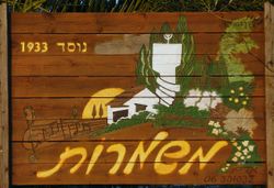
 The sign in the entrance to the kibbutz | |
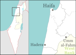
| الإحداثيات: 32°29′10″N 34°59′1″E / 32.48611°N 34.98361°E | |
| Grid position | 214800/764100 |
| البلد | Israel |
| District | Northern |
| المجلس | Menashe |
| Region | Sharon plain |
| الانتماء | Kibbutz Movement |
| Founded | October 1933 |
| أسسها | Latvian, Lithuanian and Russian Jews |
| المساحة | 96٬156 dunams (96٫156 كم² or 37٫126 ميل²) |
| التعداد (2006) | 23٬300 |
| • الكثافة | 240/km2 (630/sq mi) |
| الموقع الإلكتروني | www |
{{Infobox Israel village
| name        = Mishmarot
| image       = Mishmarot entrace sign 01.jpg
| caption     = The sign in the entrance to the kibbutz
| imgsize     = 250
| hebname     = {{script|Hebr|מִשְׁמָרוֹת}}
| arname      =
| pushpin_map = Israel haifa
| pushpin_mapsize        = 250
| pushpin_label_position = left
| coordinates = {{Coord|32|29|10|N|34|59|1|E|display=inline,title}}
| grid_name = [[Israel Transverse Mercator|ITC grid]]
| grid_position = 214800/764100
| country = [[Israel]]
| founded     = October 1933
| founded_by  = [[Latvian Jews|Latvian]], [[Lithuanian Jews|Lithuanian]] and [[Russian Jews]]
| region      = [[Sharon plain]]
| council     = [[Menashe Regional Council|Menashe]]
| industry    =
| affiliation = [[Kibbutz Movement]]
| meaning     =
| district    = north
| population  = 23,300
| popyear     = 2006
| area_dunam  = 96156
| mayor       =
| website     = {{URL|http://www.mishmarot.co.il}}
}}
Parameters
- name: name of the locality
- image (optional): image name for a representative image of the locality
- image_size (optional): width to use for the image (measurement is px), do not use a width greater than 275px.
- caption (optional): optional caption
- image_emblem (optional): image name for the logo of the locality
- emblem_size (optional): width to use for the emblem (measurement is px), do not use a width greater than 275px.
- emblem_caption (optional): optional caption
- hebname: name/spelling of the city in Hebrew
- arname (optional): name/spelling of the city in Arabic
- meaning (optional): name meaning
- founded (optional): year in which the municipality was founded
- typefrom (optional): when it was declared a city/local council
- stbHeb (optional): Standard Hebrew
- altOffSp (optional): alternative official transliterations, e.g. Petah Tiqwa
- altUnoSp (optional): alternative unofficial transliterations, e.g. Petach Tikvah
- district: district of the city/local council, can have 8 possible values:
- north: Northern District
- haifa: Haifa District
- center: Center District
- ta: Tel Aviv District
- jerusalem: Jerusalem District
- south: Southern District
- js: Judea and Samaria District (West Bank)
- population: population of the municipality. Place references and footnotes in the
population_footnotesfield. - popyear (optional): year in which the census (or estimate, since the last complete census was in 1995) was made
- population_footnotes: references for the population figure
- area_dunam: jurisdiction of the municipality, dunams (the local measurement unit for measuring jurisdiction). RAW unformatted numbers only (i.e. 5000 not 5,000) as they will be converted to km² and sq mi automatically. Place references and footnotes in the
area_footnotesfield. - area_footnotes: references for the area figure
- pushpin_map (optional but must be used with
|coordinates=). The following values can be entered:- "Israel", for a general map
- "Israel north haifa", for a map with the North and Haifa Districts
- "Israel haifa", for a map with the Haifa District
- "Israel northeast", for a map of the Kineret and Safed sub-districts (North District/northeastern Israel)
- "Israel golan", a variant of the northeast map for localities within the Golan Heights
- "Israel northwest", for a map of the Acre sub-district (North District)
- "Israel jezreel", for a map with the Jezreel Valley area
- "Israel binyamin", for a map of the Mateh Binyamin area of the West Bank
- "Israel center ta", for a map with the Center and Tel Aviv Districts
- "Israel jerusalem", for a map of the Jerusalem District
- "Israel south wb", for a map of the southern West Bank
- "Israel ashkelon", for a map of the Ashkelon sub-district (South District)
- "Israel northwest negev", for a map of the northwestern Negev desert
- "Israel gaza", a variant of the northwest negev map for localities within the Gaza Strip
- "Israel north negev", for a map of the northern Negev desert
- "Israel negev mt", for a map of the southern Negev desert
- pushpin_label_position (optional): The position of the label on the pushpin map relative to the pushpin coordinate marker. Valid options are {left, right, top, bottom, none}. If this field is not specified, the default value is right.
- pushpin_mapsize (optional): Must be entered as only a number—no need for px. The default value is 125.
- pushpin_map_caption (optional): For placing a caption under the map.
- coordinates (optional): Latitude and longitude. Use {{Coord}}.
- grid_name: Name of geographic coordinate system. See example of Amka for adding more than one grid.
- grid_position: Position on the given grid.
Tracking category
| The above documentation is transcluded from قالب:جدول كيبوتس/doc. (edit | history) Editors can experiment in this template's sandbox (create | mirror) and testcases (create) pages. Please add categories to the /doc subpage. Subpages of this template. |
