قالب:جدول دائرة انتخابية في البرلمان الأوروبي/doc
| هذه صفحة توثيق فرعية لـ قالب:جدول دائرة انتخابية في البرلمان الأوروبي. تتضمن معلومات الاستعمال، التصنيفات وأي محتوى آخر ليس من محتويات الأصل لصفحة القالب. |
| Uses Lua: |
Usage
| {{{title}}} | |
|---|---|
| European Parliament constituency | |
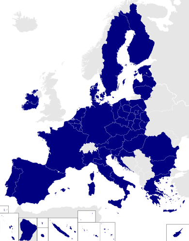 Location among the 2014 constituencies | |
| [[File:{{{map}}}|{{{mapsize}}}|alt={{{mapalt}}}|upright=1]] {{{mapcaption}}} | |
| Member state | [[{{{memberstatelink}}}|{{{memberstate}}}]] |
| الناخبون | {{{electorate population}}} |
| أنشئت | [[{{{created}}} انتخابات البرلمان الأوروبي في {{{memberstatelink2}}}|{{{created}}}]] |
| حـُلَّت | [[{{{dissolved}}} انتخابات البرلمان الأوروبي|{{{dissolved}}} ]] |
| MEPs | {{{meps}}} |
| أعيد إنشاؤها | |
| أنشئت | [[{{{created2}}} انتخابات البرلمان الأوروبي في {{{memberstatelink2}}}|{{{created2}}}]] |
| حـُلَّت | [[{{{dissolved2}}} انتخابات البرلمان الأوروبي|{{{dissolved2}}} ]] |
| نواب البرلمان الأوروبي | {{{meps2}}} |
| المصادر | |
| {{{sources}}} | |
{{Infobox European Parliament constituency
| title                 =
| locationmap2014       =
| coordinates           = <!-- {{coord|...|...}} -->
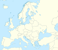
| pushpin_map           =
| pushpin_mapsize       =
| pushpin_mapcaption    =
| map                   =
| mapsize               =
| mapalt                =
| mapcaption            =
| memberstate           =
| memberstatelink       =
| memberstatelink2      =
| electorate population =
| created               =
| dissolved             =
| meps                  =
| created2              =
| dissolved2            =
| meps2                 =
| sources               =
}}
Short syntax
{{Infobox European Parliament constituency
| title                 =
| locationmap2014       =
| coordinates           = <!-- {{coord|...|...}} -->
| map                   =
| mapalt                =
| mapcaption            =
| memberstate           =
| electorate population =
| created               =
| dissolved             =
| meps                  =
}}
Parameters
- title
- what appears at the top of the infobox; required
- locationmap2014
- set to the region code for the constituency if constituency existed in 2014 (must match one of the EP-constituency maps at commons)
- coordinates
- coordinates of constituency using the {{coord}} template; set to decimal longitude if location map set to "yes"
- pushpin_map
- name of a location map to use via {{location map}} (requires coordinates)
| pushpin_mapsize :
- pushpin_mapcaption
- map
- a secondary map
- mapsize
- mapalt
- mapcaption
- memberstate
- the name of the country the constituency is part of
- memberstatelink
- the Wikipedia-article title of the country, if different from its name
- memberstatelink2
- former or full country name, if different from its name, e.g. 'West Germany' or 'the United Kingdom'
- electorate population
- population of electorate as of last election
- created
- date of constituency creation
- dissolved
- date of constituency dissolution
- meps
- number of MEPs
- created2
- dissolved2
- meps2
- sources
- sources for further reading
Examples
Łódź (existing constituency smaller than member state)
Łódź is one of 13 constituencies in Poland. The code for its infobox looks like this:
| Łódź | |
|---|---|
| European Parliament constituency | |
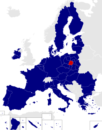 Location among the 2014 constituencies | |
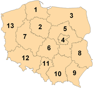 6th constituency in Poland | |
| Member state | Poland |
| أنشئت | 2004 |
| MEPs | 4 (2004) |
| المصادر | |
| [1] | |
{{Infobox European Parliament constituency
| title            = Łódź
| locationmap2014  = PL-6
| coordinates      = {{coord|51.78|19.47}}
| map              = File:European Parliament constituencies Poland.png
| mapcaption       = 6th constituency in [[Poland]]
| created          = 2004
| meps             = 4 (2004)
| memberstate      = Poland
| memberstatelink2 = Poland
| sources          = [http://www.europarl.europa.eu/elections2004/ep-election/sites/en/yourvoice/pl/law.html]
}}
Sweden (existing constituency same size as member state)
Sweden is a single constituency for European Parliament purposes. The code for its infobox looks like this:
| Sweden | |
|---|---|
| European Parliament constituency | |
| Member state | Sweden |
| أنشئت | 1995 |
| MEPs | 19 (2004) |
| المصادر | |
| [2][3] | |
{{Infobox European Parliament constituency
| title              = Sweden
| memberstate        = Sweden
| memberstatelink2   = Sweden
| pushpin_map        = Europe
| pushpin_mapcaption = Location within Europe
| coordinates        = {{coord|67.0|16.0}}
| created            = 1995
| meps               = 19 (2004)
| sources            = [http://www.europarl.europa.eu/election/newep/en/maps.htm][http://www.europarl.europa.eu/elections2004/ep-election/sites/en/yourvoice/index.html]
}}
France (no-longer-existing constituency same size as member state)
France was a single constituency for European Parliament purposes, but is now subdivided into smaller constituencies. The code for its infobox looks like this:
| France | |
|---|---|
| European Parliament constituency | |
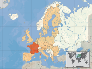 Shown within European Union | |
| Member state | France |
| أنشئت | 1979 |
| حـُلَّت | 2004 |
| MEPs | 87 (1999) |
| المصادر | |
| [4] | |
{{Infobox European Parliament constituency
| title            = France
| map              = File:EU location FRA.png
| mapcaption       = Shown within [[European Union]]
| created          = 1979
| dissolved        = 2004
| meps             = 87 (1999)
| memberstate      = France
| memberstatelink2 = France
| sources          = [http://www.europarl.europa.eu/election/newep/en/maps.htm]
}}
Leinster (no-longer-existing constituency smaller than member state)
Leinster was a constituency of the European Parliament until 2004. The code for its infobox looks like this:
| Leinster | |
|---|---|
| European Parliament constituency | |
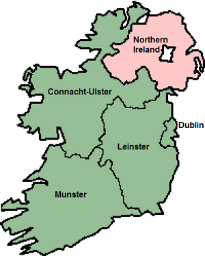 Shown within Ireland | |
| Member state | Ireland |
| أنشئت | 1979 |
| حـُلَّت | 2004 |
| MEPs | 4 (1994–2004), 3 (1979–1994) |
| المصادر | |
| [5] | |
{{Infobox European Parliament constituency
| title            = Leinster
| map              = File:IrelandEuroParlLabelled19792004.png
| mapcaption       = Shown within [[Ireland]]
| created          = 1979
| dissolved        = 2004
| meps             = 4 (1994–2004); 3 (1979–1994)
| memberstatelink  = Republic of Ireland
| memberstatelink2 = Ireland
| memberstate      = Ireland
| sources          = [http://www.europarl.europa.eu/election/law/en/lair01en.htm]
}}
Overseas Territories of France (constituency outside the member state)
The Overseas Territories of France are a constituency of the European Parliament. The code for its infobox looks like this:
| Overseas Territories of France | |
|---|---|
| European Parliament constituency | |
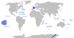 Shown in blue | |
| Member state | France |
| أنشئت | 2004 |
| MEPs | 3 |
| المصادر | |
| [6] | |
{{Infobox European Parliament constituency
| title            = Overseas Territories of France
| map              = File:Outre-mer en.png
| mapcaption       = Shown in [[Overseas departments and territories of France|blue]]
| created          = 2004
| meps             = 3
| memberstate      = France
| memberstatelink2 = France
| sources          = [http://www.europarl.europa.eu/elections2004/ep-election/sites/en/yourvoice/fr/law.html]
}}
Merseyside West (constituency with no map yet)
Merseyside West was a constituency of the European Parliament, but there is no map yet. The code for its infobox looks like this:
| Merseyside West | |
|---|---|
| European Parliament constituency | |
| Member state | United Kingdom |
| أنشئت | 1984 |
| حـُلَّت | 1999 |
| MEPs | 1 |
| المصادر | |
| [7] | |
{{Infobox European Parliament constituency
| title            = Merseyside West
| map              =
| mapcaption       =
| created          = 1984
| dissolved        = 1999
| meps             = 1
| memberstate      = United Kingdom
| memberstatelink2 = the United Kingdom
| sources          = [http://www.election.demon.co.uk/]
}}
Tracking category
Microformat
The HTML mark up produced by this template includes an hCard microformat, which makes the place-name and location parsable by computers, either acting automatically to catalogue article across Wikipedia, or via a browser tool operated by a person, to (for example) add the subject to an address book. For more information about the use of microformats on Wikipedia, please see the microformat project.
hCard uses HTML classes including:
- "adr"
- "county-name"
- "fn"
- "label"
- "locality"
- "nickname"
- "note"
- "org"
- "vcard"
Please do not rename or remove these classes.
