غرب سسكس
West Sussex | |||||||||||||||||||||||||||||||||||||||||||||||||||||||
|---|---|---|---|---|---|---|---|---|---|---|---|---|---|---|---|---|---|---|---|---|---|---|---|---|---|---|---|---|---|---|---|---|---|---|---|---|---|---|---|---|---|---|---|---|---|---|---|---|---|---|---|---|---|---|---|
 | |||||||||||||||||||||||||||||||||||||||||||||||||||||||
| البلد | المملكة المتحدة | ||||||||||||||||||||||||||||||||||||||||||||||||||||||
| المقاطعة | إنگلترة | ||||||||||||||||||||||||||||||||||||||||||||||||||||||
| المنطقة | South East England | ||||||||||||||||||||||||||||||||||||||||||||||||||||||
| التأسيس | 1888 (administratively) , 1974 (ceremonially) | ||||||||||||||||||||||||||||||||||||||||||||||||||||||
| منطقة التوقيت | UTC±00:00 (توقيت گرينتش المتوسط) | ||||||||||||||||||||||||||||||||||||||||||||||||||||||
| • الصيف (التوقيت الصيفي) | UTC+01:00 (توقيت بريطانيا الصيفي) | ||||||||||||||||||||||||||||||||||||||||||||||||||||||
| أعضاء البرلمان | 8 members | ||||||||||||||||||||||||||||||||||||||||||||||||||||||
| |||||||||||||||||||||||||||||||||||||||||||||||||||||||
غرب سسكس (بالانجليزية: West Sussex) مقاطعة إنجليزية تقع في جنوب شرق إنجلترا يحدها شرقا مقاطعة شرق ساسكس و شمال مقاطعة سري و من الغرب و الشمال الغربي مقاطعة هامبشير و من الجنوب المقاطعة مطلة على البحر حيث يحدها يحدها القنال الإنجليزي.منذ القرن الثاني عشر عندما كانت مملكة ساسكس قائمة كان اقليم ساسكس يدار بادارتين منفصلتين في شرقه و غربه. مركز المقاطعة هو تشيشستر .
مقاطعة غرب سسكس مشهورة باهتمامها بأصناف الطعام و أيضا ينتشر في المقاطعة بعض البيوت الكبيره التي هي أشبه بالقصور و التي تسمى ستيتلي هومز ينتشر ايضا في المقاطعة بعض القصور مثل قصر ارونديل و قصر برامبر أكثر من نصف المقاطعة منطقه محمية و شواطئها مناسبة للمشي و ممارسة رياضة ركوب الدرجات الهوائية. أقتصاد المقاطعة يقوم على شركات الخدمات و التجارة و تشكل الصناعة المورد الاقتصادي الثاني ، توجد في المقاطعة القليل من الانشطة الزراعية.
الجغرافيا
| Bognor Regis | ||||||||||||||||||||||||||||||||||||||||||||||||||||||||||||
|---|---|---|---|---|---|---|---|---|---|---|---|---|---|---|---|---|---|---|---|---|---|---|---|---|---|---|---|---|---|---|---|---|---|---|---|---|---|---|---|---|---|---|---|---|---|---|---|---|---|---|---|---|---|---|---|---|---|---|---|---|
| جدول طقس (التفسير) | ||||||||||||||||||||||||||||||||||||||||||||||||||||||||||||
| ||||||||||||||||||||||||||||||||||||||||||||||||||||||||||||
| ||||||||||||||||||||||||||||||||||||||||||||||||||||||||||||
Politics
Members of Parliament
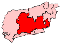
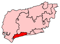
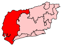
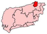
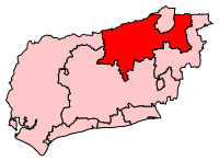
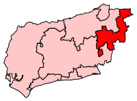
Since the 2015 general election, West Sussex has been represented entirely by Conservative Members of Parliament (MPs).[4]
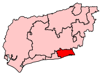
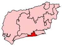
| Constituency | Constituency within West Sussex | Member of Parliament | Portrait | Party |
|---|---|---|---|---|
| Arundel & South Downs | Andrew Griffith | Conservative Party | ||
| Bognor Regis & Littlehampton | Nick Gibb | Conservative Party | ||
| Chichester | Gillian Keegan | Conservative Party | ||
| Crawley | Henry Smith | Conservative Party | ||
| Horsham | Jeremy Quin | Conservative Party | ||
| Mid Sussex | Mims Davies | Conservative Party | ||
| Worthing East & Shoreham | Tim Loughton | Conservative Party | ||
| Worthing West | Peter Bottomley | Conservative Party |
County Council

Economy and demography
This is a table of trend of regional gross value added of West Sussex at current basic prices published by Office for National Statistics with figures in millions of British Pounds Sterling.[5]
| Year | Regional gross value added[6] |
Agriculture[7] | Industry[8] | Services[9] |
|---|---|---|---|---|
| 1995 | 8,564 | 208 | 2,239 | 6,116 |
| 2000 | 10,576 | 162 | 2,545 | 7,869 |
| 2003 | 12,619 | 185 | 2,520 | 9,915 |
Significant companies in the county include Rolls-Royce Motor Cars, a substantial employer near Chichester. Gatwick Airport, with associated airlines including British Airways and Virgin Atlantic, is a major source of direct and indirect employment. Thales Group also has a presence in the county.
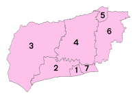
The table below shows the population change up to the 2011 census, contrasting the previous census. It also shows the proportion of residents in each district reliant upon lowest income and/or joblessness benefits, the national average proportion of which was 4.5% as at August 2012, the year for which latest datasets have been published. It can be seen that the most populous district of West Sussex is Arun containing the towns of Arundel, Bognor Regis and Littlehampton:
| Unit | JSA or Inc. Supp. claimants (August 2012) % of 2011 population | JSA and Income Support claimants (August 2001) % of 2001 population | Population (April 2011) | Population (April 2001) |
|---|---|---|---|---|
| West Sussex | 2.7% | 5.1% | 806,892 | 753,614 |
| Ranked by district | ||||
| Crawley | 3.8% | 5.3% | 106,597 | 99,744 |
| Worthing | 3.6% | 6.7% | 104,640 | 97,568 |
| Adur | 3.2% | 6.3% | 61,182 | 59,627 |
| Arun | 3.0% | 6.4% | 149,518 | 140,759 |
| Chichester | 2.3% | 4.8% | 113,794 | 106,450 |
| Horsham | 1.9% | 3.3% | 131,301 | 122,088 |
| Mid Sussex | 1.6% | 3.6% | 139,860 | 127,378 |
See also
- List of Lord Lieutenants of West Sussex
- List of High Sheriffs of West Sussex
- List of hills of West Sussex
- The Royal Sussex Regiment
- Healthcare in Sussex
References
- ^ "The West Sussex Lieutenancy". Archived from the original on 1 March 2021. Retrieved 12 April 2020.
- ^ "No. 62943". The London Gazette. 13 March 2020. p. 5161.
- ^ "Bognor Regis Climate". Met Office. Archived from the original on 13 ديسمبر 2013. Retrieved 8 ديسمبر 2013.
- ^ "BBC NEWS – Election 2010 – South East". BBC News. Archived from the original on 4 يوليو 2015. Retrieved 17 يونيو 2010.
- ^ [1] Archived 28 يوليو 2011 at the Wayback Machine
- ^ Components may not sum to totals due to rounding
- ^ includes hunting and forestry
- ^ includes energy and construction
- ^ includes financial intermediation services indirectly measured
- ^ Key Statistics: Population; Quick Statistics: Economic indicators Archived 11 فبراير 2003 at the Wayback Machine. (2011 census and 2001 census) Retrieved 27 February 2015.
وصلات خارجية

|
Kent | Surrey | Hampshire | 
|
| East Sussex | Hampshire | |||
| English Channel | English Channel | Isle of Wight |
- Pages using gadget WikiMiniAtlas
- Short description is different from Wikidata
- Pages using infobox settlement with no coordinates
- Articles with hatnote templates targeting a nonexistent page
- Pages with empty portal template
- Coordinates on Wikidata
- غرب سسكس
- Non-metropolitan counties
- South East England
- Coast to Capital Local Enterprise Partnership
- Counties of England established in 1974
- مقاطعات إنگلترة


