ساوثپورت، كنتيكت
Southport | |
|---|---|
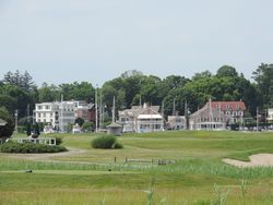
 A view of Southport Harbour from neighbouring Sasco Hill. | |
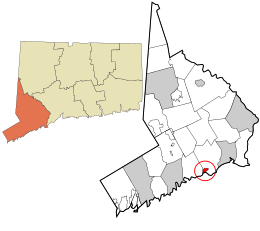
 الموقع في مقاطعة فيرفيلد وولاية كنتيكت. | |
| الإحداثيات: 41°7′55″N 73°17′4″W / 41.13194°N 73.28444°W | |
| البلد | الولايات المتحدة |
| الولاية | كنتيكت |
| المقاطعة | فيرفيلد |
| Town | Fairfield |
| Settled | 1639 |
| Incorporated (borough) | 1831 |
| Disincorporated | 1854 |
| التعداد (2010) | |
| • الإجمالي | 1٬585٫[1] |
| Zip code | 06890 |
| Area code | 203 |
ساوثپورت Southport هي حي سابق في بلدة فيرفيلد، كنتيكت، وهي أيضاً census-designated place. وتطل على Long Island Sound بين نهر مـِل و غدير ساسكو، حيث تحد Westport. As of the 2010 census, it had a population of 1,585.[1] Settled in 1639, Southport center has been designated a local historic district since 1967, and was listed on the National Register of Historic Places in 1971 as the Southport Historic District.
. . . . . . . . . . . . . . . . . . . . . . . . . . . . . . . . . . . . . . . . . . . . . . . . . . . . . . . . . . . . . . . . . . . . . . . . . . . . . . . . . . . . . . . . . . . . . . . . . . . . . . . . . . . . . . . . . . . . . . . . . . . . . . . . . . . . . . . . . . . . . . . . . . . . . . . . . . . . . . . . . . . . . . . .
الهامش
- ^ أ ب "Race, Hispanic or Latino, Age, and Housing Occupancy: 2010 Census Redistricting Data (Public Law 94-171) Summary File (QT-PL), Southport CDP, Connecticut". U.S. Census Bureau, American FactFinder 2. Retrieved August 11, 2011.
وصلات خارجية
- The Southport Conservancy (organization for preservation and restoration of historic properties in Southport)
- The Southport Globe (a website focused on the community)
- The Southport Picture File (a collection of 800 historical photos compiled by historian V. Louise Higgins. Housed at Pequot Library and accessible online.)
- Living in Southport, Conn. (New York Times photo collection)
- Brilvitch, Charles. 1977. Walking Through History. The Seaports of Black Rock and Southport. Fairfield Historical Society.
