زخارو
Zacharo
Ζαχάρω | |
|---|---|
 | |
| الإحداثيات: 37°29′N 21°39′E / 37.483°N 21.650°E | |
| البلد | |
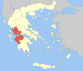
| المنطقة الادارية | West Greece |
| الوحدة المحلية | Elis |
| الحكومة | |
| • العمدة | Pantazis Chronopoulos (منذ 2002) |
| المساحة | |
| • البلدية | 276٫2 كم² (106٫6 ميل²) |
| • الوحدة البلدية | 187٫0 كم² (72٫2 ميل²) |
| المنسوب | 5 m (16 ft) |
| أعلى منسوب | 1٬345 m (4٬413 ft) |
| أوطى منسوب | 0 m (0 ft) |
| التعداد (2011)[1] | |
| • البلدية | 8٬953 |
| • كثافة البلدية | 32/km2 (84/sq mi) |
| • الوحدة البلدية | 7٬582 |
| • كثافة الوحدة البلدية | 41/km2 (110/sq mi) |
| Community | |
| • التعداد | 3٬483 (2011) |
| منطقة التوقيت | UTC+2 (EET) |
| • الصيف (التوقيت الصيفي) | UTC+3 (EEST) |
| Postal code | 270 54 |
| مفتاح الهاتف | 26250 |
| Vehicle registration | ΗΑ |
| الموقع الإلكتروني | www |
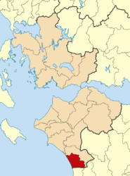
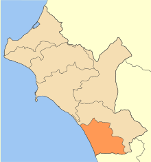
زخارو (Ζαχάρω) هي بلدة وبلدية في غرب المورة، اليونان.
يبلغ عدد سكانها حوالي 5475 نسمة.
Subdivisions
The municipal unit of Zacharo is divided into the following communities:
- Zacharo
- Agios Ilias
- Anilio
- Arini
- Artemida
- Chrysochori
- Giannitsochori
- Kakovatos
- Kalidona
- Lepreo
- Makistos
- Milea
- Minthi
- Neochori
- Prasidaki
- Rodina
- Smerna
- Schinoi
- Taxiarches
- Xirochori
Zacharo town
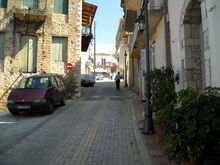
Zacharo has a school, a kindergarten, a lyceum, a gymnasium, churches, a post office, a police station, a court, a health center, banks and a railway station. Athletic facilities include a football stadium, a basketball court and a community gym which is open to the public free of charge. The town is also the home of a football team, Olympiakos Zacharos, established in 1928. In the town center, there is a square with Platanus trees. The Patron saint of Zacharo is Saint Spyridon, and the central church of the city bears his name. The Saint's feast day is on December 12 and it is a holiday for the town.
Population
| Year | Town | Municipal unit | Municipality |
|---|---|---|---|
| 1981 | 2,812 | - | - |
| 1991 | 4,318 | 11,041 | - |
| 2001 | 6,739 | 12,910 | - |
| 2011 | 3,145 | 7,582 | 8,953 |
التاريخ
The history of Zacharo begins in the middle of the 19th century. At the time of the Greek War of Independence, the area of Zacharo was sparsely populated. However, in the decades that followed, populations from the villages of the surrounding mountains started to migrate to the area. The town allegedly took its name from an inn, that belonged to a woman named Zacharoula. In 1881 Zacharo was officially proclaimed a community. In late August 2007, forest fires caused over 40 deaths, as well as extensive property damage. Zacharo was one of the worst-hit areas in Greece.
People
- Doxapatres Boutsaras, 13th century Byzantine ruler
Gallery
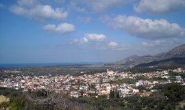
View of Zacharo from Lapithas mountain.
See also
References
- ^ أ ب "Απογραφή Πληθυσμού - Κατοικιών 2011. ΜΟΝΙΜΟΣ Πληθυσμός" (in اليونانية). Hellenic Statistical Authority.

