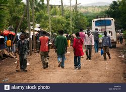
ديما، گوجام
ديما
ዲማ | |
|---|---|
 ديما، قوجام، إثيوبيا | |
| خطأ لوا في وحدة:Location_map على السطر 411: Malformed coordinates value. | |
| الإحداثيات: Coordinates: Unknown argument format تم تمرير الوسائط غير الصالحة إلى الدالة {{#coordinates:}} function | |
| البلد | |
| المنطقة | أمهرة |
| المقاطعة | گوجام |
| القِسم | شرق گوجام |
| المنسوب | 2٬076 m (6٬811 ft) |
ديما (أمهرية: ዲማ؛ إنگليزية: Dima) هي قرية في غرب-وسط إثيوپيا. وتقع في شرق گوجام في منطقة أمهرة، it has a latitude and longitude of 10°0′N 38°29′E / 10.000°N 38.483°E and an elevation of 2076 meters above sea level. It is one of three settlements in Enemay woreda.
Notable landmarks in Dima include a church dedicated to Saint George, as well as its venerable monastery, Dima Giyorgis, which was a place of refuge. The Central Statistical Agency did not provide an estimate of its population in 2005.
التاريخ
The monastery of Dima is mentioned in the reign of Emperor Susenyos as the location where Ras Antenatewos of Begemder, the chief supporter of Yaqob, found refuge after his side was defeated in the Battle of Gol in 1607.[1]
The British traveller C.T. Beke came to the town in November 1841 to pay a visit to Dejazmach Goshu Zewde, who had sought refuge at Dima at the time due to the revolt of his son Birru Goshu. At the time of Beke's visit, he found Dima to be a large town "apparently of recent construction, divided into quarters, which are surrounded by stone walls; many of the houses are also constructed of the same material. The church of St. George is the largest edifice of the kind which I have seen in Abyssinia, and internally the walls are adorned with paintings, much in the style of those of the middle ages in Europe." Beke was preceded in his visit to the Dejazmach by the Belgian consul Blondeel.[2]
الهامش
- ^ James Bruce, Travels to Discover the Source of the Nile (1805 edition), vol. 3, p. 280
- ^ Beke, "Route from Ankober to Dima", Journal of the Royal Geographical Society, 12 (1842), pp. 257f
- صفحات ذات وسوم إحداثيات غير صحيحة
- Pages using gadget WikiMiniAtlas
- Short description is different from Wikidata
- Pages with malformed coordinate tags
- Pages using infobox settlement with unknown parameters
- Articles containing أمهرية-language text
- Pages using Lang-xx templates
- Articles containing إنگليزية-language text
- Coordinates on Wikidata
- أماكن مأهولة في إقليم أمهرة