خراطة، الجزائر
خراطة
Kherrata | |
|---|---|
 | |
 | |
| الإحداثيات: 36°29′34″N 5°16′39″E / 36.492724°N 5.27759°E | |
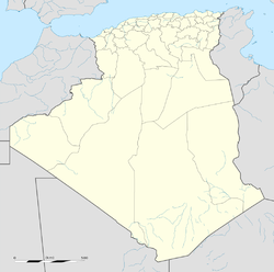
| البلد | الجزائر |
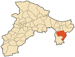
| الولاية | بجاية |
| أعلى منسوب | 1٬896 m (6٬220 ft) |
| أوطى منسوب | 498 m (1٬634 ft) |
| التعداد (2008) | |
| • الإجمالي | 35٬077 |
| منطقة التوقيت | UTC+1 (West Africa Time) |
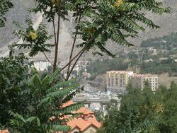
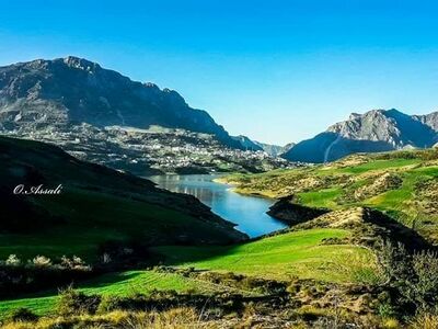
خراطة هي بلدة في شمال الجزائر في ولاية بجاية. وتقع على بعد 60 كم من عاصمة الولاية على الطريق الرابط بين مدينتي بجاية وسطيف وهي بجانب أكبر نفق في الجزائر (7 كلم) الكائن تحت سلسلة جبال جرجرة. معظم سكانها أمازيغ لهجتهم المحلية هي القبائلية.
. . . . . . . . . . . . . . . . . . . . . . . . . . . . . . . . . . . . . . . . . . . . . . . . . . . . . . . . . . . . . . . . . . . . . . . . . . . . . . . . . . . . . . . . . . . . . . . . . . . . . . . . . . . . . . . . . . . . . . . . . . . . . . . . . . . . . . . . . . . . . . . . . . . . . . . . . . . . . . . . . . . . . . . .
أصل الاسم
Kherrata is the Arabicized form of the Kabyle toponym Taxerrat or Thakherrat. The meaning refers to the relief of this particularly rugged area. It is the equivalent of the French “les gorges”. Indeed, to do a little linguistics, the root XRD is found in axrid which means the hole or the abyss and "Taxridt" which means the purse. In addition, "Takherrat" is attested in different places in Kabylia. Father Genevois, in the issue of Berber Documentary Fund dedicated to Taguemount Azouz, speaks of axrid "hole" as being a war trap. Another author, Mouloud Gaid, from the region, in his book History of Béjaia and its region , publishes a series of poems dedicated to the Algerian war where Takherrat is discussed.
الجغرافيا
الأماكن والقرى
In addition to its capital Kherrata center, the commune of Kherrata is made up of the following localities : Laouader, Aṭ Merai, Aṭ Djatit, Ahamam, Aṭ Laaziz, Ighil N'Tahar, Tala N'Tegra, Boughezrane, Bougrourene, Tiboudaouine, Ighil Emillane , Boukerdjouh, Bradma , Merouaha, Bou Saada, Ikarnaf, Tabiya, Tala Oulili, Bouzraoune, Ait Azouz, Afra, Bouchartioua, Aïfar, Menchar, Sebouka, Boufalki, Akharoub and Tiaouinine.
It includes the villages of Aṭ Merai, Takitount, Kelaoune and Djermouna.
التضاريس والجيولوجيا والجغرافيا المائية
The city is located in the seismic zone of the edges of the large so-called “sub-tellian” fault, a deep fault flush with the Moho discontinuity (internal geology), whose geography with the naked eye demonstrates this contrast between, to the north, Jura formations with a very accentuated relief, and to the south, an extended folded relief in the form of a hillock, which makes the seismic activity high, especially as the stratigraphic and pedological composition, limestone at the base resting on clay layers , which makes not only seismicity a major factor, but also very active landslides, such as the Tamaleht landslide, where an active landslide has been facing for more than two decades, and the formations of solifluction magnifications throughout the along the slopes.
Note that it was affected by large earthquakes, such as that of 1949 of magnitude 4.9mb 4 and in 2006 of magnitude 5.3Mw 5 , also, the region is the epicenter of several earthquakes, sometimes devastating, causing deaths and injuries, not to mention material damage, such as that which struck the village of Laalem (commune of Tameridjt, daira of Souk El Tenine) onMarch 20, 2006with a magnitude of 5' on the Richter scale, causing 4 deaths and more than 68 injuries 6 , 7
التاريخ
In 1870, at the entrance to the Kherrata Gorges , on the edge of Wadi Agrioun, at an altitude of 450 meters, halfway between Sétif and Bougie, a small hamlet was built: 13 families made up of 13 men - 8 women and 21 children - built 12 houses there. The official creation of the village of Kherrata by the Colonial Administration took place in 1876 and its settlement in 1878. According to an oral interpretation, the village of Kherrata bears the Arabic word meaning "Labourers".
Between 1886 and 1940, the colonial administration implemented projects to build a church, a justice of the peace, a gendarmerie , a prison and others, such as the commissioning of a telephone network. .
A plaque, at the entrance to the Gorges in relation to Bougie, recalls the major road construction work carried out under the direction of the Ponts et Chaussées from 1863 to 1870 at the rate of one kilometer per year. The first road connections took place around 1900. A stagecoach service provided postal and passenger transport in both directions. These horse-drawn carriages connected Sétif to Bougie in around thirteen hours on a route dotted with five roadhouses. Convoys of wagons of goods crisscrossed this route making a round trip in a week.
In 1913, the settler Eugène Dussaix built a castle on the outskirts of the village, near the entrance to the Gorges, before building a modern flour mill; However, the small custom mill being the symbol of the village of Kherrata in the eyes of the settlers, was preserved to allow the indigenous populations to come and grind their grain there. A church was built in 1921 by the same industrialist.
 مقالة مفصلة: مجازر 8 مايو 1945
The city was the scene of events known by the Massacre of Sétif, Guelma and Kherrata which began onMay 8, 1945and during which Algerian nationalist riots were bloodily suppressed by the French armed forces, causing between 8,000 and 45,000 deaths according to historians.
THE May 8, 1998, on the occasion of the 53rd anniversary of the events ofMay 8, 1945, the Mujahid Museum of Kherrata was created. Most of the museum is reserved for eventsMay 8, 1945and the Algerian War . However, some engravings relating to the Roman era, where Jugurtha figures prominently, are also presented. This museum is located in a former disused church which now serves as a conservatory and where collections of photos and various objects of historical interest are gathered and classified. You can discover military clothing worn by combatants during the war, old weapons used in battles, instruments and other tools used by Algerian resistance fighters.
المعالم
- منبع تابابورت.
- مضيق شعبة الآخرة
معرض صور
مضيق شعبة الآخرة
قردة مكاك بربري في مضيق شعبة الآخرة


