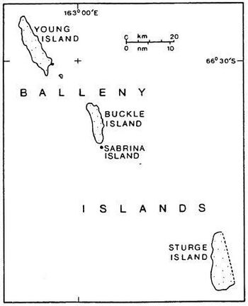
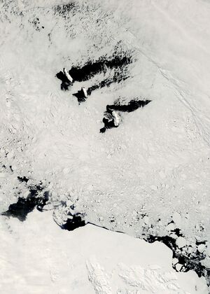
جزر بالني
 خريطة جزر بالني | |
| الجغرافيا | |
|---|---|
| الموقع | أنتارتيكا |
| الإحداثيات | 66°55′S 163°45′E / 66.917°S 163.750°E |
| الأرخبيل | جزر بالني |
| المساحة | 800 km2 (310 sq mi) |
| أعلى منسوب | 1٬705 m (5٬594 ft) |
| أعلى نقطة | Brown Peak[1][2] |
| الإدارة | |
| Administered under the نظام معاهدة أنتارتيكا | |
| السكان | |
| التعداد | Uninhabited |
جزر بالني (Balleny Islands ؛ 66°55′S 163°45′E / 66.917°S 163.750°E) هي سلسلة من الجزر غير المأهولة في المحيط الجنوبي تمتد من 66°15' إلى 67°35'ج و 162°30' إلى 165°00'ش. تمتد المجموعة لنحو 160 كم في اتجاه شمال غرب-جنوب شرق. الجزر مغطاة بكثافة بالجليد وهي ذات طبيعة بركانية. المثالج تبرز من ميولها إلى البحر. تلدزر شكّلها ما يسمى Balleny hotspot.
The group includes three main islands: Young, Buckle and Sturge, which lie in a line from northwest to southeast, and several smaller islets and rocks:
- northeast of Young Island: Seal Rocks, Pillar
- southeast of Young Island: Row Island, Borradaile Island (with Swan Base shelter hut)
- south of Buckle Island: Scott Cone, Chinstrap Islet, Sabrina Islet (with Sabrina Refuge shelter hut), and the Monolith
The islands are part of the Ross Dependency, claimed by New Zealand (انظر Territorial claims in Antarctica).
الجزر والصخور من الشمال إلى الجنوب
| الجزيرة/الصخرة | المساحة | أعلى قمة | ||
|---|---|---|---|---|
| كم² | sq mi | م | ft | |
| Young Island and satellite islets | ||||
| Seal Rocks | 0.0 | 0 | 15 | 49 |
| Pillar | 0.0 | 0 | 51 | 167 |
| Young Island | 255.4 | 98.6 | 1,340 | 4,400 (Freeman Peak) |
| Row Island | 1.7 | 0.66 | 183 | 600 |
| Borradaile Island | 3.5 | 1.4 | 381 | 1,250 |
| Beale Pinnacle | 0.0 | 0 | 61 | 200 |
| Buckle Island and satellite islets | ||||
| Buckle Island | 123.6 | 47.7 | 1,238 | 4,062 |
| Scott Cone | 0.0 | 0 | 31 | 102 |
| Eliza Cone | 0.0 | 0 | 67 | 220 |
| Chinstrap Islet | 0.0 | 0 | ||
| Sabrina Island | 0.2 | 0.077 | 90 | 300 |
| The Monolith | 0.1 | 0.039 | 79 | 259 |
| Sturge Island (no satellite islets) | ||||
| Sturge Island | 437.4 | 168.9 | 1,705[1] or 1524[2] |
5,594 or 5,000 (Brown Peak) |
سمات غاطسة
Several underwater features lie close to the Balleny Islands:
انظر أيضاً
- Cape Frances
- Composite Gazetteer of Antarctica
- Territorial claims in Antarctica
- Scientific Committee on Antarctic Research
- List of Antarctic islands south of 60° S
- قائمة الجزر
- Desert island
المراجع
- ^ أ ب Brown Peak, Composite Gazetteer of Antarctica, Scientific Committee on Antarctic Research. US source.
- ^ أ ب Brown Peak, Composite Gazetteer of Antarctica, Scientific Committee on Antarctic Research. NZ source.
- W.E. LeMasurier; J.W. Thomson (1990). Volcanoes of the Antarctic Plate and Southern Oceans. American Geophysical Union. pp. 512 pp. ISBN 0-87590-172-7.

