جبال إيلات
| جبال إيلات | |
|---|---|
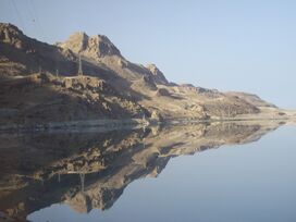
 انعكاس جبال إيلات على خليج العقبة، 2007. | |
| أعلى نقطة | |
| الارتفاع | 899 m (2،949 ft) |
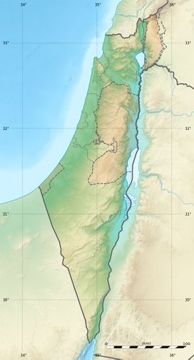
| الإحداثيات | 29°40′02″N 34°54′51″E / 29.66722°N 34.91417°E |
| الجغرافيا | |
| الجيولوجيا | |
| نوع الجبل | صخور نارية |
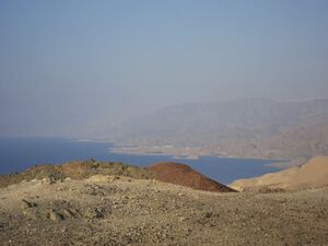
جبال إيلات (بالعبرية: הרי אילת Harei Eilat، إنگليزية: Eilat Mountains)، هي هي سلسلة جبلية تقع في جنوب النقب، جنوب إسرائيل.[1] تتبع سلسلة تمناع جبال إيلات.[2] من بين الكتلة الجبلية الوسطى، يعد جبل حزقيال الأعلى، يليه جبل سليمان. وتطل الجبال على خليج العقبة وهو جزء من البحر الأحمر.
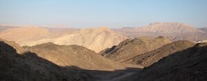
التكوينات الصخرية لجبال إيلات هي خليط من الجرانيت والحجر الجيري والحجر الرملي، ويمكن وصفها بأنها ذات ألوان شديدة التباين".[3]
التسمية
سُميت الجبال على اسم مدينة إيلات المجاورة والتي يرجع إسمها إلى مدينة إيلوت الواردة في التوراة، حيث تقع اليوم مدينة العقبة الأردنية.
بلدان الجوار
From the top of Mt. Tzfachot, in the southern tip of the mountain range, visitors may see Egyptian land (via the Sinai Peninsula) when looking southwestward. Visitors looking eastward, across the Gulf of Aqaba, may also see Jordanian land. On clear days, as well, Saudi Arabia can be seen, looking southeastward (also across the Gulf of Aqaba).

منطقة الطيور الهامة
The ridge of the Eilat Mountains along the western side of the southern Arava Valley forms part of a 60,000 ha Important Bird Area (IBA), as designated by BirdLife International, because it supports populations of various bird species, especially waterbirds and raptors on seasonal migration.[4]
المصادر
- ^ Karst Hydrology: Proceedings of an International Workshop (Workshop W2) Held at Rabat, Morocco, During the Fifth Scientific Assembly of the International Association of Hydrological Sciences (IAHS) : from 23 April to 3 May, 1997. International Association of Hydrological Sciences. 1998. p. 146. ISBN 1901502406.
- ^ Biological Resources and Migration. Springer Science & Business Media. 2013. p. 363. ISBN 3662060833.
- ^ Loren Chemla. "Hiking in Eilat mountains". Retrieved August 17, 2021.
- ^ "Southern Arava valley and Elat mountains". BirdLife Data Zone. BirdLife International. 2021. Retrieved 24 February 2021.

