تصنيف:خرائط النيل الأزرق
الملفات في التصنيف "خرائط النيل الأزرق"
الملفات ال14 التالية في هذا التصنيف من إجمالي 14.
- 1719 Mallet Map of the Source of the Nile, Ethiopia (Abyssinia) - Geographicus - Nil-mallet-1719.jpg 1٬055 × 1٬500؛ 588 كيلوبايت
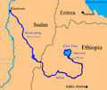
- Blue nile map.png 567 × 479؛ 110 كيلوبايت
- Description de l'univers (1683) (14804154853).jpg 2٬202 × 3٬140؛ 1٫24 ميجابايت
- Emap1683.jpg 1٬326 × 1٬800؛ 662 كيلوبايت
- Ethiopia1911.png 2٬024 × 2٬082؛ 3٫09 ميجابايت
- Map of the source of the Nile, 1683.jpg 725 × 1٬078؛ 171 كيلوبايت
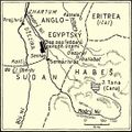
- Modrý Nil.jpg 540 × 538؛ 73 كيلوبايت
- Nile blue white.png 174 × 256؛ 89 كيلوبايت
- Nile ya buluu.png 567 × 479؛ 133 كيلوبايت
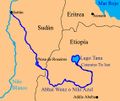
- Niloazul.jpg 567 × 479؛ 100 كيلوبايت
- Niloblanco.jpg 460 × 709؛ 78 كيلوبايت
- Renaissance Reservoir.jpg 563 × 563؛ 57 كيلوبايت
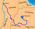
- Sinine Niilus.png 567 × 479؛ 128 كيلوبايت
- White and Blue Nile-de.svg 438 × 572؛ 424 كيلوبايت


