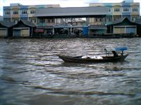
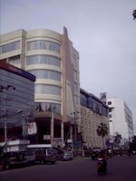
بنجرماسين
بنجرماسين
Banjarmasin | |
|---|---|
| الترجمة اللفظية بالـ Other | |
| • Jawi | بنجر ماسين |
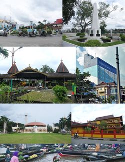 من أعلى، يسار إلى يمين: Kayu Tangi roundabout, Proclamation monument of South Kalimantan, Sultan Suriansyah tomb complex, Hotel G-Sign of Banjarmasin, Sabilal Muhtadin Great Mosque, Soetji Nurani (EYD: Suci Nurani) Temple, and Traditional Floating Market of Kuin River. | |
| الكنية: Kota Seribu Sungai (إندونيسية: City of A Thousand Rivers) | |
| الشعار: Kayuh Baimbai (Banjarese: 'Rowing Together') | |
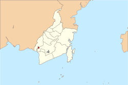 Banjarmasin within South Kalimantan | |
Location in Kalimantan و إندونيسيا | |
| الإحداثيات: 3°20′S 114°35′E / 3.333°S 114.583°E | |
| البلد | إندونسيا |
| المقاطعة | كليمنتن الجنوبية |
| City | Banjarmasin |
| Subdistricts | 5 |
| الحكومة | |
| • العمدة | يودي واهيوني |
| المساحة | |
| • الإجمالي | 72 كم² (28 ميل²) |
| المنسوب | 1 m (3 ft) |
| التعداد (2008) | |
| • الإجمالي | 627٬245 |
| • الكثافة | 8٬631/km2 (22٬350/sq mi) |
| منطقة التوقيت | UTC+8 (WITA) |
| مفتاح الهاتف | +62 511 |
| HDI (2018) | ▲ 0.768 (High)[1] |
| الموقع الإلكتروني | banjarmasinkota |
بانجارماسين Banjarmasin عاصمة مُقاطعة كاليمنتان الجنوبية في إندونيسيا. عدد سكانها 436,212 نسمة. تقع المدينة على نهر باريتو في الجنوب الشرقي من بورنيو. وتُصدر بانجارماسين البترول والخشب وجوز الهند المُجفف وأحجار الماس الذي اكتشفه الألمان عام 1711م. استولت القوات اليابانية على المدينة إبان الحرب العالمية الثانية، واستردها الحُلفاء سنة 1945م.
التاريخ

Nan Serunai was an ancient kingdom in South Kalimantan, but soon it was replaced by Buddhist kingdom of Tanjungpuri. In the fourteenth century, Banjarmasin was part of the Hindu kingdoms of Negara Dipa and Negara Daha, a vassal of Majapahit. But Pangeran Samudera converted to become a Muslim in the fifteenth century. Following this Banjarmasin was founded at the junction of the Barito and Martapura Rivers on 24 September 1526. The Dutch opened trade there in 1606. The British controlled the city for several brief periods. The British East India Company (EIC) started trading with the city, which they called Tamborneo or Tomborneo, in 1614. In 1703 the EIC established a factory there, which the inhabitants destroyed four years later. The EIC attempted, highly unsuccessfully, to trade with the city between 1736 and 1746, and then in 1747 the Sultan signed a treaty with the Dutch giving them a trade monopoly.[2]
In 1787 it became a Dutch protectorate. Banjarmasin remained the region's capital until the onset of the Banjarmasin War in 1859, when the Dutch headquarters were moved to Martapura.[3]
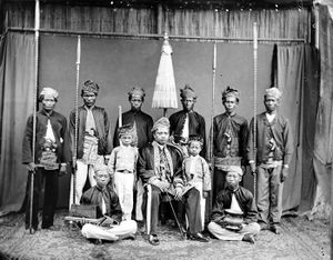
حكايات بنجر Hikayat Banjar هي تأريخ لمدينة بنجرماسين. النص، الذي يسمى أحياناً تاريخ لمبوڠ مڠكورات، يحتوي تاريخ ملوك بنجر و كوتا وارنگن في جنوب شرق وجنوب بورنيو، بالترتيب.
معالم المدينة
مسجد سبيل المهتدين، الواقع على ضفة نهر مرتاپورا، هو معلم رئيسي للمدينة. وقد بني في 1980 ليتسع لآلاف المصلين. المدينة تضم كذلك (جامعة لمبوڠ مڠكورات الحكومية.
المصادر
- Eliot, Joshua (1998). Indonesia handbook. Bath: Footprint Handbooks Ltd.
- ^ Indeks Pembangunan Manusia Kota Banjarmasin, Badan Pusat Statistik, 2018
- ^ Long, George (1835) The Penny Cyclopædia of the Society for the Diffusion of Useful Knowledge: v. 1-27. (C. Knight). Vol. 3, p.375.
- ^ Muller Kal: Indonesian Borneo, Kalimantan, Periplus Editions, Singapore 1992, ISBN 0-945971-09-5
انظر أيضاً
وصلات خارجية
- Pages using gadget WikiMiniAtlas
- Short description is different from Wikidata
- Articles containing إندونيسية-language text
- Pages using Lang-xx templates
- Coordinates on Wikidata
- Pages with empty portal template
- بنجرماسين
- Cities, towns and villages in South Kalimantan
- Port cities and towns in Indonesia
- عواصم مقاطعات إندونسيا
- كليمنتن الجنوبية


