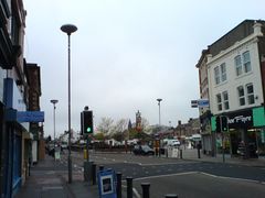
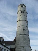
بليذ، نورثمبرلاند
| بليذ | |
|---|---|
 Blyth town centre | |
Location within Northumberland | |
| Population | 37٬339 (2011 Census) |
| OS grid reference | NZ310814 |
| • London | 300 miles (480 km) SSE |
| Civil parish |
|
| Unitary authority | |
| Ceremonial county | |
| Region | |
| Country | England |
| Sovereign state | United Kingdom |
| Post town | BLYTH |
| Postcode district | NE24 |
| Dialling code | 01670 |
| Police | Northumbria |
| Fire | Northumberland |
| Ambulance | North East |
| EU Parliament | North East England |
| UK Parliament | |
بليذ (Blyth ؛ /ˈblaɪð/ blithe) هي بلدة وإبرشية مدنية في جنوب شرق نورثمبرلاند، إنگلترة. وتقع على الساحل، إلى الجنوب من نهر بليذ وعلى بعد نحو 21 كيلومتر (13 ميل) شمال شرق نيوكاسل أپون تاين. ويبلغ عدد سكانها نحو 37,339.[2]
ميناء بليذ يعود إلى القرن الثاني عشر، ولكن تطور البلدة الحديثة بدأ فقط في الربع الأول من القرن 18. الصناعات الرئيسية التي ساعدت على ازدهار البلدة كانت مناجم الفحم وصناعة السفن، مع تجارة الملح والصيد والسكك الحديدية اللائي لعبن أدواراً هامة. تلك الصناعات قد اختفى معظمها، إلا أن الميناء مازال نشطاً في شحن الورق ولب الأشجار القادمة من اسكندناڤيا لصناعات الصحفة في إنگلترة واسكتلندة.[3]
. . . . . . . . . . . . . . . . . . . . . . . . . . . . . . . . . . . . . . . . . . . . . . . . . . . . . . . . . . . . . . . . . . . . . . . . . . . . . . . . . . . . . . . . . . . . . . . . . . . . . . . . . . . . . . . . . . . . . . . . . . . . . . . . . . . . . . . . . . . . . . . . . . . . . . . . . . . . . . . . . . . . . . . .
المعالم
| ||||||||||||||||||||||
المناخ
| Climate data for بولمر | |||||||||||||
|---|---|---|---|---|---|---|---|---|---|---|---|---|---|
| Month | Jan | Feb | Mar | Apr | May | Jun | Jul | Aug | Sep | Oct | Nov | Dec | Year |
| Mean daily maximum °C (°F) | 6.7 (44.1) |
6.9 (44.4) |
8.8 (47.8) |
10.1 (50.2) |
12.5 (54.5) |
15.6 (60.1) |
17.9 (64.2) |
18.1 (64.6) |
15.9 (60.6) |
12.8 (55.0) |
9.3 (48.7) |
7.4 (45.3) |
11.9 (53.4) |
| Mean daily minimum °C (°F) | 1.3 (34.3) |
1.5 (34.7) |
2.5 (36.5) |
3.7 (38.7) |
5.9 (42.6) |
8.6 (47.5) |
10.8 (51.4) |
10.8 (51.4) |
9.1 (48.4) |
6.7 (44.1) |
3.7 (38.7) |
2.2 (36.0) |
5.6 (42.1) |
| Average rainfall mm (inches) | 59.0 (2.32) |
41.4 (1.63) |
46.7 (1.84) |
49.2 (1.94) |
48.0 (1.89) |
53.4 (2.10) |
47.6 (1.87) |
62.1 (2.44) |
54.7 (2.15) |
58.1 (2.29) |
67.2 (2.65) |
63.6 (2.50) |
651.0 (25.63) |
| Source: Met Office | |||||||||||||
انظر أيضاً
الهامش
- ^ "Blyth Town Council | Home". blythtowncouncil.org.uk.
- ^ خطأ استشهاد: وسم
<ref>غير صحيح؛ لا نص تم توفيره للمراجع المسماةNatStats - ^ خطأ استشهاد: وسم
<ref>غير صحيح؛ لا نص تم توفيره للمراجع المسماةCommunities Blyth
مصادر مطبوعة واستزادة
- Balmer, Bob (2002) [1997]. Images of England: Blyth (3rd ed.). Tempus Publishing. ISBN 978-0-7524-0773-9.
- Balmer, Bob; Smith, Gordon (2004). Images of England: Blyth volume II. Tempus Publishing. ISBN 978-0-7524-3349-3.
وصلات خارجية
- Blyth Community website and home of Blyth Town Team
- Blyth Town Market Website
- Blyth Town Council Website
- Blyth Town Centre Management
- Blyth Photos
- Demolition of Blyth Power Station chimneys (video)
- Ridley Park Blyth – a site created by Friends of the Park for the local community
- Tide times for Blythe from the BBC and Easytide.
- Pages using gadget WikiMiniAtlas
- Articles with OS grid coordinates
- Coordinates on Wikidata
- Pages using infobox Lighthouse needing Wikidata item
- Pages using infobox lighthouse with unknown parameters
- بليذ، نورثمبرلاند
- بلدات نورثمبرلاند
- موانئ نورثمبرلاند
- موانئ بحر الشمال
- أماكن ساحلية مأهولة في نورثمبرلاند
- قواعد غواصات البحرية الملكية
- صفحات مع الخرائط


