بحيرة ردفيش
| بحيرة ردفيش Redfish Lake | |
|---|---|
 Redfish Lake and the Sawtooth Range | |
| الموقع | مقاطعة كستر، آيداهو |
| الإحداثيات | 44°7′N 114°56′W / 44.117°N 114.933°W |
| Type | Glacial |
| الموارد الرئيسية | Redfish Lake Creek |
| التصريفات الرئيسية | Redfish Lake Creek to Salmon River |
| بلدان الحوض | الولايات المتحدة |
| أقصى طول | 4.5 mi (7.2 km) |
| أقصى عرض | .72 mi (1.16 km) |
| أقصى عمق | 387 ft (118 m) |
| طول الساحل1 | 11 mi (18 km) |
| ارتفاع السطح | 6،547 ft (1،996 m) |
| خطأ: الوظيفة "auto" غير موجودة. | |
| خطأ: الوظيفة "autocaption" غير موجودة. | |
| 1 طول الساحل ليس مقياسًا مضبوطًا. | |
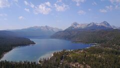
بحيرة ردفيش Redfish Lake هي alpine lake في مقاطعة كستر، آيداهو، إلى الجنوب مباشرة من ستانلي. وهي أكبر بحيرة في Sawtooth National Recreation Area.
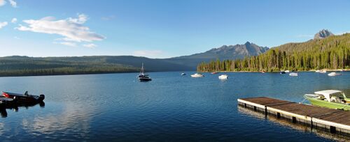
The U.S. Forest Service has developed some facilities for hiking, camping, and water sports on Redfish Lake while largely maintaining the natural landscape of the Sawtooth Mountains.[1] On the north shore sits a seasonal hotel and marina, Redfish Lake Lodge, which offers a cross-lake ferry service for hikers and sightseers in the summer.[2]
اسم المكان
The lake is named for the brilliant sockeye salmon that once returned from the Pacific Ocean in such massive quantities that the lake shimmered red during spawning season. Currently, only a small percentage of the wild sockeye succeed in making through the several hydroelectric dams along their route back to the lake to spawn. Sockeye must not be targeted while fishing and must immediately be released if they are caught.
الجغرافيا
The surface elevation of Redfish Lake is 6،547 أقدام (1،996 m) above sea level. The lake is 4.5 ميل (7.2 km) long and 0.72 ميل (1.2 km) wide, with a maximum depth of 387 أقدام (118 m), and 11 ميل (18 km) of shoreline. The actual trail around the lake is 17.5 ميل (28 km) in length.
The average temperature of the lake ranges from freezing (32 °F (0 °C)) to a high of around 62 °F (17 °C) in late July & early August. The lake freezes over in winter, with ice thickness of 30–36 بوصات (75–90 cm).
The peaks which frame the lake at its south end are
- Mount Heyburn at 10،229 ft (3،118 m) to the west
- Grand Mogul at 9،733 أقدام (2،967 m).
الوصول والإمكانات
Redfish Lake is approximately خمسة ميل (8 km) south of Stanley. A paved access road from State Highway 75 delivers visitors to a recreation area at the north shore of the lake. Facilities include campgrounds, cabins, picnic sites, toilets, drinking water, swimming beaches, a boat launch, and a horse corral. Trailheads grant access to a number of trails for hiking,[3] backpacking, horseback riding, and mountain biking, both around the lake and into the mountains (permits may be required). A visitors center runs interpretive programs.[1]
المراجع
- ^ أ ب "Redfish Lake". Sawtooth National Forest. United States Forest Service. Retrieved 9 August 2021.
- ^ "About Redfish". Redfish Lake Lodge. Retrieved 9 August 2021.
- ^ Perkowski, Mateusz (2023-10-05). "Ranch challenges public trail across its property". Capital Press (in الإنجليزية). Retrieved 2023-10-07.


